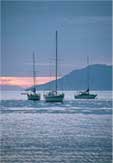
Logbook: South Africa, Swaziland, Namibia and St. Helena Island (November 2018 to March 2019)
When we arrived in South Africa on Slip Away in late October 2018, we were absolutely thrilled! We were not only relieved to have some difficult ocean passages behind us but also very excited to see a small part of this huge continent. Jan had visited Tanzania in East Africa about 25 years ago and absolutely loved it, but it was her first time in the country of South Africa. This was Rich's first time ever on the continent of Africa.
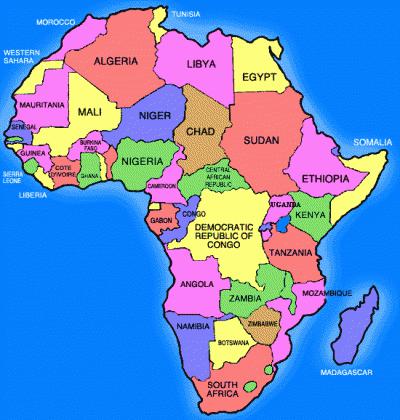
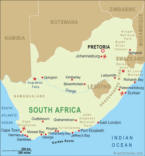
Our first port of call was Richards Bay on the northeast coast of South Africa, and we would eventually be sailing around the bottom of the continent to get to Cape Town on the west coast. This would entail rounding Cape Agulhas (the southernmost point on the continent), as well as the Cape of Good Hope (aka the "Cape of Storms"), so we still had some challenging passages ahead of us. But before setting sail again, we wanted to do some land travel.
South Africa
For anyone contemplating a visit to South Africa, we highly recommend reading James Michener's book The Covenant, which is an historical fiction account that provides excellent insight into the events that shaped this nation. The movie Invictus about South Africa's 1995 victory in the Rugby World Cup is also very worthwhile.
The Republic of South Africa (RSA), is located at the southern tip of the continent of Africa. The country covers an area of 1.2 million square kilometers (471,000 square miles), which is about size of the U.S. states of New Mexico, Texas and Oklahoma combined. The population of South Africa is approximately 58 million, and approximately 80% of South Africans are of black ancestry from a variety of ethnic groups, including Zulu, Xhosa, Swazi and several others. The remaining population is primarily European and mixed race, with a small percentage of Indians and other Asians. The economy of South Africa is the second-largest on the continent of Africa (Nigeria is the largest). South Africa's primary industries are manufacturing, wholesale and retail trade, financial services, transport, mining, agriculture and tourism.
Early inhabitants of South Africa included the Bantu, Khoisan and Xhosa tribes. The first European to make landfall in South Africa was the Portuguese seafarer Bartholomew Dias in 1488. Dias was in search of a sea route to the Far East and discovered the Cape of Good Hope, initially naming it the Cape of Storms. In 1498, Vasco da Gama (also Portuguese) was the first European to reach India by sailing around the bottom of the African continent.
In the early 1600's, English and Dutch merchants were competing fiercely in the spice trade, and in 1652, Jan van Riebeeck, on behalf of the Dutch East India Company, established a provisioning station at what would become Cape Town at the Cape of Good Hope. A number of Dutch East India company employees stayed in South Africa after completing their contracts, and other colonists arrived, including a group of French Huguenots who were escaping religious persecution. The Dutch settlers expanded eastward, frequently warring with local tribes.
The British moved in and occupied Cape Town from 1795 to 1803, when it briefly returned to the Dutch, and then the British took over again in 1806. Many of the Dutch (called Boers or Afrikaners) left Cape Town to avoid British rule and established Boer Republics further east. The late 1800's were a tumultuous time with the British fighting the Zulu tribe in the Anglo-Zulu War (1879), and then the Boers in the First Boer War (1880-81), which was won by the Boers, and after that the Second Boer War (1899-1902), in which the British defeated the Boer Republics. In 1910, Great Britain granted South Africa "nominal" independence, and in 1931, South Africa became fully independent. South Africa is a member of the British Commonwealth of Nations.
During the Dutch and British colonial years, racial segregation was mostly informal, although some legislation was enacted to control the settlement and movement of native people. In 1948, the National Party (a political party that promoted Afrikaner interests) was elected to power and established a legalized system of racial segregation called "Apartheid." The system classified all individuals into three races - white, coloured and black. Whites made up less than 20% of the population and controlled the much larger black population. Whites enjoyed the highest standard of living, comparable to developed Western Nations. Blacks were significantly disadvantaged in every aspect of life - income, education, housing and more. Coloureds were persons of mixed race or Asian descent and had less advantages than whites but more than blacks.
Internal opposition to apartheid grew quickly and anti-apartheid political organizations such as the African National Congress (ANC) were established. By the early 1960's opposition to apartheid came from both inside and outside the country. South African security forces cracked down on internal dissent, and violence became widespread. Several countries boycotted business with the South African government, and eventually international sanctions were imposed.
In 1990, South Africa's National Party government took the first steps toward dismantling apartheid by lifting a ban on the ANC and other anti-apartheid organizations and when then-President F.W. de Klerk released Nelson Mandela from prison after serving 27 years of a life sentence for conspiring to overthrow the government. In 1994, South Africa held it's first universal elections in which citizens of all races were allowed to participate, and the ANC won by a significant majority. The new National Assembly's first act was to elect Nelson Mandela as President, and he served as President of South Africa from 1994 to 1999.
South Africa has not had a smooth transition since the abolition of apartheid, and its problems are complex. While some blacks have risen to middle and upper class, many continue to live in poverty, and unemployment is high. Many white South Africans, while overwhelmingly supporting equal rights for all, feel they are no longer welcome in the country of their birth and where generations of their families have lived. Crime and violence are widespread. Additionally, the influx of migrants escaping war and/or poverty from other African nations is significant and contributes to the struggle. (As an example, every Uber driver with whom we rode in South Africa was from Zimbabwe.)
But for all of its problems, South Africa is an incredible country. Its natural beauty is stunning. Kruger National Park and a number of private game reserves have taken significant steps to preserve wildlife. We met wonderful people of all colors who treated us well, and many people are working for a united country that will flourish. But others have significant concerns for the future of their country and are looking for a way to leave.
Richards Bay and Wildlife ReservesWe spent about a week in Richard's Bay settling in before heading out on a road trip. Slip Away was moored at the International Wharf, which is part of the Tuzi Gazi Waterfront, and there were a few restaurants along the wharf where we enjoyed celebratory meals and drinks with our fellow sailors. Our local weather advisor, Des Cason, came to the waterfront for a day, and we were all happy to meet the man who dedicated so much time and effort to helping us have a safe passage to his homeland.
The Hluhluwe-iMfolozi Game Reserve was just over an hour from the waterfront, and we were planning a visit there, but we also wanted to venture further afield to Kruger National Park, which was about eight hours away by car. Jan got to work planning a trip, and we rented a car and headed off. Tourism is a big industry in South Africa, and we were traveling during a busy season. All of the affordable accommodations inside the parks were booked, but for the most part, we were quite happy with the places we stayed outside the parks. We found the best prices for rental cars on Expedia.com and booked all of our accommodations through booking.com.
Hluhluwe-iMfolozi Park (November 7 & 8). Hluhluwe-iMfolozi is the oldest game reserve in Africa (opened as a park in 1895) and covers 960 square kilometers (370 square miles). The park is known for its conservation efforts which have contributed to this park having the largest population of white rhinos in the world.
One can either take a safari tour or self-drive through most of South Africa's game parks, and we decided that we would try the self-drive option. Hluhluwe is the northern half of the park and iMfolozi is the southern half of the park, and it's small enough that one can cover the entire park in a couple of days. Most folks make it their goal to find the Big Five - Elephant, Rhino, Lion, African Buffalo and Leopard - and we saw four of the big five here, but there is much, much more to see.
While visiting Hluhluwe-iMfolozi, we stayed at a lovely B&B called Marula Place in the town of Mtubatuba, which was about a 20-minute drive to the park. (Our tongue was getting very twisted learning to pronounce all of these African names!)
"Operation White Rhino" in the 1950's won the Hluhluwe-iMfolozi
Park world recognition for its White Rhino conservation
African Hoopoe
Baboons
Eswatini / aka Swaziland (November 9 & 10). When we left our B&B in Mtubatuba, we headed further north to Swaziland. Swaziland is one of the smallest countries on the continent of Africa, and is landlocked with South Africa bordering it on the north, west and south, and a small border with Mozambique on its east side. Swaziland is a developing nation, and its population of just over one million people are primarily ethnic Swazi, which is part of the Bantu group of peoples.
Crossing the border into Swaziland was straightforward, and took about 20 minutes to pass through Immigration and Customs. The first difference we noticed between Swaziland and South Africa was the quality of roads. The roads in South Africa were very good, but driving in Swaziland was slow and tedious with a significant number of potholes, numerous speed bumps, and lots of road construction.
Great roads in South Africa
Road construction in SwazilandWe were able to find accommodations inside the Mlilwane Wildlife Sanctuary, and enjoyed the walking paths within the preserve (apparently no lions here!). We spent only one night here and wished we had stayed longer. In the evening, as we sat on the porch of our "rondavel", we heard hoof beats and saw a herd of zebras passing not far away. The next morning, as Rich packed up the car, he turned to find an impala watching him. He held out his hand, and she came over and sniffed it before moving on - very cool!
Traditional dance performance at the Swaziland Cultural Center
Our rondavel accommodations inside the
Mlilwane Wildlife Sanctuary.
Beautiful view from the front porch!
We came across this croc on a walking path - yikes!Kruger National Park (November 11 & 12). The next morning, we were off to Kruger National Park, which is one of the largest game reserves in Africa. Areas of this park were first protected in 1898, and it became South Africa's first national park in 1926. The park extends 360 km (220 miles) from north to south and 65 km (40 miles) from east to west, so we were only able to see a very small part of the park, but our experience here was awesome!
While visiting Kruger, we stayed at the Crocodile Bridge Safari Lodge, which was located just outside one of the southern gates to the park. The proprietors of the lodge - Alan & Michelle - were super nice, extremely knowledgeable about the area and recommended routes to self-drive in the park. We spent two full days driving around a small portion of the park, and the wildlife sightings were fantastic! We also had excellent wildlife sightings from the safari lodge because the fence to the park ran along the front of the lodge property, and the Crocodile River (a great watering hole) was just beyond the fence. The scenery changed every day!
A group of giraffes is called a "tower"
The Kudu is such a majestic-looking animal
It seemed like there were hundreds of Cape Buffalo in this herd,
and they were in no hurry to cross the road. We waited patiently
until a ranger came by and told us it was ok to drive slowly
through them. We did so but those were some anxious moments!
A couple of lions strolling by
Southern yellow-billed hornbill
Mum and baby zebra
Elephants enjoying the Crocodile River in front of our safari lodge
Yellow-billed stork
Our luxury tent at the safari lodge - very nice!After our Kruger visit, we headed back in the direction of Richards Bay. When we checked Google Maps for potential routes south, the options for driving through Swaziland were shorter than taking a route which stayed in South Africa, but remembering the bad roads in Swaziland, as well as the time needed to go through Customs & Immigration, we decided to take the longer route which stayed in South Africa. We were quite happy with this choice because the roads were excellent on this route, and the scenery was beautiful! Before returning to Richards Bay, we had a couple more stops on our itinerary.
Zululand Cat Conservation Project / aka Emdoneni Cheetah Project (November 13). The Cheetah Project began in 1994, when the founder, Ida Nel, became aware of three cheetah which were raised in captivity and were in need of a home. Ida had land available, as well as a passion for wildlife, and took them in. Not long after that, an injured serval cat was brought to her, and the project eventually expanded to include caracal and African wild cats. The center is dedicated to providing a home for cats which cannot return to the wild for various reasons, but also breeding, rehabilitating and releasing cats back to the wild whenever possible.
After seven hours on the road, we arrived in time for our scheduled afternoon tour at the Cheetah Project. The tour provided a great education and the cats were awesome!
The project has successfully released a number of cats back to the wild.
This handsome Caracal cannot be released back
to the wild due to a health issue
We never imagined that we could get this close to a cheetah -
we even heard the cheetah purr!We spent that night at the Insinkwe Safaris Bush Camp, which was a short drive from the Cheetah project. This was the one property that was a disappointment to us. Although the staff was great and the room was clean, the pool was green, and the place was almost deserted - only one other family staying there. It felt like the place was struggling to keep its doors open.
iSimangaliso / aka St. Lucia Wetland Park (November 14). The next morning, we headed to the St. Lucia Wetland Park, which has the largest population of hippos in South Africa. We were booked on a hippo tour with friends Fabio, Lisa & Lucio (s.v. Amandla) and Dustin (s.v. Tiama), and we spent a couple of hours floating on the St. Lucia estuary sighting hippos, crocodiles and a variety of birds. Great fun!
A "raft" of hippos in St. Lucia
These pretty yellow weaver birds
build their nests in the reeds
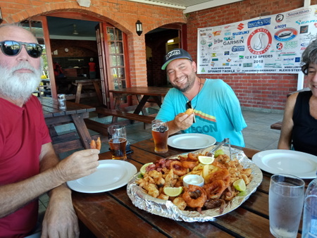
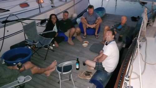
Lunch at the Ski Boat Club of St. Lucia with Lucio, Dustin & LisaAfter our day in St. Lucia, it was a short drive back to Slip Away in Richards Bay. We spent a couple more weeks in Richards Bay, mostly enjoying the company of fellow sailors, including a braai (the South African word for a barbeque) at the Zululand Yacht Club hosted by the Ocean Cruising Club. We were also watching for a weather window to start our trek toward Cape Town, and near the end of November, one finally arrived.
The trip from Richards Bay to Cape Town is right around 1000 miles, so non-stop would take us around 8 days. It was our intention to get to Cape Town for Christmas, and we were looking forward to a visit by our friends Larry & Roxane Bakerjian who were flying into Cape Town from the U.S. a few days after that. One needs to be very lucky to make it all the way from Richards Bay to Cape Town in one shot, but there are a few ports along the way to safely shelter from weather, which can get pretty wild when sailing along the South African coast. Christmas was over three weeks away and our friends' arrival was almost four weeks away, so we thought we could get there in time - but we were wrong!
Richards Bay to Durban (November 29 to 30, 95 miles, 18 hours). We again consulted our local guru Des Cason for weather advice on making passages. The east coast of South Africa is referred to the "Wild Coast", and the weather can change quickly and become very dangerous when southerly gales develop. Strong southerly winds against the strong south-setting Agulhas current can create huge seas and "ship-killer" waves - we wanted no part of that!!
We had a forecast calling for north winds for a few days, which was the right direction, but we sailed only as far as Durban (95 miles) on the first leg of our journey because the winds were expected to reach gale force after 24 hours. We departed the International Wharf at Richards Bay at 5 p.m. so we could get out of the port area well before sunset and arrive Durban the next morning. Port Control gave us permission to leave the wharf, but then asked us to mill about for a short while because they had a couple of big ships entering and departing the port. The "short while" turned into two hours, and we finally got the OK to exit the port at 7 p.m. - a half-hour past sunset. There had been a few gaps between ships when we felt we would have had sufficient time to exit and be out of the way, but the Port Officer would not give us permission to leave, and we grew frustrated as we waited.
View of the International Wharf from the Port Captain's Office
Once this big ship came in, we were finally able to depart Richards BayAfter leaving the port, we maneuvered in the darkness through the many big ships anchored outside. The ships were lit, and our AIS also displayed the locations of the ships, which helped with navigation. We also turned on our radar and noticed that "hits" were faint, and a number of the targets were not showing up at all - that's not good! We cleared the anchored ships with no issues and found the Agulhas current which would help carry us south. Winds were very light overnight, and we motored along. At 5 a.m., we finally had enough wind to unfurl our headsail, and by 9:30 when we entered the Port of Durban, it was blowing 25-30 knots and building. We wended our way through the busy port to the Durban City Marina, where our friends Fabio & Lisa (s.v. Amandla) welcomed us and took our lines as we pulled up to the dock. All was calm and quiet inside the marina - impossible to tell it was blowing so hard outside. Three boats left Richards Bay that previous day, and two of us decided to stop at Durban. The third continued on to East London (another 250 miles) and encountered extremely strong winds (up to 50 knots) and very big seas, so we were very happy with our decision to stop at Durban.
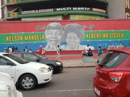
Durban (November 30 to December 13). Durban is the third largest city in South Africa and the country's busiest port. Durban was an interesting stop, but sadly the city is not what it used to be. We saw some very nice suburbs of Durban, but the once-thriving central business district is now crime-ridden and has a reputation for being quite dangerous. The Durban City Marina is situated on the edge of the central business district, and it was gated and secured, but it was a different world outside the gates. We could and did walk to a grocery store a couple of blocks from the marina, and we shopped at the fruit and veggie stands along the streets, but the marina staff told us to take off all jewelry (no earrings, watches or wedding rings), keep our cell phones hidden or leave them on the boat and carry very little cash. We never had any problems, and we are not aware of any of the other boaters having any issues, but we were all very careful and never walked anywhere outside the gates after dark.
The Durban City Hall was built in 1901
Enjoying an Historical Walkabout Tour
of Durban led by a former school teacher
Mural on the streets of Durban dedicated to two
of their prominent freedom fightersThe timing of our arrival in Durban was excellent because Jan and Fabio both have birthdays in early December. They had celebrated together the previous year in Malaysia and were looking forward celebrating together again this year on a new continent. Fabio's birthday was December 2, and we went out for dinner at an excellent Indian restaurant. Jan's birthday was the following day, and after spending the day hiking at Krantzkloof Nature Reserve, Fabio (an outstanding chef) made dinner for us on Amandla.
Celebrating Fabio's birthday with the crews of Amandla and Vanille
Hiking at Krantzkloof Nature Reserve
on Jan's birthday
Beautiful views from Krantzkloof Nature ReserveSo now it was early December, and we really needed to get on with the business of getting to Cape Town, but the weather was not cooperating. We watched and waited and consulted with Des Cason. Every time it looked like a weather window was going to materialize, it fell apart.
We became friendly with a local guy named David from the marina, and he invited us to a braai one evening with a small group of fellow sailors. That evening was a very special one for us because there was only one other non-local guy with us at the braai, and we had the chance to talk with these folks about their lives in South Africa. Additionally, we met a guy called "Tiger" (real name Cyril), and he had sailed between Durban and Cape Town many times. He told us that the weather for our trip would be much improved in January, and recommended that we think about flying to Cape Town to meet our friends (an option we were already discussing).
We waited a few more days, but there was still no weather window on the horizon, and not making it to Cape Town for our friends' visit was not an option. Fortunately, they had booked a hotel room in Cape Town and were not planning to stay aboard Slip Away! Christmas was still a couple weeks away, but we didn't really want to hang out in Durban for another couple of weeks. Durban Marina was a secure place for Slip Away, and our friend David said he would be happy to look after her, so we booked flights and planned another road trip.
As luck would have it, a weather window opened the day after we flew from Durban to Cape Town, and it was a good enough window that had we waited and taken it, we could have sailed to Cape Town by Christmas. Mother Nature isn't always as gracious as we would like, but we had already accepted that the fates had intervened, and our road trip was awesome!
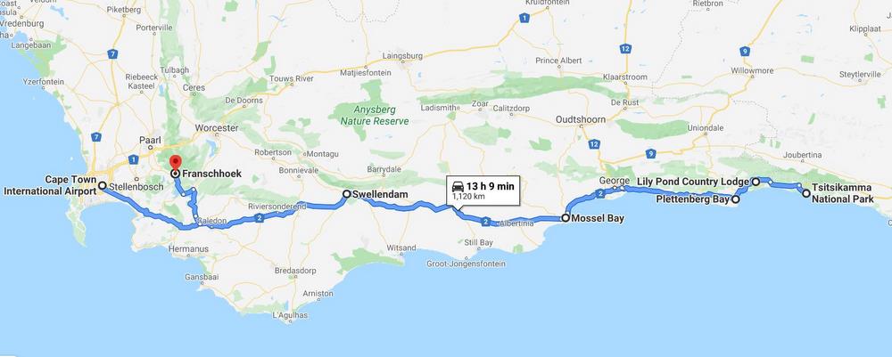
Garden Route Road Trip (December 13 to 20). The Garden Route is a 300 km (190 mile) stretch of the southeastern coast of South Africa and gets its name from the ecologically diverse vegetation in this area. American friends who had lived in South Africa years ago recommended the Garden Route to us, and it did not disappoint.
When we arrived at the Cape Town airport, we picked up a rental car, and headed off. We spent a week meandering along the Garden Route stopping first at Swellendam, the third oldest town in South Africa. From there, we worked our way east, staying a couple of nights at the wonderful Lily Pond Country Lodge, which is owned by Dutch sailing friends Niels & Margret (s.v. Unwind). While staying at Lily Pond, we were able to visit Nature's Valley and the Tsitsikama National Park. After that, it was a couple of days in Plettenberg Bay then a couple of hours in Knysna enroute to Mossel Bay, where we spent another couple of days before heading to the Franschhoek wine region. The coastline was spectacular, and we enjoyed several good hikes, as well as visits to some historical sites.
The Dutch Reformed Church in Swellendam.
Congregation formed in 1798.
Old church built in 1802.
Present church built in 1911.
We saw this beautiful African Paradise Flycatcher
while hiking in Swellendam's Marloth Nature Reserve
Our friends Margret & Niels (s.v. Unwind) with receptionist Carol
at their Lily Pond Country Lodge.
Lovely place and gracious hosts!
Hiking the Kalanderkloof Trail in Nature's Valley
Storms River Mouth Suspension bridges at Tsitsikamma National Park
Robberg Nature Reserve at Plettenberg Bay
Cape Fur Seals at Robberg Nature Reserve
Cliff side houses at Knysna
Bartholomew Dias Museum in Mossel BayFranschhoek Wine Valley (December 21 to 23). South Africa has some outstanding wines, and we had tasted a number of them, but we also very eager to visit at least one of their famous wine regions. Stellenbosch is probably the best known wine region in South Africa, but while we were at Kruger National Park, we met a young couple who highly recommended a visit to the Franschhoek Wine Valley. In the late 1600's, French Huguenots settled in this area establishing farms and businesses. The area became known as Franschhoek (Dutch for "French Corner"), and many of the farms became wineries.
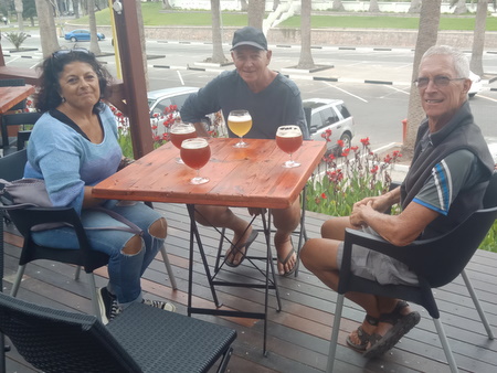
Sailing friends Karel & Phil (s.v. Tehani-li) joined us in Franschhoek, and we spent a day visiting several vineyards with the "wine tram" providing transportation (thank goodness!). We had a great time and tasted some awesome wines and good food too!
All aboard the Wine Tram!
Starting the day with a glass of champagne
Our favorite vineyard on the tour
Beautiful views from Haute Cabriere wineryCape Town (December 23 to January 4). After Franschhoek, we dropped our car back at the Cape Town airport, and Karel & Phil gave us a lift into the city and dropped us at the Airbnb we had booked for the next couple of weeks. We booked a private room in a beautiful home, and our host Clyde and his housekeeper Amos quickly became dear friends. Our location was perfect because we were able to easily walk to the Victoria & Alfred (V&A) Waterfront, a complex of restaurants, hotels, shops and entertainment venues, which serves as the central tourist area in Cape Town. Our friends Larry & Roxane were coming from Los Angeles shortly after Christmas, so we had a few days to settle in before they arrived.
Over the next couple of days, we enjoyed a Christmas celebration with fellow sailors organized by Neils & Margret (s.v. Unwind) at the Royal Cape Yacht Club. We did some sightseeing on a walking tour of Cape Town, and on an absolutely perfect day for weather, we climbed the Platteklip Gorge trail to the top of Table Mountain. Awesome!
Race classification under the Apartheid system
Statue of Nelson Mandela on the balcony of the
Cape Town City Hall from where he made his first
public speech after being released from
prison in February 1990
Table Mountain standing majestically over Cape Town and calling our name
Hiking up the Platteklip Gorge trail to the top of Table Mountain
Jan and Lisa (s.v. Amandla) celebrating
their arrival at the top of Table Mountain
View from the top of Table Mountain - Lion's Head Mountain,
Camps Bay, Clifton Bay Beach and Robben IslandLarry & Rox arrived on December 29, and we had six great days of sightseeing with them. We spent a day meandering around the V&A Waterfront and another touring the impoverished "township" of Guguletu with a former gang member who now works with the Contribution to Opportunities organization. We took a city tour on the Hop-On-Hop-Off (HOHO) bus, which included another trip to the top of Table Mountain (this time via a cable car), and we also splurged on a private tour to Cape Point and the Cape of Good Hope. We had tickets booked to visit Robben Island, where Nelson Mandela was imprisoned for 18 years, and were hugely disappointed that it was the only day of bad weather (not really bad, just extremely windy), so that the tour was cancelled. There was no chance of rebooking because tours were full due to the holidays. So we did another HOHO bus tour that day, visiting the Constantia wine region. On New Year's Eve, our Airbnb host Clyde was hosting a party and invited us and Rox & Larry. We accepted the invitation, and it was a truly enjoyable and memorable evening.
As always happens when having fun, the time with Rox & Larry flew by, and before we knew it, they were flying off to Johannesburg, and we were returning to Durban.
We loved the music played by this group at the V&A Waterfront
Our tour guide Mapanya grew up in the Guguletu
township, was a gang member, and spent 17 years
in prison, but he is now dedicating his life to
helping others reform their lives.
Living conditions in the Guguletu Township
Heading up to Table Mountain the easy way - on the cable car.
New Year's Eve with our Airbnb host Clyde
The Twelve Apostles Mountain Range is the back side of Table Mountain.
The beach was very crowded during the holidays!
The promontory at the Cape of Good Hope
Soon we would be sailing around the Cape of Good Hope!
African Penguins in Simons Town
Larry, Rox and the two of us with our Cape Point guideDurban (January 4 to 7). We had very early morning flight from Cape Town to Durban, and that turned out to be a very good thing. We landed in Durban shortly after 9 a.m. on a Friday morning, and when we turned on our phone, we had an email from our weather guru Des Cason. He informed us that it looked like there would be a weather window for us to leave Durban on Monday to start our journey to Cape Town on Slip Away. Even though this would be a domestic trip, we still needed to get clearance from the Customs, Immigration and Port Captain's offices - bureaucracy at its best! The officials' offices are closed on weekends, so in order to leave on Monday morning, we needed to get our paperwork done that day. We called the marina and advised them of our departure plans because they needed to issue paperwork letting the officials know that we satisfied all of our debts with them. We taxied back to Slip Away, threw our bags on the boat, paid our bill and picked up the necessary paperwork from the marina office, headed to the bank to pay port fees and then rushed around to all the officials' offices. After the paperwork was complete, we stopped at the grocery store to pick up some fresh provisions and then headed back to Slip Away. Whew! Fortunately, we had Saturday and Sunday to catch our breath and prepare Slip Away for departure.
We left Durban at first light on Monday and were able to get as far as Port Elizabeth (394 miles, 2 days + 8 hours) before stopping due to forecasted headwinds. The weather was very benign on this first leg on the journey, forcing us to motor most of the way, but we did have some good sailing winds on our first day at sea. The Agulhas current gave us a good boost, with our speed over ground reaching 10+ knots for a short while, but it seemed that the stronger the current, the lumpier the seas. We also saw some stunning bioluminescence in the sea on our night watches - gorgeous!
Port Elizabeth (January 9 to 15). We spent six days in Port Elizabeth waiting for the headwinds to diminish. We were not eager to spend time here because it is an industrial port with a nearby iron ore depot, and when the wind blows from the east, boats in the marina can get coated with black iron ore dust from the depot. Additionally, friends who stopped in this marina earlier in the season when strong easterly winds were blowing told us that a large swell entered the marina, and the violent movement of the boats and docks caused several dock lines to break. Fortunately, we did not experience these problems because the winds were blowing from the west while we were here, but we saw first-hand the mess the black dust made out of the local boats. Since we had some time to kill here, we rented a car for a day and visited the nearby Addo Elephant National Park. We also started doing some planning for our upcoming journey across the Atlantic Ocean, and since there was a well-stocked grocery store nearby, we began the process of provisioning with canned and dry goods. The westerly winds finally abated, and we were able to continue on our way.
Keeping cool at the pool on a hot afternoon
A couple of black-backed jackals hanging out with the herdAfter leaving Port Elizabeth, the weather forced us to make another interim stop - this time at Mossel Bay (190 miles, 37 hours). We were able to sail most of the passage from Port Elizabeth to Mossel Bay, but a good part of the trip was not very pleasant. We left Port Elizabeth late afternoon, and shortly thereafter rounded the eastern cape of South Africa and headed west along the southern coast of the continent. Winds were light when we started out, then built to 15-20 knots from the southeast shortly before midnight, and the sailing was great. By noon the next day, winds had built to the upper 20's, with gusts in the mid 30's and seas were running about 3 meters (10 feet) - not comfortable, but manageable since the wind and seas were on our port quarter. As expected, we had strong winds all through the day, and we sailed with just a small part of our headsail unfurled to keep our speed down so as not to arrive at Mossel Bay in the dark. The strong winds and seas continued into the night, but then in the very early hours of the next morning, it suddenly stopped - it was like someone turned off a switch! At 3 a.m., we had to start the engine and motor for the last few hours with just a light breeze from the northeast. Very strange and crazy weather!
Mossel Bay (January 17 to 19). When we arrived in Mossel Bay, Port Control welcomed us to tie up at the town wharf, but there was still a large swell running from the east (leftover from the strong winds), which made it impossible. We were however able to anchor outside the harbor. Although it was a large swell, it had a long period and was fairly comfortable, and after a few hours, it abated altogether. Our next weather window was just around the corner, so we spent just two nights anchored here. Our next leg of the journey was an exciting one for us. We would round Cape Agulhas, the southernmost cape on the African continent, leaving the Indian Ocean in our wake and entering the Atlantic. The weather on this passage was quite good with light winds for the most part and then perfect sailing conditions rounding the Cape - 20 knots of wind from the southeast and 4-6 foot seas (1.5 meters). We also reached another milestone on this passage, surpassing 50,000 nautical miles traveled on board Slip Away.
Although our ultimate goal was to get to Cape Town, we had decided to stop just short of there and call in at Simons Town (212 miles, 36 hours) to haul out and do some boat maintenance. We could have hauled out in Cape Town, but we heard very good reports about the boatyard in Simons Town, and we preferred their Travelift to the rail haul-out in Cape Town. We'd been in touch with "Spilly" who is the Simons Town Marina Manager, as well as the Administrator Kim, and they were watching our progress closely.
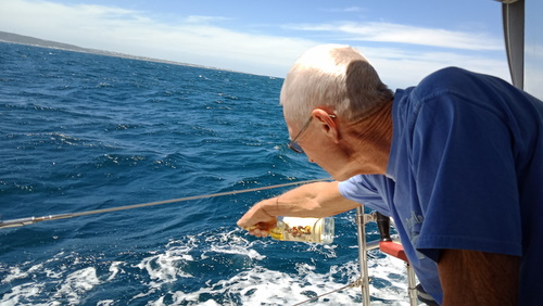
Offering a tot of rum to King Neptune as we
round Cape Agulhas and enter the Atlantic OceanSimons Town (January 21 to 27). We dropped our anchor in False Bay at Simon's Town early in the morning, and our haul-out was scheduled for that same afternoon. Although Simons Town is a lovely place, it can get quite windy here, and westerly winds are usually especially strong. The morning of our arrival was calm, but we needed to wait until the high tide in the early afternoon to haul out, and westerly winds were forecast for that afternoon. We had moved Slip Away to an end tie on a dock, and as we prepared to depart the dock for the Travelift winds were fairly light. The marina brought their small motorboat to help guide us into the Travelift, if necessary, but we were able to navigate Slip Away into the slings without a hitch. Our timing was quite fortuitous because as the crew secured the boat in the travelift, the winds started howling - the wind speed went from 10 knots to 30 knots in a matter of seconds. Yikes! But we were secured in time, and Slip Away was safely lifted out of the water.
Slip Away spent four days in the Simons Town boatyard, and we accomplished an incredible amount of work during that time. The boatyard crew sanded and painted Slip Away's bottom and polished her hull. A Furuno service rep replaced the magnetron in our radar. A local welder repaired a broken lifeline attachment on the bow pulpit and reinforced the other three attachment points. We also purchased and installed a new start battery, and Rich installed a new depth transducer (brought to us by Larry & Rox when they visited in Cape Town). At times, we had multiple projects going on the boat at one time, but we managed the mayhem. This was by far our most efficient haul-out ever!
Slip Away was scheduled to go back in the water on a Friday afternoon, and that morning, gale force winds arrived and were expected the last through the weekend. Spilly came to us to discuss delaying our launch, and we were certainly agreeable to that but had to work out the logistics of leaving Slip Away in the boatyard for another ten days or so because we were flying out to Namibia on Sunday and would be gone for a week. The Simons Town boatyard is small so does not always have space available, but we were able to work that out. However, around mid-day the winds died down considerably - still blowing about 15 knots, but certainly not anything like the morning, and they stayed down for a few hours. The high tide window for launching was late afternoon, so we revisited the issue with Spilly and agreed to go ahead with putting Slip Away back in the water. The launch went smoothly, and the marina again secured their small motorboat to our port quarter to provide assistance maneuvering us into our marina berth, if needed. We motored toward our assigned slip and were just a couple boat-lengths from turning into it when the gale decided to return. We could see the initial wind gust coming at us on the water - Holy Crap!! Even with the motorboat helping us, docking the boat was incredibly difficult, as we were being blown off the dock and were dangerously close to crashing into another boat. Tensions were extremely high, but with the help of Spilly and crew, and a bit of luck in having a left-hand rotation prop, which backed us to starboard in reverse, we managed to secure Slip Away with no damage to her or the boat next door. We all needed a stiff drink after that!
New bottom paint and polished hull - nice work guys!
Replacing the magnetron in the radar
made a huge difference in its performance!
Blowing a gale on False Bay in Simons TownWe spent Saturday securing Slip Away and packing for our trip, and early Sunday morning, we headed off to the Cape Town airport. The timing of this trip was not ideal, but our 90-day South African visitor visas were expiring, so we needed to leave the country and start the clock on a new visa upon our return. Our friends Karel & Phil (s.v. Tehani-li) were in the same situation and had booked a tour to Namibia and asked if we wanted to join them. Although we don't often join organized tours, we didn't really have a lot of time to put a trip together, and the idea of letting someone else handle all the details appealed to us. We also enjoy spending time with Karel & Phil, so we were happy to join them on the Namibia Highlights Safari with African Budget Safaris.
Namibia
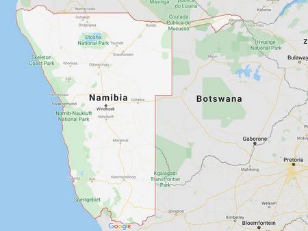
Namibia sits just north of the western part of South Africa, with the Atlantic Ocean along its west coast, Botswana to the east and Zambia and Angola to the north. Its name is derived from the Namib Desert, which is the oldest desert in the world, and Namibia is the driest country in Sub-Saharan Africa. With a population of 2.6 million people, it is one of the most sparsely populated countries in the world. Primary industries include agriculture, herding, tourism and mining (diamonds, uranium, gold, silver and base metals).
Early inhabitants of Namibia were peoples from the San, Damara, Nama and Bantu tribes. In the late 1880's the German Empire established rule over most of this territory, forming a colony known as German South West Africa, and developing farming and infrastructure. In the early 1900's, the Germans committed genocide against local tribes, killing an estimated 80,000 indigenous people. German rule ended in 1915 when they were defeated by South African forces, and in 1920, after the end of World War I, the League of Nations mandated administration of this colony to South Africa. Namibia gained independence from South Africa in 1990 following the Namibian War of Independence.
Namibia Highlights Safari (January 27 to February 3). Our trip had an inauspicious start when shortly after arriving at the Cape Town airport, our flight on Air Namibia was cancelled. An airline representative efficiently rebooked us on to FlySafair, but the new flight departed six hours later than the original one, so we spent many hours at the airport. The FlySafair flight then departed an hour late, but once we took off, it was an uneventful flight to Windhoek, Namibia.
We stayed two nights in Windhoek which is the capital city of Namibia, and while there, we enjoyed a walking tour of the city, as well as a visit to a traditional San village. When we left Windhoek, we traveled in a 12-passenger truck (but only 7 of us on the trip), and our tour guides Daniel and Tinashe took great care of us. From Windhoek, we drove north to Etosha National Park, then southwest to the coastal town of Swakopmund, and after that we spent time in the Namib Desert, visiting Dead Vlei, Sesriem Canyon and the Sossusvlei Sand Dunes. Daniel was the lead guide and drove the truck, covering a total of 900 miles (over 1400 km), and most of that time, we were on rough, unpaved roads. As we traveled, Daniel provided very informative commentary on all the areas we visited. Tinashe was a "guide in training" but he was quite knowledgeable about animal life because he had previously worked as a park ranger. Both of them worked quite hard, and they always had smiles on their faces.
It was an awesome week, and we were very happy that we had the opportunity to visit Namibia. We saw a great variety of terrain and wild animals, including a leopard sighting (our first!) on the day we arrived at Etosha National Park. Also, the food was good, including an opportunity to try a variety of game meats, and despite this being a "budget" tour, accommodations were very nice. But, the tour was not easy travel. The pace was at times exhausting - up and on the road early every day and staying in a new place almost every night. Temperatures were extremely hot, the truck was not air conditioned, and the roads were very dusty. Not only was it the dry season but also the country was in a drought, and the countryside was parched and/or barren. It's no wonder that Namibia is one of the most sparsely populated countries in the world - it's a wonder that anyone can survive here!
Ancient San Village
The Independence Memorial Museum in Windhoek,
built by North Korea, with whom Namibia
once had a strong trading relationship.
Our tour transport - "Zazu"
Our first and only leopard sighting -
resting in the shade of a road marker
A pair of Oryx
Sparring Springbok
Driving across the Namib Desert
How can anyone survive out here?!
Sharing our water with some of the desert dwellers
Our guide Daniel (right) and
his assistant Tinashe - always smiling!
Quenching our thirst with a cold beer in Swakopmund
Sand dunes of Sossusvlei
Climbing Dune 45 was hard work!
The trees in the clay pan of Deadvlei are estimated to be about 900
years old, but they have not decomposed due to the dry climate
Sesriem Canyon
Accommodations at Desert Camp were very nice!
After our tour, we flew back to Cape Town and were issued new 90-day visitor visas for South Africa. We breathed a sigh of relief because by law, they could have limited us to 14 days since we had recently spent 90 days in their country. But they didn't, and we were grateful!
Simons Town (February 3 to 8). Once back in Simons Town, we finished up a few more jobs. A local rigging shop tuned our rigging, we had some canvas repairs done on our cockpit enclosure by a local yacht club member, and we sold our spare outboard engine. After a few days, we saw a good weather window to head to Cape Town and took it.
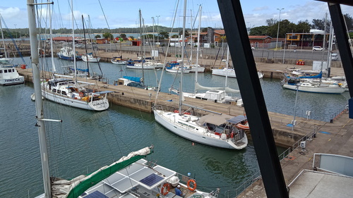
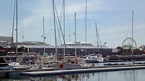
Cape Town (February 8 to 23). The trip from Simons Town to Cape Town is 60 miles, so do-able in a day, but it's a long day. We left the marina the previous afternoon and anchored in the bay for the night thinking this would make it easier for us to depart at first light the next morning, but then we ended up losing time removing all the kelp that had wrapped around our anchor chain! We finally got underway, motored out of False Bay, and at 0830 we motored around the Cape of Good Hope with light winds and calm seas - another milestone! We continued motoring in light winds, and a couple hours later, we were fighting a bit of a countercurrent, so Rich hit the throttle to speed up a bit, but the engine did not react. He moved the throttle back and forth a bit, and the engine slowed, but it would not speed up when we moved the throttle forward. Another Holy Crap moment - what's happening?!! He investigated and found that the throttle cable attachment in the steering pedestal had broken off. He went into McGuyver mode and attached a piece of line to the engine throttle on the injector pump and ran it out to the cockpit so we could use the line to control the throttle. Getting to Cape Town in a timely manner became even more imperative, and we picked up the RPM's to get us there as quickly as possible. We had a berth booked at the V&A Marina, and called the marina manager to alert them to our problem. In order to get into the marina, we needed to wait for a couple of bridge openings, and the marina manager said they would send out their launch to help us should we need assistance maneuvering. We also had several friends in V&A Marina on their boats, and they too were on standby to help if needed.
It was overcast as we rounded the Cape of Good Hope,
but the wind and seas were very kind
Skies brightened as we headed north, and the scenery was gorgeous
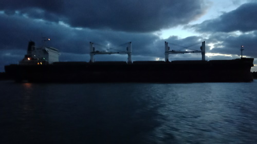
Big ship at anchor off Cape Town
The beautiful sight of Cape Town from the sea
with Table Mountain in the backgroundThe wind often picks up in Cape Town in the afternoon, but we were lucky in that the winds stayed fairly light that day. When we arrived outside the bridges to the marina, their launch met us and escorted us through the bridges, but we were able to maneuver on our own. They found us a berth that had an easy entry, and docking went smoothly. Another crisis averted! Now that Slip Away was safely docked, we could finally celebrate our arrival in Cape Town!
Prior to arriving in Cape Town, we had reserved some time with a local mechanic to help us with some engine maintenance items, and within a few days, he had our throttle cable issue repaired too. Overall, our experience with the trades people in South Africa was very positive.
We spent just over two weeks on our second visit to Cape Town and thoroughly enjoyed the central location of the V&A Marina with restaurants, shops and entertainment within walking distance. Our time here was quite busy with final preparations for the next leg of our journey. We spent hours shopping for and loading the boat with provisions, and made sure all of our boat gear was in working order. Upon leaving Cape Town, we had a long journey ahead of us as we were heading home to the USA. We were intending to stop at the remote island of St. Helena in the South Atlantic (1700 miles from Cape Town), and after that, we were planning to sail to the Bahamas (4700 miles), so by far our longest passage.
Slip Away docked between Sukha and Vanille at V&A Marina
Sunfish are a fairly rare sighting, but there was one swimming in the marina!In our final days in Cape Town, we also treasured our last moments with this cruising community. The journey by sea to Cape Town is a challenging one and the camaraderie with this group was wonderful. The majority of our sailing friends departed Cape Town before us, but there were a few stragglers, and the evening before our departure, a small group gathered on the dock by Slip Away, shared a drink with us and wished us well.
Amandla departing V&A Marina
Farewell dock party the night before our departurePassage from Cape Town to St. Helena Island (February 23 to March 7, 1700 miles, 12 days). We left V&A Marina and Cape Town late afternoon - our departure was later in the day than expected due to the dock party the previous night, but we weren't in a big hurry. When we exited the marina, the sun was shining, but as we headed offshore and into the shipping lanes, we motored into a dense fog bank. There were a number of ships in the shipping lanes, but AIS and radar helped us to avoid any issues with them - the new magnetron in our radar was working great! We wanted to clear the shipping lanes as quickly as possible, so we motored directly across them, and then turned to the WNW on our course for St. Helena Island. We found a nice breeze - 12-15 knots of WSW wind - set our sails and turned off the engine. We had a nice sail through the night, but the southerly component to the wind made it quite cold! We sailed for the next 10 hours, but then we had light winds for a few days and had to burn our precious diesel, but the seas were very gentle, and temps warmed up after that first cold night. Three days after leaving Cape Town, we finally found consistent winds, and for the most part we had quite pleasant sailing conditions with winds ranging from 10 to 20 knots from the southeast, and 3 to 6 foot (1 to 2 meter) seas. We noted only "one small squall" in our logbook - nice! The moon waned into the new moon on this passage, and we had some cloudy nights which were very dark, but we also had some clear nights with incredible stars. Three days before arriving at St. Helena Island, we crossed into the Western Hemisphere - Slip Away was last in the Western Hemisphere in July 2013, so she had spent almost six years in the Eastern Hemisphere! After 12 days at sea, we arrived at James Bay on St. Helena Island.
Land Ho! Sighting St. Helena Island off our port bow after 12 days at sea
St. Helena mooring field lit by the sunsetSaint Helena Island (March 7 to 16). St. Helena is a volcanic island located in the south Atlantic Ocean, and it is considered one of the most isolated islands in the world. It lies 1,200 miles (1,950 kms) off the coast of southwestern Africa and covers an area of just 50 square miles (130 sq km). St. Helena was uninhabited when the Portuguese discovered it in 1502, but by the 1600's, it became an important stopover for ships sailing from Asia to Europe. From the mid-1600's, St. Helena was primarily governed by the British East India Company, and the company fortified and colonized the island. After Napoleon's defeat by the British at Waterloo in 1815, he was exiled to St. Helena and lived there until his death in 1821. St. Helena also served as a prison camp for over 5,000 Boers taken prisoner by the British in the Second Boer War (1899 to 1902). St. Helena became a British colony in 1833, and its present designation is British Overseas Territory. The present population numbers approximately 6,600, and locals refer to themselves at "saints."
The anchorage at St. Helena is an open roadstead and very deep, but the locals and have made the anchorage much more "user friendly" by installing moorings for visiting yachts. When we arrived, a few other cruising boats were already here, and our friend Fabio (s.v. Amandla) came over in his dinghy and helped us secure Slip Away to her mooring. Getting ashore here has its challenges as well, and for the most part, boaters take the local water taxi instead of using their dinghies.
The water taxi landing on a calm day
One of the more challenging days for getting on and off the water taxi!
(This photo was shared with us by one of our fellow sailors,
but we're not sure who took it so cannot give proper credit)There was a fair amount to do and see on this small island. We spent a day climbing Jacob's Ladder, a staircase of 700 steps which is the remains of an incline railway connecting Jamestown (the main town) to Ladder Hill Fort. We also took an island tour, seeing several historical sights including Napoleon's tomb and residence, as well as enjoying the spectacular landscapes on the island.
Hazel, the owner of the Consulate Hotel, was very welcoming to sailors.
Most days we stopped by for coffee and wifi (very slow on this island!),
and we even ended up spending a night in the hotel
when the anchorage was extremely rolly.
Jamestown, nestled in a valley on St. Helena Island
Napoleon's grave
The house where Napoleon spent his final years
Descending Jacob's Ladder was much
easier than ascending it
Beautiful landscapes on St. Helena IslandThe highlight of our visit here, however, was a dream we had been chasing for many years - an opportunity to swim with whale sharks! Whale sharks are the biggest fish in the ocean, with an average length of 18 to 33 feet (5.5 to 10 meters) and weighing in at about 20 tons. But they are gentle giants - one of only three filter-feeding sharks, feasting on zooplankton, such as krill, crab larvae and jellyfish. So they are not dangerous, unless you maybe get too close and get whacked by their tail! We had tried a number of times in the past to find and swim with whale sharks, but despite our being in the right place at the right time (Bahia de Los Angeles in the Sea of Cortez and Utila in the Bay Islands of Honduras), they eluded us. Whale sharks visit St. Helena Island every year in their summer months - January to March - so we once again found ourselves in the right place at the right time. St. Helena requires that visitors who wish to swim with the shale sharks go with a local tour operator, and we booked a trip shortly after our arrival. But then the trip was cancelled due to bad weather - we really felt like we were jinxed! However, a couple days later, the weather settled down and we finally did it! We went on the whale shark tour with a small group - the two of us, along with Brian, Carol and Matt (s.v. Prince Diamond) and a couple who was staying ashore at a hotel. The boat operator said he counted 20 whale sharks that day, and the shore-based couple did not get in the water, so there were five of us swimming with 20 whale sharks. Incredible!
The two of us, up close and personal with a whale shark
(photo courtesy of Matt, s.v. Prince Diamond)
Wow, three whale sharks in one photo!
Individual whale sharks can be tracked because the pattern
of spots on each one are believed to be unique - like a fingerprint
St. Helena Island was the penultimate stop on our world tour. From here, our plan was to sail to the Bahamas and then home to the USA. Most of the cruising yachts who were here with us were heading to Brazil and then the Caribbean, and we could have chosen that route too and even taken another year to get home, but after living on board Slip Away on the high seas for over 16 years, we had decided it was time for us to "swallow the hook." We were excited that we would be realizing our dream and completing our circumnavigation, but home was still a long way away.
The passage from St. Helena to the Bahamas would be almost 4,800 miles. Prior to this, our longest passage was 3,000 miles, which took us 21 days, so we were planning to be at sea for possibly as long as 40 days. We had stocked Slip Away with plenty of food and fuel, and we believed that she and we were ready for the journey. Friends who had sailed the South Atlantic assured us this would be the easiest ocean crossing ever, and we had our fingers crossed that their words would ring true for us. The weather forecast looked good, and on March 16, we slipped our mooring line and headed north.
Sun setting behind Slip Away at St. Helena Island
(photo courtesy of Chantal s.v. Hokulea)
.JPG)
.JPG)
.JPG)
.jpg)
.jpg)
.JPG)
.JPG)
.JPG)
.JPG)
.JPG)
.JPG)
.JPG)
.JPG)
.JPG)
.JPG)
.JPG)
.JPG)
.JPG)
.JPG)
.JPG)
.JPG)
.JPG)
.JPG)
.JPG)
.jpg)
.JPG)
.JPG)
.JPG)
.JPG)
.jpg)
.JPG)
.JPG)
.JPG)
.JPG)
.jpg)
.jpg)
.jpg)
.jpg)
.jpg)
.jpg)
.jpg)
.jpg)
.jpg)
.jpg)
.JPG)
.jpg)
.jpg)
.jpg)
.jpg)
.jpg)
%20w-Clyde.jpg)
.jpg)
.jpg)
.jpg)
.jpg)
.jpg)
.JPG)
.JPG)
.jpg)
.jpg)
.jpg)
.JPG)
.JPG)
.JPG)
.JPG)
.JPG)
.JPG)
.JPG)
.JPG)
.JPG)
.JPG)
%20-%20Dune%2045.JPG)
%20-%20Dune%2045.JPG)
%20-%20Dead%20Vlei.JPG)
.JPG)
.JPG)
.jpg)
.jpg)
.jpg)
.jpg)
.jpg)
.JPG)
.JPG)
.JPG)
.JPG)
.jpg)
.JPG)
.JPG)
.JPG)
.JPG)
.JPG)
.JPG)
.jpg)
.JPG)
.JPG)
.jpg)