Logbook: Australia Part II - Tasmania, Sydney, Port Stephens & Moreton Bay (January to May 2015)
Our first few months in Australia had been awesome, and we had plans to spend several more months exploring this land "down under." In early January, after the Christmas and New Year celebrations ended, we flew from Sydney to Hobart, Tasmania. We flew to Tasmania with Heather & Jon (s.v. Evergreen), and in Hobart, we met up with Richard & Ali (s.v. Vulcan Spirit). Richard & Ali had braved the Bass Strait and sailed to Tasmania, but we found good deals on airfares, so took the easy way out and left Slip Away and Evergreen at Cammeray Marina in Sydney and jetted south. We spent three weeks touring Tasmania before returning to Sydney, and shortly thereafter, we sailed north stopping at Port Stephens for a couple of weeks before continuing on to Moreton Bay (Brisbane area).
Tasmania Tasmania is an island located 150 miles (240 km) south of the Australian mainland across the Bass Strait. It covers an area of approximately 26,000 square miles (68,000 square kilometers), which is roughly equal to the combined areas of the U.S. states of Vermont, New Hampshire and Massachusetts. Tasmania is one of Australia's six states, and the capital city is Hobart. Total population of the island is just over 500,000, and over half of the population lives in the greater Hobart area.
Tasmania was inhabited by Aborigines for about 40,000 years before the arrival of Europeans. The first reported European sighting of Tasmania was in 1642 by explorer Abel Tasman, who named the island Van Diemen's Land after his sponsor Anthony van Diemen, the Governor of the Dutch East Indies. Early explorers believed that Tasmania was part of the Australian mainland, but George Bass and Matthew Flinders established that it was a separate island when they circumnavigated it in their sloop, the Norfolk in 1798. The island was renamed Tasmania in 1856.
Early British settlers of Tasmania were mostly convicts and their military guards. Several convict-based settlements were established in Tasmania, including Port Arthur which operated from 1833 to 1877 and housed some of Great Britain's most hardened convicts. Port Arthur is now a World Heritage site and the most popular tourist attraction on Tasmania. Port Arthur was also the site of the Port Arthur massacre in 1996, when a lone gunman, Martin Bryant, shot and killed 35 and wounded 23 people in the cafe, gift shop and other nearby areas. Following this event, Australia adopted strict gun ownership laws nationwide.
We were looking forward to visiting some of Tasmania's towns and seeing other sights, but we were especially interested in doing some hiking in the reserves and national parks. Almost 45% of Tasmania is designated as reserve land, national parks and World Heritage sites. The Parks & Wildlife Service of Tasmania publishes a free booklet called 60 Great Short Walks which outlines hikes from a half-hour to a full day, and it was exceptionally helpful in planning our itinerary.
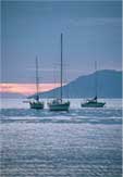
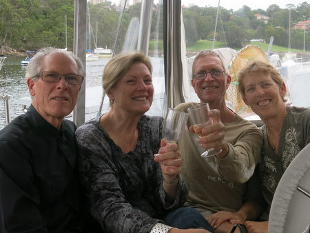
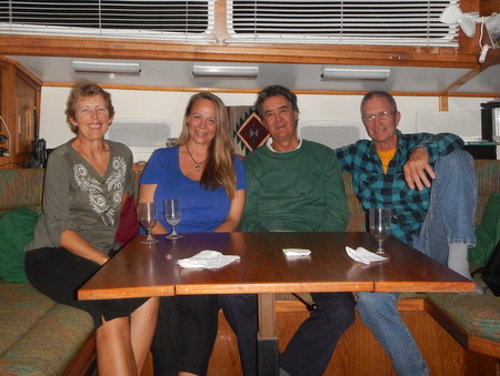
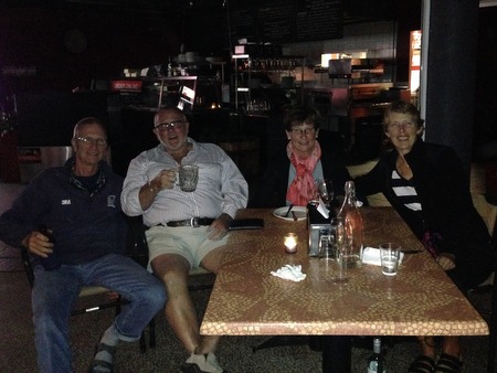
Hobart and surrounds (January 6 - 8). When we arrived in Hobart, the crews of Evergreen and Slip Away each picked up a rental car and headed to the Prince of Wales Marina, where Vulcan Spirit was docked. Our flight arrived late afternoon, and when we got to the marina, we celebrated with champagne,, and Ali had prepared a delicious dinner. Vulcan Spirit is a spacious 53-foot boat, and Richard & Ali had offered that we could all stay on board when we were in Hobart. Richard & Ali had guests on board for the previous two weeks, as well, so this was a very generous offer!
Weather in Tasmania is reputed to be quite changeable and sometimes rainy, so when the forecast called for the following day to be warm and sunny, we decided to make the best of it, and the crews of Evergreen and Slip Away drove out to Fortescue Bay on the Tasman Peninsula for a hike to Cape Hauy (9 km return) in the Tasman National Park. Richard & Ali had already done this hike, so they took a pass to stay home and work on a few boat chores. Temps reached 28C (82F) in Hobart that day, which created fog along the coast, but it was still a beautiful hike. After the hike, on our way back to Hobart, we stopped at a few other coastal sights - the Tasman Arch, Devil's Kitchen and Tessellated Pavement.
Jon & Heather on the Cape Hauy hike.
Wildlife sighting on the trail
Beautiful hike, even with the fog.
Tasman Arch - a bridged chasm formed by the collapse of a cave roof
Tessellated Pavement - interesting erosion patternsThe following day was rainy, so we decided to take in a bit of Hobart. All six of us visited the Royal Botanical Gardens, had lunch at a cafe at Battery Point and then spent a couple of hours at the Tasmania Museum & Art Gallery.
Although we wanted to see more of Hobart, we also were eager to start our road trip around the island. Richard & Ali made arrangements for a rental car, but would not pick it up for a couple of days. They had been in Tasmania for a couple of weeks and already saw some of the places we wanted to go, so we headed off to see some of those sights, with plans to re-connect in a few days.
Port Arthur Historic Sites (January 9). What was once the Port Arthur Penal Colony for hardened British criminals is now the Port Arthur Historic Sites, and we spent a day touring it. Our visit started with a 40-minute guided walking tour, during which the guide told us stories of the convicts and their lives at Port Arthur. After that, we went on a harbor cruise, and then we spent several hours wandering around the grounds, visiting historic buildings, ruins and restored houses. After visiting Port Arthur, we drove north to the town of Triabunna, where we spent the night in a hotel with plans to catch a ferry the next morning to Maria Island.
View of Port Arthur Historic Sites from the harbor
Charles O'Hara Booth was in charge of Port Arthur for
eleven years. During this time, the colony grew to 1,200
convicts and most of the buildings were built.
The remains of what was once a beautiful churchMaria Island National Park (January 10 - 11). Maria Island (pronounced like Mariah) was also a penal colony in the 1800's, and it is now a National Park and well known for its wildlife. Guests can stay overnight here in barracks buildings, and we would have liked to have done that, but those accommodations were fully booked for the entire month of January. Heather & Jon came to Tasmania prepared to camp. We did not, but Richard & Ali loaned us a tent and other gear so that we could spend a night at Maria Island. Some folks visit Maria Island on a day trip, but the best wildlife sightings are at dusk and dawn, so an overnight stay is a much better option.
We caught the ferry in the morning and our return was booked for the next afternoon, so we had about a day and a half on the island. On the way to the island, the sky was gloomy, and we barely had our tent set up when it started to rain. Fortunately, it was a brief shower, and we had the rest of the day to hike on the island. Our first hike, called Bishop & Clerk (12 km roundtrip), was fairly strenuous, but offered beautiful vistas. As the day progressed, the clouds cleared and the sea was a beautiful blue color. The very last bit of the hike (after a scramble up some rock scree) required a short but steep climb up the face of a rock. Rich scaled the rock to the top, but Jan looked at that and decided she would enjoy the view from where she was. On our way down from that hike, we had a great encounter with an echidna, which let us photograph him while he rooted around in the ground cover for food. After we completed the Bishop & Clerk hike, we continued on to the Painted Cliffs (4.5 km roundtrip). The timing was perfect for low tide to see some of the tide pool life and also get the early evening sun on the cliffs - just gorgeous! As we headed back to camp, the wildlife show got started. We saw several wombats (including a mum and baby), wallabies and pademelons. Fantastic!
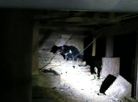
Later that evening, we attended a ranger presentation on Tasmanian Devils, which have become endangered due to a contagious cancer which is spreading among populations on the mainland. The Parks & Wildlife Service has introduced some disease-free devils on the island, and the population is growing. After the presentation, the ranger took us "devil hunting" and we found one, but it quickly scurried under a building once our flashlights were shown on it. We also saw a few possums and more pademelons and wombats. The campground was crawling with wildlife.
With such a full day, one would have thought that we would have slept like the dead that night, but we're not used to sleeping on thin camping pads, and neither of us slept very well at all! The next morning, we walked back out to the Painted Cliffs, where the ranger gave a talk on the tide pool life - anemones, starfish, crabs and other animals. After that, we didn't have much energy for another long walk, so we meandered around the visitor center and ruins of the convict settlement and a cement company which operated on the island in the early 1920's. After lunch we caught the ferry back to Triabunna. Despite our lack of sleep, Maria Island was one of our favorite places in Tasmania.
View from the top of the Bishop & Clerk hike
Echidna sighting
Jan at the Painted Cliffs
Mum & baby wombat
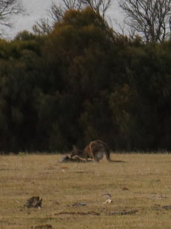
Not sure if this is a kangaroo or wallaby,
but it appears to have a joey in its pouch
Tasmanian DevilFrom Maria Island, Heather & Jon carried on to Freycinet National Park, and we headed back to Hobart to re-connect with Richard & Ali. We enjoyed a good night's sleep on Vulcan Spirit that night!
Heritage Highway & Launceston (January 12 - 14). Richard & Ali picked up their rental car the next morning, and the four of us headed north toward Launceston via the Heritage Highway, which traces the route of the original road between Hobart and Launceston - a road built by convicts in the early 1800's. On our way to Launceston, we stopped in the town of Ross, where we devoured delicious scallop pies for lunch (Rich ate two!) and had a walk around the town. The highlight here was the Ross Bridge, which crosses the Macquarie River. The sandstone bridge was built by convicts, two of which were stonemasons, and there are intricate carvings on the sides of the bridge. After our stop in Ross, we continued on to Launceston, and since the weather was fine, the four of us hiked along the Cataract Gorge to the abandoned Duck Reach Power Station (6 km return).
Beautiful sandstone bridge in the town of Ross
Footbridge over the Cataract Gorge near Duck ReachThe next day we had a full day of sightseeing, starting with a walking tour of the town of Launceston, which is the second-largest city on Tasmania. Launceston is the only city in Tasmania which is inland, but it is situated on the Tamar River, which provides access to the sea. After our tour of the city, we drove 50 km north along the Tamar River to Beauty Point and toured Seahorse World, a business which breeds and sells seahorses. From there, we continued across the river to Georgetown to tour the Bass & Flinders Museum.
Launceston had some great historic buildings
Leafy seadragons at Seahorse World
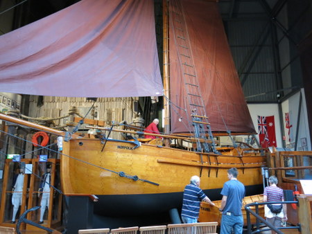
Replica of the Norfolk, the sloop in which Bass & Flinders sailed
when they circumnavigated TasmaniaDuring our time in Launceston, Richard & Ali and the two of us shared a "family" cabin at one of the caravan parks. The cabin furnishings were a bit dated, but it was comfortable enough, had a full kitchen so we could cook our own meals and provided good shelter during some rainy days. On our second night there, Heather & Jon pulled into the campground too, so we had a short visit with them. The next day, Richard & Ali headed off with Jon & Heather to do some wilderness backpacking, and the two of us chose a bit easier route.
Liffey Falls & Mt. Roland (January 14 - 15). From Launceston, we drove west, making a stop at Liffey Falls for a 10 km hike (6 miles) recommended by our friends Neil & Kathy (s.v. Attitude) who visited Tasmania the previous year. The hike at Liffey Falls ended up being one of our favorites of the trip. The trail ran through the rainforest, and the previous night had been very rainy, so the flora was very lush and green.
Hiking on a lush trail at Liffey Falls
With so much moisture, there was
quite a bit of lichen growth
Liffey FallsAfter the hike, we continued to the Gowrie Park Wilderness Village, where we spent the next couple of nights in their backpacker accommodations. From the outside, the rooms looked like small compartments built into a shipping container, but they were clean and well designed with a set of bunk beds, closet, small desk and several electrical outlets to charge electronics. Jan slept on the bottom bunk and was quite comfy with a firm mattress, but Rich was less so on the top bunk, which had a thin mattress which sagged like a hammock.
Just a short distance from our accommodations was the trailhead for Mt. Roland, and the next day, we headed out on that hike (15 km return or 12 miles). The day was sunny, and the scenery was beautiful. The track initially climbed through a forest of eucalyptus trees, then across a plateau with alpine grasses, and the final ascent was a scramble over large boulders to the summit at 1234 meters (4050 feet). We ran into a few folks on the trail who warned us to keep an eye out for snakes (all snakes on Tasmania are poisonous), but fortunately we didn't see any.
Eucalyptus trees at lower elevation
On top of Mt. Roland
Valley view from near the top of Mt. RolandAlthough we were hoping to spend another day and visit Cradle Mountain from here, the weather sent us off in another direction, and we had to save our visit to Cradle Mountain for later in the trip.
Sheffield, Devonport, Burnie (January 16). With a weather forecast calling for rain and a few days of strong winds, we decided to head off and see a few more towns. From Gowrie Park, we drove to nearby Sheffield, which had a declining population in the 1970's and 80's but re-created itself as the Town of Murals and has become a popular tourist attraction. There are over 60 murals painted on walls and buildings in Sheffield, and they depict historical events, prominent townspeople and natural scenery. We spent a couple hours wandering around Sheffield, and then continued on to Devonport.
Devonport is a port city on the northern coast, and ferries from here provide transportation across the Bass Strait to Melbourne on the mainland. We stopped for lunch at a cafe and then drove up to the lighthouse on Mersey Bluff, where the wind was blowing so hard that Jan needed help to get her car door open! We enjoyed the view, but the wind was bitter cold, so we didn't stay long.
From Devonport, we drove the "Scenic Road" along the coast, through the small town of Penguin, to the town of Burnie. We booked a room at the Burnie Backpackers, which was the nicest backpacker place we stayed in. Accommodations were in an old historical building on a hillside, with beautiful views of the harbor from the common-area lounges and porches. We spoke with the owner and complimented him on the nice accommodations, but he told us that he was struggling financially because this is a working port town and there's not much tourism. The tourist attraction which brought us to Burnie was the opportunity to see Little Blue Penguins. That evening, we visited the Little Penguin Observation Centre at Parsonage Point and watched the penguins swim ashore after sunset to feed their babies. Local volunteers run a free tour, which was a fantastic deal because other places offering penguin tours generally charge $25 to $40 per person. Sunset wasn't until 8:45 p.m., so it was a late night for us, and it was quite windy and VERY cold. Although we dressed warmly, we were still shivering, but we saw about 25-30 penguins and thoroughly enjoyed watching the wildlife and talking to the volunteers.
This mural in the town of Sheffield was its newest one and commemorates
the ANZAC forces (Australia & New Zealand Army Corp) and
the battle of Gallipoli in World War I (100 years ago this year)
Our stop in the town of Penguin enroute to Burnie. The little blue penguins
we saw later that night were much smaller, but unfortunately, we weren't
able to take flash photography and didn't get any good photos.Edge of the World, Arthur Pieman Conservation Area & Stanley (January 17 - 18). The next morning, we were on the road again. From Burnie, we drove to the west coast of Tasmania to the Edge of the World at Gardiner Point to see the longest stretch of uninterrupted ocean in the world - over 11,000 miles (18,000 km) across the Indian and Atlantic Oceans to Argentina. It was a wild and windy day, which seemed appropriate since at 41 degrees south latitude, we were in the "roaring 40's." From Gardiner Point, we drove south along the coast and then turned inland to drive along the South Arthur Forest Drive on our way to the town of Stanley. There were several spots to stop along the way and we did a couple of short walks - Sumac Lookout for views of the Arthur River and a walk through the rainforest at Julius River. There was a lot to see along this route, and we wished we had time to see more of the stops which a park ranger had highlighted on a map for us.
It was a wild and windy day at the Edge of the World
View of the Arthur River from Sumac LookoutWe spent that night in backpacker accommodations at the Stanley caravan park, and had the place almost to ourselves - just the two of us and one other woman sharing the bathroom and kitchen. We were up early the next morning to hike Circular Head (aka the "Nut"), an extinct volcano plug, which rises to 152 meters (500 feet). It was still quite windy, but it was a sunny day and the views were quite nice, and we especially enjoyed running across some pademelons on the trail. Stanley is an historical sea port and again, we wished we had more time here, but we wanted to take advantage of a good weather forecast to visit Cradle Mountain, so we needed to be on our way.
The town of Stanley and the Nut
Mum & baby pademelons on our hike
around the top of the Nut
View of Stanley Bay from atop the Nut.Cradle Mountain (January 19 - 20). Cradle Mountain sits on the northern end of the Cradle Mountain - Lake St. Clair National Park, which is part of the Tasmanian Wilderness World Heritage Area. Accommodations in the park were expensive and hard to come by, but we managed to snag two beds in a backpacker dorm room. The room had beds for two more people, which were still available when we made our reservation, so we texted Richard & Ali and let them know there was space in our room if they wanted to bunk with us. The timing worked for them, so the four of us shared a dorm room, which really made us appreciate the cabin we shared in Launceston.
Richard & Ali were keen to summit Cradle Mountain, and they got an early start for that. We heard that the last bit to the top of Cradle Mountain was pretty difficult and had some snow and ice on it from the recent stormy weather, so we opted for some easier trails. Before heading off, we stopped and talked to a ranger who recommended the hike to Hansons Peak, which required traversing a couple of steep spots with chains, but it wasn't too bad. From there, we continued to Twisted Lakes, then across the Cradle Mountain Face Track to Marion's Lookout, and then back to the car park via the Overland and Lake Lilla Tracks. We ended up doing a big loop, which we estimated was about 12-13 km and took us 6 hours. The weather was stunning that day with abundant sunshine and light winds. The hiking trails were busy, but not overly crowded. It wasn't surprising that so many people were out in the park on such a beautiful day.
Iconic photo of Cradle Mountain with Dove Lake in the foreground
View from Hansons Peak
Hansons Peak & Twisted LakesThe next morning, we were hoping to do a bit more walking in the park before moving on, but we woke up to a cool, windy and misty morning. The valley was socked in with fog, so there were no views to be had like the previous day. After a coffee with Richard & Ali at the Visitor Center Cafe, they went to the Ranger Station and Interpretation Center, but the two of us decided to carry on.
Strahan & Queenstown (January 20 - 21). From Cradle Mountain, we continued on to the town of Strahan (pronounced "Strawn") on the West Coast. Strahan is situated on Macquarie Harbour and was once a thriving port, but its present focus is tourism. Backpacker accommodations in Strahan were full, so we needed to find alternative lodging, and most of the hotels were in the AUD$150-200 range per night. (We were used to paying $50-60 per night at the backpacker places.) The Visitor Center helped us find a not-so-expensive room (AUD $95 per night) at Harbour Views, a small inn just outside of town, and it was delightful. Rich had managed to pick up a bad cold and needed some rest, so he had a nap in the afternoon while Jan went for a walk around the harbor. Strahan was marketed as a "must-see" spot, but its attractions - expensive river cruises and airplane rides - did not appeal to us. The next morning, we met up with Richard & Ali and did an easy walk from Peoples Park to Hogarth Falls (2.4 km return). The track through the forest was very pleasant, and we were very excited to see a platypus swimming in the creek.
Richard & Ali at Hogarth Falls
The platypus was not easy to see or photographFrom Strahan, we headed east toward Derwent Bridge and Lake St. Clair, which sits on the southern side of the Cradle Mountain - Lake St. Clair National Park. Enroute, we drove through and stopped for lunch in Queenstown, an area which has been extensively strip mined for copper. The denuded slopes around Queenstown were a sharp contrast to the wooded hills and mountains we had been enjoying over the past couple of weeks.
Derwent Bridge / Lake St. Clair National Park (January 21 - 23). While visiting the Lake St. Clair National Park, we stayed in "bushwalker" accommodations at the Derwent Bridge Wilderness Hotel, which was located just outside the park. Although we were used to rustic backpacker accommodations, this one lacked some basic amenities. It had no kitchen area (not even a kettle to heat water for morning coffee) and no linens (fortunately, we had some light sleeping bags and a couple of blankets). The beds were thin foam and the pillows were like rocks. Their website stated that their charges were $35/person/night, but they charged us $35 for the room instead of per person. We weren't sure if that was on purpose or a mistake by the lady who checked us in, but we thought that was a more reasonable price for this place. The hotel had other rooms (non-backpacker accommodations), but those were about $150/night, which was a bit more than our budget allowed. The hotel had a nice bar and restaurant area, so we decided to treat ourselves to beer at the bar for happy hour - $8 for a draft beer, so we each only had one. We met the owner of the hotel and tried to make conversation with him but he wasn't all that friendly. We played a couple of games of pool and called it a night. One of the good things about this place is that we had a cell phone signal, so could get internet, and Jan found a listing on Trip Advisor for the Hungry Wombat Cafe, which was nearby and had good reviews for their breakfast. We sampled their breakfast the next morning, and since we were planning a big hike, we chowed down - pancakes for Jan and the "big brekkie" for Rich. The food was just OK, but the coffee was pretty good - Australians do a good job with coffee. Also, the Hungry Wombat was much more reasonably priced than the $21 breakfast buffet at our hotel.
Very basic accommodations at Derwent BridgeAfter breakfast, we headed into the park and hiked the Cynthia Bay - Shadow Lake Circuit (15 km). This area had a quite a bit of rain over the past week, so the trail was soggy and muddy. The terrain was interesting and different - some "sub-alpine moorland" and lots of moss and lichens on the trees, but the views were not as stunning as some of the other hikes we'd done.
Lake St. Clair is the deepest freshwater lake in Australia
and sits on the south side of Cradle Mountain
Negotiating an especially muddy spot in the hiking trail
An elevated boardwalk through the sub-alpine moorland
Some of the moorland floraAs we were finishing our hike, we ran into Richard & Ali on the trail - totally unplanned, although we knew they would be in the area. They were meeting up with Jon & Heather the next day to do another backcountry camping expedition. They were spending that night at the backpacker accommodations in the National Park campground, and we compared notes. Charges for backpacker accommodations in the park were $40/person/night (and they were charged full fare), and although they had a common-area kitchen, their accommodations and amenities were pretty shabby - the worst they'd had on the trip. Since they were heading out for their backcountry camping trip in the morning, we decided to meet for dinner that night at our hotel. At dinner, Jan had a delicious veggie lasagna, but the others' meals were rather ho-hum. At least the company was fun!
Hobart (January 23 - 25). The next morning, Rich fetched coffee from the Hungry Wombat Cafe, and we headed for Hobart. Derwent Bridge was an odd place, and we were not sad to leave it behind! Although Richard & Ali were off on their backpacking trip with Jon & Heather, they told us we were welcome to stay on board Vulcan Spirit while we were in Hobart, and we were looking forward to some comforts of home on their boat.
We arrived back in Hobart around lunch time, and Rich was craving a Whopper. Although there's no Burger King in Australia, they have Hungry Jack's which has the same food. Jan was becoming quite accomplished at using our new smart phone, found a conveniently located Hungry Jack's restaurant and directed him there. After lunch, we drove the very windy Pinnacle Road up to Mt. Wellington, which overlooks Hobart. It was a clear day, and the views over the city were quite beautiful. Mt. Wellington is 1,269 meters high (4,163 feet), and while the temperature at the base was a comfortable 24 C (75 F), it was a brisk 14 C (57 F) at the top, and quite windy. After our visit to Mt. Wellington, we ran a few errands and then headed to Vulcan Spirit, which felt like total luxury after a couple of weeks on the road!
Views of Hobart from atop Mt. Wellington with the Visitor Center in the foreground
More views from the topThe next day was Saturday, the day of the Salamanca Market, which is an institution in Hobart. Jan loves outdoor markets, and friends told her not to miss this one, so we made sure to be back in Hobart for it. It was a lovely and sunny day, and both of us enjoyed perusing the goods for sale in the market. We bought a few fruits and veggies, some locally made fudge, and a cutting board made from local woods. After the market, we returned to the Tasmania Museum & Art Gallery since we felt like we didn't have enough time there during our previous visit. We found the display on the Tasmanian Aboriginal people to be especially interesting.
Colorful produce at the Salamanca Market
Hobart waterfrontBicheno & Freycinet National Park (January 25 - 27). We had only a few days left in Tasmania and one more National Park we still wanted to visit - Freycinet National Park. Our timing wasn't stellar for visiting this park because it was a holiday weekend - Australia Day, which celebrates the anniversary of the arrival of the First Fleet of British ships at Port Jackson. Backpacker accommodations in the park were sold out, so we ended up booking a hotel room at a Best Western in the nearby town of Bicheno.
Our drive to Bicheno took us through Triabunna, a small town where we had stayed the night prior to our trip to Maria Island. On our previous visit, we enjoyed a good breakfast at the Art Cafe in Triabunna, as well as some nice conversation with the owner (a Swiss guy). So we made it a point to stop there for lunch on our way to Freycinet, and once again, the food was delicious. When we arrived in Bicheno, we took a walk along a trail which ran along the foreshore before retiring to our hotel room and tuning our TV to the Australian Open tennis tournament which was being played in Melbourne. We watched an exciting match in which a young Australian, Nick Kyrgos, upset a top-ranked player.
The next morning, we were up early and headed to Freycinet National Park. Although it had been quite windy and rainy during the night, the bad weather blew through, and we had a lovely sunny day. We first hiked to iconic Wineglass Bay, then cut across the isthmus track and returned via the Hazards Beach track (11 km total). That night, we watched more tennis, and this time it was the women, with Venus Williams upsetting a favorite for the tournament, and she and Serena both advancing to the quarter-finals.
Wineglass Bay in Freycinet National Park
Jan enjoying our walk on a beautiful sunny day
Hazards BeachHobart (January 27 - 28). On our way back to Hobart the next day, we stopped at Kate's Berry Farm where we picked up a jar of jam for Ali, and we both enjoyed a scoop of homemade ice cream - strawberry chocolate chip for Jan and blueberry for Rich - yummy! We arrived back at Vulcan Spirit that afternoon, and Richard & Ali and Jon & Heather were there too. That night was our last in Tasmania, and although we would see more of Jon & Heather, we weren't sure when our paths would cross again with Richard & Ali. We celebrated with champagne and went out for a nice dinner. Rich was still getting over his cold - it was a tenacious one! - and by now Jan had it too, so although we both feeling pretty lousy, it was still a good evening. Our flight left the next afternoon, and since neither of us were feeling well, we slept in that morning and just hung out on Vulcan Spirit. Another couple we knew - Larry & Karen on s.v. Panta Rhei - arrived the previous day at the marina and were just starting their travels in Tasmania, so we shared with them the places we visited and liked.
Jon & Heather and the two of us flew back to Sydney that afternoon, and arrived back at Cammeray Marina about an hour after the shuttle boat quit running. But we had planned ahead - we called earlier in the day and offered the shuttle driver a six-pack of beer if he'd do us a favor and give us a lift. He happily agreed to that arrangement, picked us up at the dock and took us to our respective boats. Thank you Brett! It was so nice to be home and to sleep in our own bed that night!
Sydney - Cammeray Marina (January 28 to February 9). Now that we were back from our trip to Tasmania, it was time to think about moving on from Sydney. We were sad to think about leaving - we loved this city and our friends here had become like family to us. We needed to say good-bye to them before we left, but first, we needed to get well. The Tasmanian cold was hanging on, and we both felt like crap. So, we took it easy for several days - rested lots, did just a few light chores and only walked to the grocery store and back - and the cold finally abated. Of our other fellow Tasmania travelers, Richard & Ali and Jon managed to avoid the cold, but unfortunately, Heather caught it, and she described it as a "doozy!"
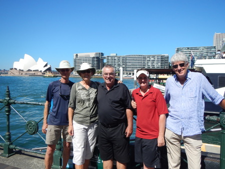
During our last week in Sydney, we managed to see and say good-bye to most of our Sydney family. For our last day here, we purchased tickets to an "Opera's Greatest Hits" performance at the Sydney Opera House. The concert was on a Sunday evening, and we had planned to go into the city earlier in the day for one last stroll through the Botanical Gardens. However, at the last minute, we got some surprise visitors - our friends Kerri & Andrew (s.v. Mariposa) flew into Sydney from Auckland in order to help deliver a boat back to New Zealand. So on that Sunday afternoon, we ended up catching up with them for a few hours in the city - a very sweet reunion!
Our farewell dinner on board Slip Away with John & Rosemary
Coffee with Aunt Patty
Lunch on Slip Away with Deena & Bruce
Our last afternoon in Sydney with
Andrew & Kerri (s.v. Mariposa) and Andrew's friend RegPort Stephens, New South Wales (February 10 - 23). When we departed Sydney, we sailed north to Port Stephens (94 nm, 20 hours). The weather forecast called for light and variable winds, so we were quite surprised and happy that we were able to sail 8 hours of the trip with 10-15 knots of wind from the east. Port Stephens is a large bay with several options for anchoring. Jon & Heather (s.v. Evergreen) had sailed up to Port Stephens a few days before us and had scoped out a few dive sites, which they were raving about, so we were excited to arrive here and check them out.
When we first pulled into Port Stephens, we tied up to a free public mooring in Nelson Bay. Although we are usually quite happy (and prefer) to use our own anchor, there are some strong tidal currents in this bay, so using the mooring was a nice option. These moorings were close to the good dive sites, and we did a couple of dives from here - Fly Point and Pipeline. The diving here was very different from the tropical diving we've been doing recently. This was our introduction to "muck" diving. There were no colorful corals, but there was lots of interesting sea life, most of which we had never seen before - wobbegong sharks, a coffin ray, rhinoceros crab and several varieties of new nudibranchs. Very cool!
Spotted Wobbegong
Coffin Ray
Rhinoceros Crab
There was a wide variety of nudibranchs on these dives
We saw lots of these tiny "blue dragons"We were watching for a weather window to continue north, but all weather forecasts for the foreseeable future were calling for north winds, so we settled in to stay for a bit. The moorings at Nelson Bay were not especially good in north winds, and we were ready for a change of scenery, so we moved to Salamander Bay, which was a much better anchorage with protection from winds from most directions, less tidal currents and good holding in sticky mud. In the weather forecasts, we were keeping an eye on a low pressure system which was approaching Australia's east coast and had the potential to turn into a hurricane. It was about 700 miles north of us, so didn't pose any imminent danger, but we didn't want to get any closer to it, so we stayed put. This low pressure system did turn into a hurricane, and in fact, a second hurricane formed along the north coast of Australia, and on February 20, Australia was hit with twin Category 5 tropical cyclones - TC Marcia, which went ashore near Yeppoon in Queensland and TC Lam, which went ashore in the Northern Territories. Fortunately, we were well south of both and out of harm's way.
In addition to the good anchorage, Salamander Bay was great location for access to shore. A shopping mall with three grocery stores was just a 15 minute walk from the Bay. There were also bus stops nearby, so we could get around the local area easily and also go further afield. We were quite happy to find out that we could use our Sydney prepaid bus passes here, and we ended up taking a couple of excursions.
First, Jan had some friends she wanted to see in the Hunter Valley. Jan had visited Australia in 1990 with her friend Janet Miles, and through Janet, she met Bill & Wendy Lawson. Bill & Wendy retired early from teaching careers in Sydney and moved to the Hunter Valley (one of Australia's top wine regions) to start a vineyard. In 1990, Bill & Wendy had just bought the property - open land with just a small farmhouse on it. Jan & Janet stayed with them there a couple of days while visiting the area. Over the past 25 years, Bill & Wendy have planted vines and built their vineyard, Catherine Vale. It was a couple of hours by bus from Port Stephens to the Hunter Valley, but the timetables worked out so that we could do it in a day trip. On the bus, we got to see a bit more of the countryside, and we had a fantastic day visiting with Bill & Wendy, sampling some of their wines, seeing their property and learning a bit about growing grapes. Catherine Vale has come a long way in the past 25 years!
Tasting Catherine Vale wines with Wendy & Bill
Catherine Vale grapes on the vineWe did a few other excursions by bus from Salamander Bay. The crews of Evergreen and Slip Away bussed into Newcastle for the day (about an hour away), walked around the town (which is a major coal port) and spent a couple of hours at the Newcastle Museum. Also, the Royal Australia Air Force (RAAF) has a base near the Newcastle Airport, and the two of us very much enjoyed a visit to Fighter World, a fighter jet museum. On another day, we hiked to Tomaree Heads, the headlands at the entrance of Port Stephens. After our hike, we took the bus to Holbert's Oyster Farm and enjoyed a late lunch of fresh oysters and prawns, which are farmed locally. As we left Holberts and started our walk back to Salamander Bay, we ran into a guy leaving Diemars Oyster Farm (just next to Holberts). Rich was interested in the oyster farming process and stopped to ask him a few questions. Unbeknownst to us, we were speaking to Warren Diemars, the very first oyster farmer in this area. (He told us he was 84 years old, but he looked like he was in his 60's!) He was happy to answer Rich's questions, let us sample an oyster from his farm (better than Holbert's!) and then offered us a ride home. What a nice guy!
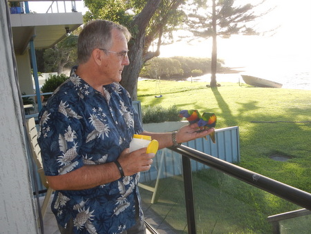
During our time in Salamander Bay, we were also treated to some American hospitality. Barbara & Jim Cole (friends of friends) live in Salamander Bay; Jim works for Boeing and has been on assignment here in Australia for the past couple of years. They got in touch with us and invited Evergreen and us to their home for dinner - a very nice treat!
The busy port of Newcastle
Fighter jets on display at the Fighter World museum
View of Shoal Bay and Port Stephens from Tomaree Heads
The two of us at Tomaree Heads
This Lace Monitor Lizard scared the heck out of us because at first
all we saw was his tail, and we thought it was a snake
Jim Cole feeding lorikeets from his porch
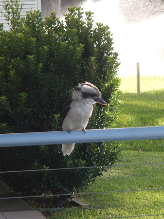
This kookaburra stopped by the Cole's for a visit too
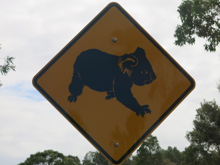
There are koalas in this area, but unfortunately, we didn't see any hereWe ended up spending almost two weeks in Port Stephens. It's funny that we hadn't really given much thought to stopping and spending time here, but we ended up really enjoying it. This was a great place to be "stuck" for a couple of weeks. But, finally, the weather patterns changed, and it was time for us to move on.
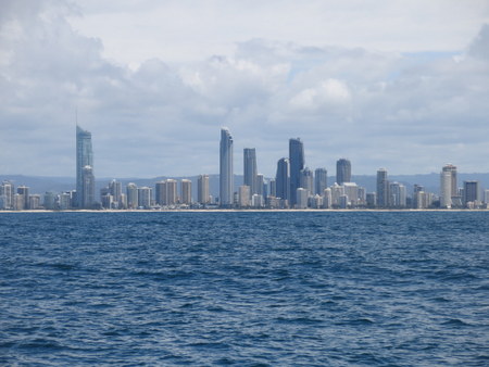
Passage from Port Stephens to Moreton Bay (February 24 - 27, 338 nm, 2 days + 12 hours). Although it would have been nice to stop at a few more places along the coast as we headed north toward Brisbane, we didn't really have time to dally. We needed to do some boat maintenance and had a berth reserved in Newport Marina starting on March 1 for a couple of months, so we needed to get a "wiggle" on. The weather forecast was good, but we had light winds for this passage, so we spent 2½ days motoring north. We stayed closer in to shore heading north than we did on our passage south and managed to avoid the worst of the strong south-setting current which gave us such a nice ride in the other direction. However, there were some spots where we couldn't get completely out of it, including a few hours when it slowed us down by almost three knots. In any event, it was a good trip. After two days offshore, we pulled into the Gold Coast Seaway in the early afternoon, and the tides were favorable for us to continue north through the inland waterways to Moreton Bay. We stopped and anchored for the night at Brown Bay (just before reaching the southern end of Moreton Bay), and the next morning, we weighed anchor and carried on to the Tangalooma Wrecks anchorage off Moreton Island. Tangalooma Wrecks (February 27 to March 1). We had a couple of days to play before we headed into Newport Marina, and spent that time anchored off Moreton Island, much of which is designated as a National Park. In the early 1960's the Australia government scuttled a number of workboats off the west coast of Moreton Island just north of Tangalooma Point in order to create an artificial reef that would provide a sheltered anchorage in westerly winds. The project was not a complete success (the anchorage is still not great in westerly winds), but we had light southeasterly winds during our time here, so the anchorage was great. Also, fish congregate around the wrecks, which makes for good snorkeling. We did some snorkeling here and went for a nice hike to "The Desert" - an area on the island with big sand dunes. The weather was beautiful, and even though it was a weekend, the anchorage was not too crowded. It was a nice couple of days.
High rises along the Gold Coast of South Queensland
The Tangalooma Wrecks and boats anchored between
them and Moreton Island
Majestic Sea Eagle
The sand dunes of the "Desert" in the interior of Moreton IslandNewport Marina, Scarborough, Queensland (March 1 to May 18). We ended our weekend at Tangalooma with a good sail across Moreton Bay to Newport Marina (18 nm, 3¼ hours). Winds were quite light when we first left the island, so we started out motoring, but then decided to put up the spinnaker for a run across the flat waters of the bay. Of course, shortly after we hoisted the spinnaker, the wind started to build, which made us a bit nervous with that big sail. But we did enjoy about an hour's worth of time sailing with our colorful chute. We pulled into Newport Marina mid-afternoon and Vic, the marina manager, was there to help us tie up.
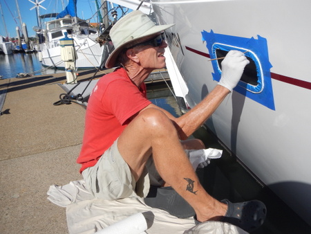
We spent the next couple of months in Newport Marina doing mostly boat maintenance and repair work. Our cruising plans for later in the year were taking us to Indonesia, and we wanted to take care of any maintenance issues while we were still in a first-world country with access to supplies and services. We didn't have any major issues and did not require a haul-out, but there were some things which required attention. Rich spent many hours re-bedding all of our windows, stanchions and various other pieces of deck hardware, which took care of some leaks which had developed. He also did some engine maintenance, and we replaced some old running rigging, varnished all exterior teak, and polished Slip Away's hull so that she was shiny and bright. We keep an on-going list of items we need and/or want to buy for ourselves or the boat, and Jan was happy to find that on-line shopping in Australia was as easy as it is in the U.S. Jan was able to source and purchase quite a few of the items we needed on Ebay, and those items shipped to us from around the globe - a new anchor and chain for the dinghy from Australian suppliers, a new kill switch for the outboard from China, several Lonely Planet guide books from a used book dealer in Great Britain, new scuba BCD's from the U.S. - the list goes on, and shipping charges were very reasonable and sometimes free. We also bought some things off Amazon, and both Amazon and Ebay in the U.S. have re-vamped their international shipping services with great rates.
Re-bedding a v-berth port
Replacing the tri-color light on the main masthead
Searching for the source of an elusive leakIn addition to the boat, we did some maintenance on ourselves with health checks with a local GP and dermatologist. We also visited a Travel Doctor where we received several vaccinations for our upcoming travels - tetanus boosters, typhoid, rabies, Japanese Encephalitis - as well as a script for malaria prophylaxis.
Though we were pretty consumed with boat work, we enjoyed a number of get-togethers with our friends Peter & Laura Taylor who lived nearby. Dinners at their apartment were such a nice treat! And they were so generous to us - lending us bicycles for the entire time we were there and leaving one of their cars with us when they went away for a couple of weeks. The bikes were great for running small local errands, but having a car allowed us to take care of some bigger errands and/or ones that took us further afield. Jan needed to stock the boat with provisions for the next several months, and the car was a god-send. She made several trips to the grocery stores, each time coming home with the trunk of the car filled with heavy stuff.
Farewell dinner on board Slip Away with Laura & Peter Taylor
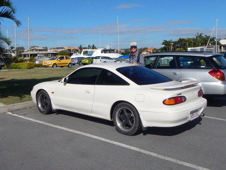
Our "wheels" - not only helpful in running errands, but fun to drive!
We also made friends with another local couple - Gary & Wendy Cox - whose boat was just across the dock from us. We were only in the marina for about a week when Gary came over and invited us to dinner at their home. Another couple (George & Kim) who lived nearby were also invited to dinner that night, and they gave us a ride to Gary & Wendy's house. It was a delightful evening, and we enjoyed a couple more get-togethers with Gary & Wendy. Gary also offered his car to us when we needed it. Aussie hospitality is unsurpassed! Our goal was to be done with our boat work by the end of April so that we could take our time sailing north along the east coast of Australia to Cairns, where we would join the Sail2Indonesia Rally. Of course, boat work is never "done", and we were delayed a bit when a couple of our travel vaccinations had to be administered over the course of a few weeks. Then the weather turned to crap for a few days, so we stayed a bit longer. But the weather finally cleared, and it was time for us to get on our way.
On May 18, we left the dock at Newport Marina, sailed across Moreton Bay and headed north.
Pizza night with Gary & Wendy at Miccolini's
(across the street from the marina).Just a few more photos:
Our friends the McNeill family (s.v. Blackjack) were in Australia from
New Zealand for a wedding and stopped by to pay us a visit.
So nice to see them again!
This little green tree frog showed up one evening on our solar panel.
Myna birds around the marina greeted us each morning with beautiful songs
Lorikeets on Jan's morning walk
.JPG)
.JPG)
.JPG)
.JPG)
.JPG)
.JPG)
.JPG)
.JPG)
.JPG)
.JPG)
.JPG)
%20-%20Echidna.JPG)
.JPG)
.JPG)
.JPG)
.JPG)
.JPG)
.JPG)
.JPG)
.JPG)
.JPG)
.JPG)
.JPG)
.JPG)
.JPG)
.JPG)
.JPG)
.JPG)
.JPG)
.JPG)
.JPG)
.JPG)
.JPG)
.JPG)
.JPG)
%20-%20Platypus.JPG)
.JPG)
.JPG)
.JPG)
.JPG)
.JPG)
.JPG)
.JPG)
.JPG)
.JPG)
.JPG)
.JPG)
.JPG)
.JPG)
.JPG)
.JPG)
%20-%20spotted%20wobbegong.JPG)
%20-%20coffin%20ray.JPG)
%20-%20Rhino%20crab.JPG)
.JPG)
.JPG)
.JPG)
.JPG)
.JPG)
.JPG)
.JPG)
.JPG)
.JPG)
.JPG)
.JPG)
.JPG)
.JPG)
.JPG)
.JPG)
.JPG)
.JPG)