Logbook: New Zealand (December 2013 to June 2014) + Jan's USA trip (April to May 2014)
We arrived back in New Zealand from Fiji in early December 2013 and were excited to spend the coming summer cruising on the North Island. This was our third summer in New Zealand, but on our previous visits we did mostly land travel and boat work, so we didn't see many anchorages. We spent one week last year at Great Barrier Island, and we knew we wanted to go back there, and we had several other anchorages and islands we wanted to visit as well. Our plan was to cruise the upper part of the North Island - the northeast coast and some of the offshore islands. Although it was summer in New Zealand, and our Kiwi friends tell us their country offers some excellent scuba diving, the water was a bit too cool for us - we readily admit that we are wimps! Instead, we planned to spend our summer hiking some of the many beautiful trails this country has to offer. Let the fun begin! Opua (December 9 to 16). Opua is the northernmost port of entry for New Zealand, and we arrived at dawn on December 9. Check-in with Customs, Quarantine and Immigration went smoothly. We knew we couldn't bring any fresh produce or meats into New Zealand, so we arrived with our fridge and freezer almost empty. After completing our paperwork with the officials, we found a good spot to anchor and settled in. Our friend Phil (s.v. Black Jack) took us grocery shopping in Kerikeri, so we could re-stock our freezer and fill up with fresh fruits and veggies. Although Fiji had good produce markets, there is a much wider variety of fruits and veggies available in New Zealand. It's amazing how excited we get over broccoli and cauliflower when we haven't had it for six months! We enjoyed a few get-togethers with friends and meals at the local cruising club, but after a week in Opua, we were ready to get out and start exploring.
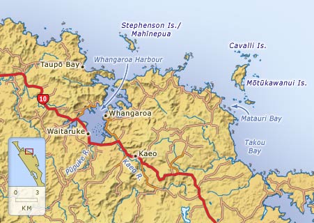
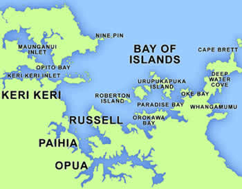
New Zealand's Bay of Islands sit just a few miles north of Opua. They are a beautiful cruising area, but with the holidays approaching, they would soon be overrun with the local crowd. We preferred a quieter scene for the holidays, so planned to head to Whangaroa, which is further north along the coast. The weather forecast was calling for southwesterly winds in a couple of days, which would allow us to sail north, so we hung out in the Bay of Islands for a short while to wait for those.
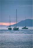
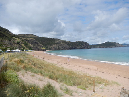
Arriving Opua at dawn in early DecemberBay of Islands - Roberton and Moturoa Islands (December 16 to 18). We first visited Roberton Island (just 8 miles from Opua), met up with some friends there and hiked to the lookout point, where we enjoyed the beautiful views of the area. After a day at Roberton, we moved to Moturoa Island (3 miles away) and did another short hike before leaving for Whangaroa the following morning.
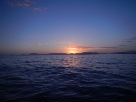
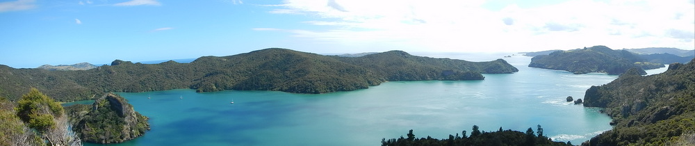
View from the lookout atop Roberton Island. Moturoa is the island just past the end of Roberton.Whangaroa Harbour (December 18, 2013 to January 2, 2014). It was a 32-mile trip from the Bay of Islands to Whangaroa Harbour, an easy day sail, especially since we were approaching the summer solstice in New Zealand, and days were quite long. Unfortunately, the forecast of 15 knots of southwest winds never materialized - that would have been ideal. Winds were mostly light from a variety of directions - from south to northwest. We sailed a short while, but it was mostly a motor trip.
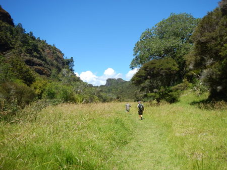
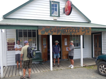
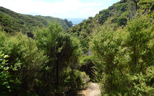
Whangaroa is a gorgeous harbor with rocky bluffs and ridges formed by eroded volcanoes. The harbor is very large and well-protected, with several bays in which we could anchor. Our first stop was Waitepipi Bay, a beautiful spot with access to several hiking trails. Our friends Karen & Paul (s.v. Gigi) and Craig & Bruce (s.v. Gato Go) had also sailed up to Whangaroa, and we studied our trail maps and decided to hike the Wairakau Stream Track (11 km roundtrip). The track started at the nearby Lane Cove and meandered through the "bush" (that's what they call the forest in NZ) to the village of Totara North. Our cruising guide indicated that in Totara North we would find a wharf with a shop that sold ice cream. We set off "tramping" (that's what they call hiking in NZ), and at the end of the trail, we found a road. We weren't sure whether to turn left or right to get to the wharf, so we stopped a passing "ute" (a small pickup truck) and asked directions. The driver told us that the wharf was to the left, but the shop that sold ice cream was closed. Darn! But then, he suggested that if we walked to the right for about a half kilometer, we would find a tavern where we could get some lunch. We were all hungry, so we headed for the pub. Lunch at the Gum Diggers Tavern was excellent - great burgers, cold beer and fun atmosphere. Fortified with food, we headed back toward Lane Cove. On the trail, we ran into a local family who was hiking in the opposite direction as us - they started at Totara North, hiked to Lane Cove and were headed back Totara North. We said hello when we passed them the first time, but this time, we stopped and chatted a bit and realized we knew one of them - the teenage son, Murdoch. Murdoch is a good friend of the kids on s.v. Black Jack. He had visited them in Fiji, and we met him there. And, here we were on the same hiking trail. Small world!
Tramping on the Wairakau Stream Track
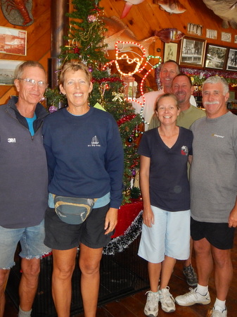
The two of us with Karen & Paul (s.v. Gigi) and
Craig & Bruce (s.v. Gato Go) at the Gum Digger's Tavern
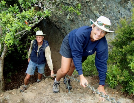
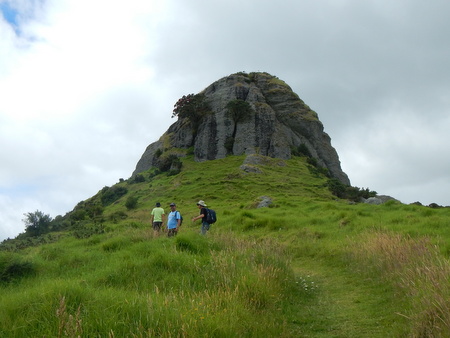
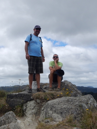
The Gum Digger's Tavern - a great stop for lunch mid-way on our hikeA couple days later, the six of us did another hike together - a much shorter, but more strenuous hike to the Duke's Nose. It was only a half-kilometer each way, but it was an uphill tramp, and the last part involved using chains to climb up the face of a rock. Rock climbing is not exactly Jan's strong suit, but she did it. Getting to the top wasn't so bad; getting back down was a bit more difficult, but Rich patiently coached her down. The views of the harbor from the Duke's Nose were outstanding!
Climbing up to the Duke's Nose - Rich makes it look easy!
Gato Go anchored in front of the Duke's Nose
Rich & Bruce did the precarious hike out onto the actual nose.
Jan & Craig passed on that.
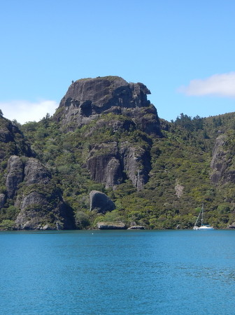
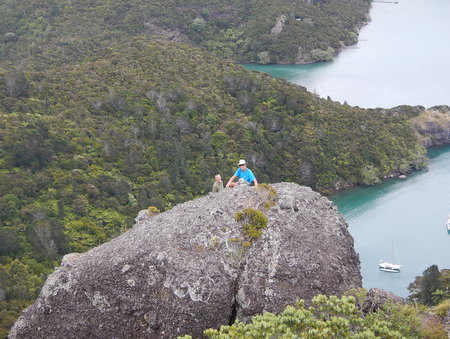
View of Whangaroa Harbour from atop the Duke's HeadSlip Away and Gato Go had their eye on another hike - St. Paul's Rock - but we had to move to another anchorage to do it, and Gigi opted out on this one. The St. Paul's Rock track was accessed from the town of Whangaroa, and we anchored across the bay at Totara North. The actual track was about 1.5 km roundtrip, but walking from town to the trailhead probably doubled that distance. We did the hike in the morning - to the top of the rock and more beautiful views of the bay. Since the Gum Digger's Tavern was a fairly easy walk from the Totara North anchorage, after our morning hike, we headed to the pub for lunch. All of us had ordered burgers on our previous visit, but Paul (s.v. Gigi) had their fish & chips and said it was excellent. The woman working at the pub (one of the owners) told us that her husband catches the fish fresh daily. So this time all four of us ordered fish & chips - and it was delicious! As far as we were concerned, this was the best fish & chips we'd had in New Zealand.
Rich, Craig & Bruce heading up to St. Paul's Rock (aka "the Nipple")
Craig & Bruce at the top of St. Paul's Rock
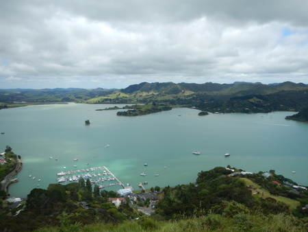
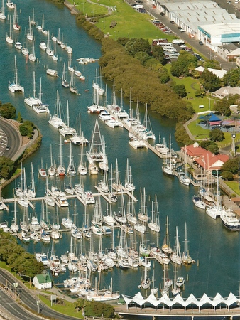
View of the Whangaroa town and marina from St. Paul's Rock.
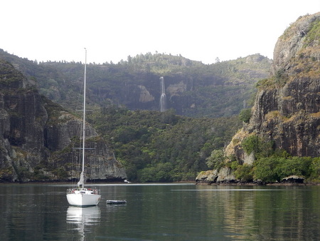
Slip Away and Gato Go are anchored on the opposite side of the bay at
Totara North.Christmas was just a couple of days away, and Gigi and Gato Go had plans to celebrate the holidays with some land-based friends in Opua, so we said good-bye, and they sailed south. We were looking forward to spending a bit more time in Whangaroa and had a Christmas celebration planned with Chris (s.v. Lady Bug) and Matthew (s.v. Rock & Roll Star) who had recently arrived in the bay. Chris and Matthew were both "batching it" for the holidays - their significant others were working temporary jobs to replenish the cruising kitty - Chris' wife Rani as a pharmacist in Canada, and Matthew's partner Jill as a chef on a luxury yacht. The guys offered to cook the main dishes for our Christmas dinner. Chris made a chicken curry. Matthew roasted a leg of lamb with all the trimmings and hosted the dinner on Rock & Roll Star. So, Jan had it easy and only needed to bring a couple of side dishes and dessert - some of her homemade Christmas cookies. It was a low-key but very enjoyable holiday celebration.
On Boxing Day (December 26), our friends Irv & Marie (s.v. Freezing Rain) drove up from Auckland to meet us in Whangaroa. They arrived late afternoon, and we then rode with them up to Mangonui Fish Shop (about 35 km further north) for dinner. The Mangonui Fish Shop claims to have the best fish & chips in New Zealand, so we were keen to try theirs. Their fish & chips were OK, but not as good as the Gum Diggers! Irv & Marie spent the night at the Whangaroa Inn, and the next day, we joined them for a drive along the scenic coastal road to Kerikeri. In Kerikeri, we visited the Rainbow Falls, had lunch at Cafe Cinema (a favorite of ours) and they took us grocery shopping so we could re-stock our supply of fresh veggies and fruits. After bringing us back to Whangaroa, Irv & Marie headed back to Auckland. It had been a fun couple of days. We first met Irv & Marie in Mexico in 2005 - what a nice reunion on the opposite side of the world!
Fish & Chips at the Mangonui Fish Shop - good, but not the best!
Unfortunately the sun was not shining on this visit,
so we didn't see the rainbow at Rainbow Falls.
Beautiful Wainui Beach along the scenic coastal roadWe stayed in Whangaroa Harbour through the New Year and hiked the Duke's Nose once more, this time with Chris (s.v. Lady Bug). On New Year's Eve, the two of us hiked the Wairakau Stream Track from Lane Cove to Totara North once more for another fish & chips lunch at the Gum Digger's Tavern. That evening, we gathered on the beach with the crews of Lady Bug, La Fiesta, and Zephyrus and toasted the New Year. The two of us had had a full day, so we only lasted until about 9 p.m. (cruisers' midnight) and then went home to sleep.
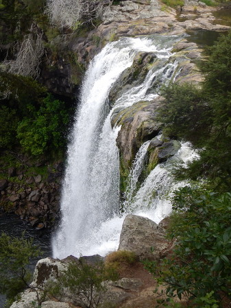
We had a bit of rain on Christmas, and afterward
we saw a beautiful waterfall from the anchorage
Chris (s.v. Lady Bug) enjoying the view
from the Duke's Nose
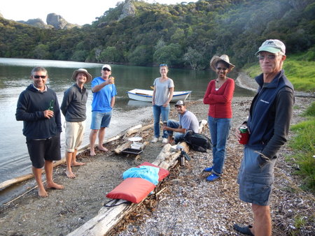
Our low-key New Year's Eve celebration on the beach with
the crews from La Fiesta, Lady Bug, Zephyrus and Slip AwayWe really loved Whangaroa - the scenery is beautiful, the anchorages are excellent (calm, good holding and good shelter), and we did some outstanding hikes. But we had more places to see, so it was time to move on. After the New Year celebrations, with a weather forecast for settled conditions, we ventured to a couple of anchorages outside the harbor.
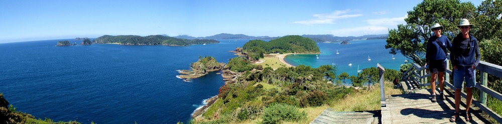
Mahinepua Bay & Cavalli Islands (January 2-3). We left Whangaroa Harbour on a wind-less morning, so we motored the short distance to Mahinepua Bay (9½ nm). We arrived late morning, packed a lunch, and hiked a beautiful trail which ran the length of the Mahinepua Peninsula (6 km roundtrip). The next morning, in light winds, we sailed the even shorter distance (4½ nm) to Motukawanui Island in the Cavalli Island Group. Again, we packed a lunch and headed ashore to hike a trail which ran along ridges and through valleys of the island (7 km roundtrip). The scenery was fantastic and the track was quite hilly, which gave our legs a good workout.
Looking back toward the mainland from the Mahinepua Peninsula Track
Motueke Island (better known as Flat Island) off the tip of the Mahinepua Peninsula
The bush was thick in the interior of Motukawanui
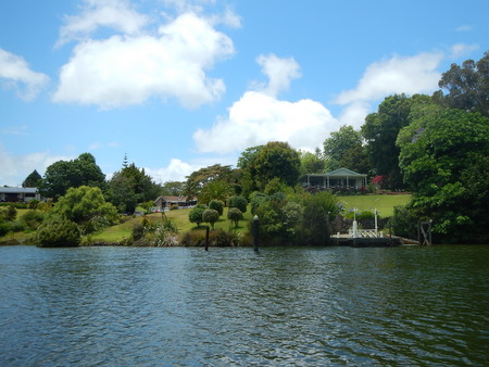
Slip Away anchored at Horseshoe Bay on Motukawanui Island
We arrived back at Slip Away from our hike on Motukawanui at about 3 p.m., and the wind had come up to about 15 knots from the northwest. Our anchorage had a fair amount of wind chop, and we didn't feel comfortable staying here for the night, so we weighed anchor, unfurled our headsail and headed down the coast to Waiana Bay, which on the charts looked like it would offer protection from the north winds. When we arrived at Waiana, it was protected from the wind, but the swell was wrapping around the corner making for a rolly anchorage. It was about 4:30 p.m., and we looked at the distance to the Bay of Islands, which was about 15 miles further down the coast. We knew we could find a good anchorage there, and since summer days in New Zealand are quite long, we figured we could pretty easily make it there before dark. We sailed south with 15-18 knots of wind from astern and arrived at the very calm Whale Bay (just inside Cape Wiwiki) and dropped our hook by 7:15 p.m. Whale Bay is on the northern edge of the Bay of Islands, and since it was just a couple days after the New Year, the holiday crowds were definitely present. We were amazed at the number of boats here, but it was a fairly large anchorage, and we dropped our hook on the outskirts of the masses. Although we find most New Zealanders to be super people, there are a couple of things they don't do well. Many are not particularly good drivers, and the poor anchoring skills of the holiday boating crowd are legendary. So we were trying to keep our distance. When we anchored, we still had well over an hour of daylight/twilight, and in that time we saw a few boats leave and several more come into the anchorage. Our spot on the outskirts was no longer so far out. At about 8:45 pm, one last boat pulled into the anchorage - a power boat with a group of guys on it. They dropped their anchor right in front of us, let out about 2:1 scope (we usually do at least 5:1), and sat about a boat length off our bow. Great! It was too late to move to a new spot, and even if we wanted to, this guy was sitting on top of our anchor. Rich had a sleepless night, worried that the wind would come up and this boat would drag into us. When Jan woke up the next morning, she found Rich sitting out on the front deck, drinking his coffee and giving the stink-eye to the offending boat. The boat weighed anchor early to go out fishing, and fortunately, they did not pull our anchor up with theirs.
This boat was anchored a bit too close for comfortDoves Bay / Kerikeri (January 4-8). Since we arrived in the Bay of Islands on the last big weekend of the holiday break, rather than hang out in the islands, we headed to Doves Bay, near the Kerikeri Cruising Club. From this anchorage, we could dinghy up the river to Kerikeri, which is one of our favorite towns in Northland. Shortly after we dropped anchor, we got a call on the radio from our friends Don & Paulie (m.v. Storm Haven), who were just arriving in the Bay of Islands from an anchorage further south. They ended up joining us in Doves Bay for a couple of days, and we shared a couple of meals and had a fun excursion into Kerikeri for their Sunday Farmer's Market. Storm Haven then continued north to Whangaroa, and we stayed a couple more days. We made another trip into Kerikeri to meet our friend Murray Reid for coffee. After coffee with Murray, we did a nice walk along the river and went into town to meander through a few stores, coming home with new pillows and a couple of items from the hardware store. The Kerikeri Cruising Club was pretty deserted - most of its members probably out enjoying the islands, so there wasn't much actually happening in the marina or at the club. But, they did have a decent washer and dryer, so Jan had an opportunity to do a few loads of laundry, which had been accumulating over the past few weeks. On our last night here, s.v. Black Jack pulled into the anchorage, and we enjoyed the opportunity to catch up with Phil & Helen over drinks on Slip Away.
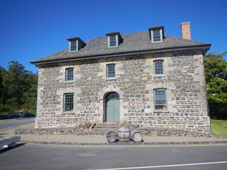
The Stone Store in Kerikeri is New Zealand's oldest stone building,
built in the 1830's.
Since it was Summer, the gardens near the
Stone Store were in full bloom
The dinghy trip along the Kerikeri River was quite scenic.
A walk along the river bank with a stop at Wharepuke Falls - nice day!
The dinghy is loaded with provisions after a shopping trip in Kerikeri
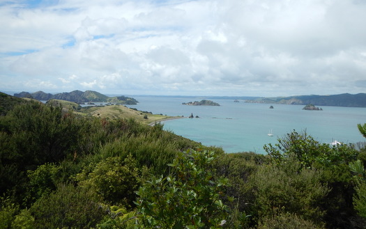
Bay of Islands - Moturua and Urupukapuka Islands (January 8-11). Although some businesses were closed for another week of holiday break, the Christmas crowds had dwindled a bit in the Bay of Islands, so we were eager to see more of this area. From Kerikeri, we had a nice sail to Moturua Island (9 nm). Most of the island of Moturua has been set aside as a scenic reserve; the forest is regenerating, and native birds are returning to nest on the island. We spent a morning hiking a trail that circumnavigated the island (a 4.6 km loop), and on the trail, we ran into a couple of volunteers who were tracking bird populations. We really enjoyed the song of the Tui bird and also saw some dotterels on the beach.
We must have inadvertently walked close by to this Dotterel's nest
because he or she put up quite a fuss with us.
We saw numerous stoat and rat traps on the islands -
Project Island Song is trying to remove the pests
that kill the native birds
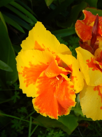
Pohutukawa trees in full bloom on Moturua
It was a short distance from Moturua to Urupukapuka Island (3½ miles), but it was such a pretty day that we chose to spend an hour sailing it slowly in the light winds. However, as we arrived at Urupukapuka, we had the opportunity to see NZ anchoring etiquette at its worst. As we approached the anchorage, we started the engine and headed toward an open spot to drop our hook. There was a squall approaching, but we figured we had time to get anchored before the rain hit. We were slowly motoring along approaching our spot, when a power boat sped past us, maneuvered into the spot we were aiming for, and quickly dropped their anchor. There was plenty of room in this anchorage, so we were pretty perplexed about this boat's actions - actually trying to figure out what the heck they were doing! Once they anchored and stopped their boat, the female crew member on board turned and yelled to us "We're anchored!" We were coming right up on their stern, and had to quickly change course to avoid hitting them. So, we picked out a new anchoring spot (just in front of this boat) and dropped our hook. Unfortunately, this short delay caused Rich to get soaked with a cold shower while we were anchoring. Shortly after the squall passed, the offending boat picked up their anchor and left. WTF?! When we related this story to some of our NZ friends (ones who understand normal anchoring protocol), they just shook their heads.
Urupukapuka is the largest of the Bay of Islands and is also parkland, but it is farmed, so most of the trees have been cleared from the island. That said, it has numerous hiking trails, and we spent the better part of a day tramping around the island, up and over rolling hills and enjoying beautiful views of the Bay of Islands (about 10km total). We nicknamed this island "Uru-poopa-poopa" due to all the sheep poop on the trails and made sure there was no residue on our shoes before heading back to Slip Away. While on the trail, we met a family from Wellington, the Goulds on s.v. Soulmate, and spent some time talking with them, only to find out that we had good friends in common - the Wilson family (s.v. Ceol Mor) whom we visited in Wellington during our land travels a couple years ago. We enjoyed a fun happy hour on Soulmate that evening.
Hiking is quite scenic on Urupukapuka
Waewaetorea Passage between Urupukapuka and Waewaetorea IslandsOpua (January 11-12). From Urupukapuka, we needed to go into Opua to pick up a new thermostat for our engine. It's quite convenient that Opua is located so close to the Bay of Islands. We motored into Opua in the morning (12 miles), picked up the part and Rich installed it that afternoon. That evening, we went to dinner at the Opua Cruising Club and ran into a few friends. The next morning, we headed out again. Although we would have enjoyed lingering here a bit longer, there were north winds in the weather forecast, which would afford us a good opportunity to travel south.
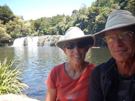
Deep Water Cove (January 12-13). There was one last hike we wanted to do before leaving the Bay of Islands area - the Cape Brett trail from Deep Water Cove. We had a day before the north winds were forecast to arrive, so we left Opua early on a Sunday morning and motored in calm conditions to Deep Water Cove (16 miles). We arrived late morning and immediately headed ashore for the 10 km hike. We had friends who had done this hike and told us the views were stunning, but they didn't mention that the trail was quite a workout. A brochure we had described the trail as "undulating" - reading between the lines, that meant nothing flat, only steep up and steep down. The scenery along this trail was indeed gorgeous.
Rich pauses to take in the view
Steep drop-offs along the coast
Cape Brett - the end of the trailWhangaruru Harbour & Mimiwhangata Bay (January 13-15). The morning after our arduous hike to Cape Brett, we enjoyed a different view of the Cape when we sailed around it and then headed south along the east coast of NZ's North Island. We enjoyed a few hours of lovely sailing with 10-15 knots of WNW winds and flat calm seas, making it almost all the way to Whangaruru Harbour (20 miles) before the winds got fluky and we had to start up the engine.
Sailing around Cape Brett with favorable winds and calm seas
The coastline from Cape Brett to Whangaruru HarbourWhangaruru is another large harbor offering several anchoring options, and we moved around each day as the wind direction was constantly changing. Upon arrival, we anchored just inside the bay on the west side of the headland (near the campground indicated by a tent on the map), and the next day we hiked the Whangaruru North Head Scenic Reserve Track (10K). When we returned from the hike, the wind had come up from the southwest, so we sailed 5 miles further south and anchored in the southwest corner of Mimiwhangata Bay (at the bottom of the map). The next morning, did another 10K hike through the Mimiwhangata Coastal Farm Park - our legs were getting quite strong by now! As we hiked that day, the wind came up from the east at about 15 knots, so when we got back to Slip Away in the early afternoon, we moved over to the east side of Mimiwhangata Bay (just a mile across).
The flora was quite diverse on Whangaruru North Head
Lots of bromeliads at Whangaruru North Head and throughout New Zealand
View from Mimiwhangata to the Poor Knights Islands offshore
Mimiwhangata had gorgeous beaches - hope these cows appreciated the view!Whangarei Heads (January 16). From Whangaruru, we continued south toward the Whangarei Heads, intending to meet our friends Craig & Bruce (s.v. Gato Go) at McLeod Bay. We arrived and anchored at McLeod just as Craig & Bruce were returning from a hike, but once again, we needed to seek out a another anchorage due to the wind direction. Fortunately, we had options, and In short order both of us moved to the anchorage outside Marsden Cove Marina, which has some strong currents but offered better protection. We had a fun get-together and dinner on Slip Away that evening, and early the next morning, Gato Go moved into the marina because they had some business to take care of. We planned to stay anchored outside for another day or so before moving into the marina in anticipation of some bad weather that was heading our way.
Winds were not supposed to be particularly strong that day, but by mid-morning, they were blowing in the mid-20's. The anchorage was uncomfortable, and with this nice and not-too-expensive marina sitting just in front of us, we saw no reason to stay at anchor. So, we called the marina office, got a berth assignment, weighed anchor and headed in. We then called Craig & Bruce to let them know we were on our way into the marina and asked them to help us with our dock lines. Docking the boat in this wind would be no fun, and we definitely needed some help! We didn't realize that our assigned berth was about a 10 minute walk from Craig & Bruce's and we arrived too quickly - they weren't quite there yet. Our berth was near the end of "A" dock, but as we turned down the channel between "A" & "B" docks, we were past our berth before we saw the number on it. Crap!! As soon as we realized we missed our berth, Jan spotted an open "double-wide" catamaran berth on "B" dock. She quickly turned into the middle of the big berth and hit reverse. When she backed out into the channel, fortunately our prop walked in the right direction, so that we could turn around and head back out in the direction from which we came. This gave Craig & Bruce enough time to get to our berth, and also gave us a chance to take a deep breath before turning around and starting over again! On our second attempt, we got into the correct berth, and the docking went relatively well with the help of our friends.
Marsden Cove Marina (January 17-25). Cyclone June had just wreaked havoc on some of the South Pacific Islands and was now headed toward New Zealand. Although the cyclone would weaken when it hit colder waters, the remnants were still expected to bring stormy weather, so we sought shelter in Marsden Cove Marina. We had a day of high winds and a bit of rain as the storm passed over us, but overall it wasn't too bad. Inside the marina, we were safe and snug and we enjoyed quite a bit of socializing. Craig & Bruce had a car, and we went out for pizza one night - a nice treat! Our friends Don & Paulie (m.v. Storm Haven) came into the marina shortly after us, so we got to spend some time with them too. We also met some new folks on the dock so made a few new friends. Before we knew it, a week had gone by, and the bad weather was long gone. It was time to head further south, and after this short respite in Marsden Cove, our plan was to visit some of the islands in the Hauraki Gulf.
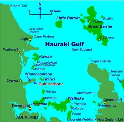
Bon Accord Harbour, Kawau Island (January 25 to 28). With a weather forecast calling for north winds, we departed Marsden Cove early in the morning for our long day sail to Kawau Island (46 nm, 9¼ hours). We motored the first half of the trip in light winds, but then had a nice sail the second half with 10-15 knots of east-northeast winds (on our beam). Kawau Island was mined for copper in the mid 1800's, but in 1862, the island was purchased by a politician, Sir George Grey. He built a mansion on the island and collected a variety of non-native plants (such as redwood trees) and animals (including wallabies and peacocks), which are still on the island today. Most of the island is privately owned, but about 10% of the island is a preserve, which includes the Historic Mansion House and a series of easy walking tracks. We hadn't had much exercise during the past week at Marsden Cove, so it was time to get back in shape! We packed a lunch and spent the day walking the trails. We heard that we shouldn't expect to see any of the wallabies in the daytime, but shortly after we started hiking, we were caught by surprise when we saw one bounding down the trail toward us. The wallaby was also obviously taken by surprise when it spotted us, because it quickly darted into the bush. Darn! We were definitely not quick enough for that photo op! One of the trails we hiked ran along the southern shoreline of the island, and it was a windy day with quite strong southerlies. Fortunately, Slip Away felt only a gentle breeze anchored in the very well sheltered Bon Accord Harbour. At the end of the day, we stopped for a beer at the Mansion House Cafe and ran into Jock & Leanne (s.v. Just in Time), a couple we met in Fiji.
Coastal section of the hiking trail on Kawau Island
Remains of the copper mining industry
It was much easier to get a photo of the wallaby fence
than the wallaby who darted by usFrom Kawau Island, we had hoped to continue south toward Auckland, but when the weather forecast called for southerly winds for the next few days, we altered our plans and headed east to Great Barrier Island.
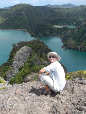
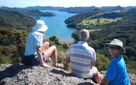
Great Barrier Island (January 28 to February 6). We spent a week at Great Barrier Island last year and loved it so were quite excited to go back. Great Barrier is a large, rugged island with lots of wilderness, great hiking trails and only about 700 permanent residents. There are several good anchorages on the island, and we wanted to explore a few of them. When we left Kawau Island, we started out heading for Port Fitzroy, but we had a better wind angle for sailing to Tryphena Harbour, so that's where we ended up (36 nm, 8 hours).
We didn't really have much information on Tryphena Harbour, but of course, we were interested in doing a hike. We dinghied ashore to the village of Mullberry Grove and saw a sign for a small library, where we found a couple of ladies who gave us a good recommendation. We ended up doing an all-day hike which took us from Mullberry Grove, up Rosalie Bay Road to Windy Hill, where we visited the small but excellent "Top of the Rock Gallery" (gorgeous photographic art). The gallery was unlocked and unattended, with an "honesty box" to leave your money if you wanted to purchase something. We then crossed over the ridge and followed a track to Medlands Beach on the opposite coast. Our legs were not up for a return trip via the same route, so we hitched a ride back to Mulberry Grove. The library ladies told us we wouldn't have a problem hitching a ride, and they were right. We were picked up by a very interesting gentleman from Auckland who was spending a few days here on holiday. He went out of his way to deliver us all the way to Mulberry Grove, so we bought him a beer and had a good chat with him before we went our separate ways.
View of Rakitu (Arid) Island from Windy Hill
Top of the Rock Art Gallery
Medford Beach on the east coast of Great Barrier Island
With a weather forecast calling for southwesterly winds, we saw a good opportunity to visit the east coast of Great Barrier, so we left Tryphena Harbour and sailed around the southern tip of the island. We were quite interested in visiting the small Rakitu Island (aka Arid Island), off the coast of Great Barrier. Rakitu has an anchorage with a narrow entrance, and our guidebook indicated it was large enough to hold 5 or 6 boats. However, the author must have been referring to 5 or 6 very small boats! The anchorage was empty when we arrived, and we slowly motored inside and quickly realized that we were surrounded by rocks with very little wiggle room. We immediately turned around and left. The anchorage was so small that we couldn't do a U-turn - we had to do a W-turn. We headed to Harotaonga Bay, just a couple miles away, along the east coast of Great Barrier Island. Although we weren't able to stay at Rakitu, just seeing it up close from the water was worth the trip. The limestone rock formations were gorgeous and reminded us of the island of Niue. We spent the night at Harotaonga Bay with the winds howling from the southwest. The wind was forecast to go southerly and easterly the next day, so we weighed anchor early the next morning and sailed around the northern tip of Great Barrier enroute to Port Fitzroy (25 miles away), the best harbor on Great Barrier, as it offers protection from all directions of wind. At Port Fitzroy, we met up with our friends Richard & Ali (s.v. Vulcan Spirit). We love spending time with Richard & Ali, so we were thrilled that we could manage this rendezvous.
One of the limestone caves on Rakitu (Arid) IslandWe spent the next several days with these good friends. On the day we arrived in Port Fitzroy, we did a warm-up hike on Warren's Track and the Old Lady Track, with an ice cream break in between at the Port Fitzroy General Store. The next morning, we headed out for the trek up to Mt. Hobson. The two of us had done this hike the previous year and were looking forward to doing it again. The scenery along this hike is just beautiful, especially the views from the top, and our legs were stronger this year, so it was easier this time. (It's about 15K roundtrip.) Over the next few days, we did another hike on Kaikoura Island (aka Selwyn Island), and we all enjoyed a hot bath at Smokehouse Bay. Great Barrier, and especially Port Fitzroy, is a popular destination, and we ran into a few other folks we knew, including Brian & Amanda (s.v. Clara Catherine), a couple we hadn't seen since the Marquesas Islands in French Polynesia.
Waterfall on Warren's Track
View of Port Fitzroy from the Old Lady Track Lookout
Mt. Hobson Hike
Mt. Hobson Hike
Rich and Ali taking a break after eating lunch
on the porch of the Department of Conservation (DOC) Hut
Cutting wood to stoke the fire for a hot bath at Smokehouse Bay
Water is hot - time for a bath!
View south from Kaikoura (Selwyn) IslandWe could have spent much more time at Great Barrier, but when we saw north winds in the weather forecast, we decided to head south to Auckland. Auckland was our southernmost destination for this cruising season, and since the prevailing winds here generally have some southerly component to them, we felt we needed to take advantage of this weather window. We said good-bye to Richard & Ali, and the afternoon before our planned sail to Auckland, we moved 10 miles south of Port Fitzroy to Whangaparapara Harbour, which not only put us a bit closer to Auckland, but also would be an easier harbor from which to depart before dawn. For the past few days, the weather forecast had been calling for 15 knots of northeast wind, which would be ideal for this trip. When we arrived in Whangaparapara and checked the weather once more (which we did at least twice daily), it had changed a bit - the weather service had now issued a "strong wind warning" calling for 25 knots of wind, gusting 30. Oh great!
Passage from Great Barrier Island to Auckland (February 6, 48½ nm, 7½ hours). It was a long day sail to Auckland from Great Barrier, and in addition to covering the distance, we needed to arrive by 2:30 p.m. - in time for high slack tide to enter the Tamaki River and get into the berth we had booked at the Bucklands Beach Yacht Club. We were up before dawn and listened to the weather forecast one more time. There was still a strong wind warning, but winds would be lighter in the morning, build during the day and be stronger in the northern part of the Hauraki Gulf. That was all good news for us as we were getting an early start and heading south. Also, the wind direction was now forecast to be easterly - we would have preferred it to be northeast, but easterly was still OK. We weighed anchor shortly after 6 a.m. and hoisted our mainsail with a double reef in it. We motor-sailed for the first one and one-half hours because the winds were fairly light, and we couldn't dally. However, shortly before 8 a.m., the winds filled in, quickly building to the low 20's and we were flying along with a boat speed over 7 knots (that's really fast for us!). We ended up having a fantastic sail that day. Winds peaked for us in the mid-20's and the seas weren't bad. As we headed south, we pretty quickly got behind the Coromandel Peninsula, which provided protection from ocean swell. Also, we saw a whale breach off Cape Colville (the northern tip of the Coromandel Peninsula). Rich spotted the whale breaching, but Jan missed it the first time because she was looking the other way. But, we continued to watch for it, and it breached again - a fantastic sight!
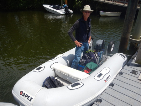
We arrived in Auckland an hour ahead of time - we actually sailed 42 miles in 6 hours, so we averaged 7 knots! While waiting for the tide, we dropped anchor at Motuihe Island, ate lunch, tidied up the boat, and prepared lines and fenders for docking. Once we were fed and and had the boat ready, we weighed anchor again. As we entered the Tamaki River, we called our friends Kerri & Andrew (s.v. Mariposa) who live in Auckland and are members of the Bucklands Beach Yacht Club. We had previously arranged for them to come and help us tie up at our berth, and thank goodness they were available! We timed it right for slack current but it was windy and there was little room to maneuver. But again, with a little help from our friends, we managed to get secured to the dock without a problem. Sigh of relief! Docking the boat always makes us nervous, and especially so in NZ because most of their docks don't have cleats - they secure their docklines to metal loops. The loops are great if the boat stays tied up to the dock all the time, but it's impossible to use the loops to help control the boat while docking, especially a boat like Slip Away, which weighs 18 tons. Cleats work very well for that. We are surprised that NZ uses these loops given that there are so many sailors in NZ, but it appears they are converting because we see cleats on newer docks. The dock at Bucklands Beach Yacht Club had loops, but Kerri & Andrew had obviously dealt with this before and used the pilings to help control Slip Away in the strong winds. Anchoring the boat is so much easier!
Auckland (February 6 to 10). We spent the next several days hanging out with our friends Kerri & Andrew. We enjoyed a dinner at the Yacht Club, cooked dinner and did laundry at their house, grocery shopped, and went to a "night market". One of the days, we took a ferry into the CBD, where we stumbled upon an "Emergency & Volunteer Services" expo at the ferry wharf before spending the rest of the afternoon touring the Auckland Maritime Museum, which we thought was excellent. It was fun visiting the big city on Slip Away, but it was the time with our friends that we enjoyed the most. On the morning we departed the Yacht Club, Kerri & Andrew came to say good-bye and help us shove off from the dock. We hated saying good-bye this time because we're not sure when our paths will cross again.
Rich, Kerri & Andrew listening intently to the fireman's presentation
at the "Emergency & Volunteer Services" expo
Auckland Skyline
Rangitoto (February 10 to 12). From the Yacht Club, we motored the short distance to Rangitoto Island (7 miles). After lunch, we headed ashore and did a hike on Motutapu Island, which is connected to Rangitoto by a causeway. Later that afternoon, Ali & Richard (s.v. Vulcan Spirit) arrived, and the next day, we hiked to the top of Rangitoto together. At 600 years old, Rangitoto is New Zealand's youngest island, and it is an icon of the Auckland landscape. Maori folklore tells the story of the volcano eruption that formed this island (it is dormant now). The hike to the top took us over some stark lava fields, but vegetation has taken root and the landscape is changing. At the top, a boardwalk circles the caldera. It was a great day, and that evening, we enjoyed dinner on board Vulcan Spirit. Our reunion with Ali & Richard was short but sweet, and we again found ourselves saying good-bye as we headed off in different directions after Rangitoto.
White-faced Heron and Pukeko on Motutapu Island
Rangitoto's lava fields - a close-up view of the island
View of Rangitoto from afarOneroa Bay, Waiheke Island (February 12 to 16). It was another short hop from Rangitoto to Waiheke Island (8 miles), and with 15-20 knots of southwest wind and slight seas, we had a lovely sail from one island to the other. Waiheke is best known for its wineries, and we spent a morning on a tour which took us to three of its wineries. (The rest of the day was shot after drinking wine in the morning!) In addition to visiting the wineries, the tour gave us a good overview of the island, and the next day, which was Valentine's Day, we took the local bus to the Wild on Waiheke Brewery for lunch. The microbrewery industry has also taken root on Waiheke and is growing. On our last day at Waiheke, we decided we needed to walk off some of this food and alcohol, and we did a long walk along a coastal track past beautiful homes and vineyards.
With its proximity to Auckland, Oneroa Bay on Waiheke Island was a busy place on a summer weekend
Waiheke's Vineyards
Full moon rising over Oneroa Bay
.JPG)
.JPG)
%20Dotterel.JPG)
.JPG)
.JPG)
.JPG)
.JPG)
.JPG)
.JPG)
.JPG)
.JPG)
.JPG)
.JPG)
.JPG)
.JPG)
.JPG)
.JPG)
.JPG)
.JPG)
.JPG)
.JPG)
.JPG)
.JPG)
.JPG)
.JPG)
-001.JPG)
.JPG)
.JPG)
-001.JPG)
.JPG)
.JPG)
.JPG)
.JPG)
.JPG)
.JPG)
-001.JPG)
.JPG)
%20-%20Full%20Moon.JPG)
Hobbs Bay, Tiritiri Matangi Island (February 16 to 17). We had flat calm conditions for our trip from Waiheke Island to Tiritiri Matangi Island (13 miles), so we motored, but it was a great day because we saw several groups of little blue penguins swimming on the sea surface - apparently, they were enjoying the calm waters too! Tiritiri Matangi is a renowned wildlife sanctuary, and one of the most successful community-led conservation projects in the world. Maori tribes initially cleared and cultivated parts of this island, and Europeans started farming here in the 1850's. By the 1970's, only 6% of the native bush remained. In the 1980's, Tiritiri Matangi was designated a scientific reserve, and the "Supporters of Tiritiri Matangi" organization was founded. Since then, volunteers have planted over a quarter of a million native trees on the island, and 60% of the island is now forested. They also managed to eradicate the rat population, and once the forest began to develop, they reintroduced native birds. We did a couple of hikes on this island, and during one part of the hike, we sat down on some benches and watched birds at feeders and listened to their songs. The bird songs on this island were tremendous! We especially appreciated the birdsongs because the cicadas had been incredibly loud over the past few weeks.
Little blue penguins on the Hauraki Gulf
The Takahe is one of NZ's endangered birds that now lives on Tiritiri Matangi
Tui birds look rather regal and have a beautiful song
The song of the bellbird is our favoriteHobbs Wharf, Gulf Harbour Marina (February 17 to 24). Tiritiri Matangi sits just off the Whangaparaoa Peninsula, and Gulf Harbour Marina is located on the Peninsula. Several of our friends were berthed in the marina, and we were looking forward to visiting with them. There are a number of anchorages on both the north and south sides of the Peninsula, and we intended to find an appropriate anchorage based on which way the wind was blowing. However, our friends Marie & Irv (s.v. Freezing Rain) found us a better option. Inside the marina, there is a small basin, and the surrounding area is being developed with condos and houses. There is a mooring ball in the middle of this basin, and the mooring ball is owned by the developer. He sometimes keeps his boat on the mooring, but at that time, his boat was berthed in Auckland. Marie & Irv asked at the developer's office if we could use the mooring, and they said it would be no problem. We offered to pay a nightly rate for the mooring, but he said that wasn't necessary. How nice! The basin and mooring were just around the corner from the dock where all of our friends were - Marie & Irv (s.v. Freezing Rain), Don & Paulie (m.v. Storm Haven), Robbie & Neville (s.v. Catwagon) and Jed & Audrey (s.v. Avista). We had a great week with all of them - several potluck dinners and happy hours, walks around the area, and shopping excursions to the local grocery stores and veggie markets. On our last day there, our friends Sasha & Gareth and their kids Kiara & Tali, drove up from Auckland and spent an afternoon with us on the boat. Lots of fun!
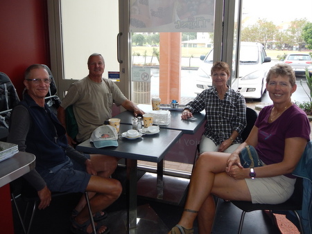
Enjoying a cup of coffee with Don & Paulie (m.v. Storm Haven)
Slip Away moored at Hobbs Wharf
The Kyd/Dixon family pays us a visit on Slip Away
Whangarei Heads - Urquharts & McLeod Bays (February 24 to 26). It was time for us head north back toward Whangarei. We had a haul-out scheduled at Norsand Boatyard at the end of the month, so we needed to get a move on, or "rattle our dags" as the Kiwis would say. We left Hobbs Wharf early in the morning and covered the distance back to Whangarei Heads in a long day (57 nm, 10½ hours). Winds were light on the trip, so we were only able to sail about three hours - the motor churned away for the rest of the trip.
We had a couple of days before we needed to get up the river toward Norsand, so we made a couple of stops along the way. We spent one night in Urquharts Bay where we hiked the Bream Head Track, one of our favorites from last year, but this time, we also climbed the 1224 steps to Mt. Lion (Rich counted them). The next day, we moved over to McLeod Bay and climbed up to Mt. Manaia, another 1113 steps - no counting necessary, someone wrote it on the trail sign. We really enjoyed both hikes, but oh, our aching legs!!
Slip Away anchored at Urquharts Bay with Mt. Manaia in the background
How much further to the top of Mt. Lion???
View of Smugglers Bay & Busby Head from atop Mt. Lion
Ready to tackle Mt. Manaia
Scenery along the trail was gorgeous
View from atop Mt. Manaia - McLeod Bay in the foreground,
Urquharts bay in the backgroundAlthough we were only half-way through our stay in New Zealand, this wrapped up our "cruising" season. It was time to do some boat maintenance and repair projects, and Jan had a trip planned back to the U.S. So, we reluctantly motored up the Hatea River to Norsand Boatyard (11 miles).
Norsand Boatyard, Whangarei (February 28 to March 13). We scheduled a haul-out at Norsand to replace a few thru-hulls, slap on another couple coats of bottom paint, polish the hull, varnish the caprail and do a few other miscellaneous projects. After spending so much time at Norsand last year, we felt quite at home when we hauled out again. We were very happy with the bottom paint they used the previous year - Jotun SeaForce 90 - so we had them apply another couple of coats with the thought that this would last us at least a couple of years, and thus avoid an expensive haul-out next year in Australia.
Another trip on the haul-out trailer at Norsand Boatyard
Slip Away looking good with new bottom paint and a shiny hullThis haul-out was one of the shortest stays we've ever had in a boatyard - less than two weeks. We got some help from Norsand on a couple of projects, and again, we were quite happy with the quality of work and the time it took to complete the jobs. But, as we were approaching our scheduled launch date, we became a little nervous. We were set to launch on Friday, March 14, and the weather service was forecasting that the remnants of yet another cyclone - Cyclone Lusi - was expected to hit the area on that day. The last thing we wanted to do was launch the boat in the middle of a storm. But, no problem - the necessary work was done, so they put us back in the water a day early. We have never before launched ahead of schedule - what a concept!
Town Basin Marina, Whangarei (March 13 to May 30). From the boatyard, we headed a few miles further up the river to the Town Basin Marina. Cyclone Lusi was on her way, and there was a flurry of activity to ensure boats were secured. This cyclone was expected to pack more of a punch than the previous one, and the local boaters and marina were taking it pretty seriously, making sure that each boat was tied up securely and any items on deck removed or tied down. One of the really good things about Town Basin Marina is that it is 10 miles inland, which we expected would provide some protection from the winds. However, this cyclone was forecast to have a fair amount of rain in it, so there was also some concern about flooding, and there wasn't much we could do about that. Again, we were quite fortunate. Lusi brought us a few hours of strong winds, but as expected, our location protected us from the worst - we had only a few gusts in the high 20's. Out on the coast at Marsden Cove, it was blowing in the 40's. We also had some pretty good rain, but no real flooding in Whangarei. The Bay of Islands area further north was hit much harder with higher winds and some flooding in the town of Russell.
After cyclone Lusi passed, Rich settled into what would be his home for the next few months, and got started on a "to-do" list of jobs he wanted to accomplish. Jan had a few projects of her own to work on, but she also needed to get organized for her trip to the U.S. Jan was heading home to celebrate her mother's birthday in early April and attend her niece's wedding in early May. Although Rich would have liked to go with her, he was passing on this trip to help save a bit of money since we both had just been to California in September for his son's wedding, and we saw all of the Crowell Clan there. Jan would be gone for a total of six weeks - what a strange feeling to be separated for that long when we are used to spending almost 24/7 together!
We saw this photo in the Town Basin Marina office
(taken in 2012) and realized we are in it!
Slip Away is on the end tie of the top dock
on the left side of the photo.
Jon & Heather (s.v. Evergreen) were also in Town Basin Marina.
We all took a day off and hiked Mt. Manaia again.Jan's USA Trip (April 1 to May 13). Jan used to travel on her own quite a bit when she was single, but Rich had been in the picture for over 15 years now, so solo travel was a faint memory for her. She was quickly reminded that traveling with a partner is much easier (e.g. when traveling with Rich, she never has to take her carry-on luggage to the bathroom with her!), but she adjusted, and the trip, although quite long, went smoothly. The day before her flight, she took the bus from Whangarei to Auckland and spent a night at a hotel near the airport. Her flight departed early the next morning - 4 hours to Sydney, a 6-hour layover, and then 14 hours to Los Angeles. When she arrived in L.A., she caught the bus to Hermosa Beach for a short visit with our friends Camille & John, and less than 48 hours later, she continued on to Cincinnati. Jan got one good night's sleep over those four days between leaving Whangarei and arriving in Cincinnati, and she was pretty darned jet-lagged!
Jan's visit to Cincinnati was bittersweet. She thoroughly enjoyed the time with her family and friends (lots of good sister and girlfriend time!), and she was happy to be home to celebrate her Mom's birthday (#84). But, her Mom's health is declining and she's suffering from dementia, so Mom had good days and bad. Additionally, while there, Jan attended the funeral of a friend who died from cancer. This friend was a schoolmate and one of Jan's closest "partners in crime" in their late teens/early 20's. It was a wonderful reunion of old friends at the funeral, but of course they were all wishing they were gathered for a different reason.
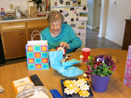
Showering Mom with presents on her 84th birthday
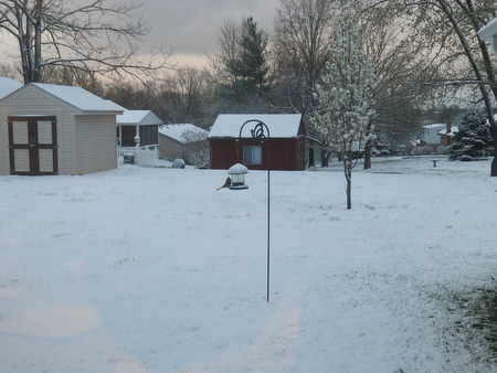
Jan was not expecting snow in April!
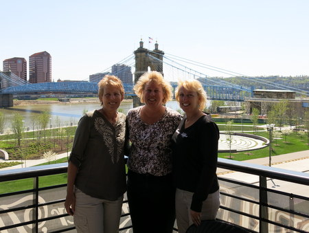
Sisters are very special!
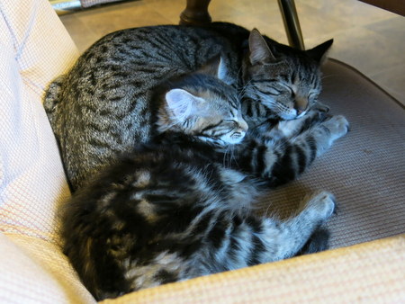
The newest additions to our family - Barney & Lucy -
the kittens quickly won Jan's heart!Meanwhile, back in New Zealand, Rich was plugging away on boat projects - working with the mechanic to repair the broken alternator mount on our main engine, installing led lights, plumbing, re-bedding deck hardware, varnishing, painting and lots of other miscellaneous jobs. Rich isn't much of a cook, and Jan wanted to be sure he didn't survive solely on junk food while she was gone, so she made and froze some meals for him before she left. Although Rich was quite happy to have those, they weren't enough to last him six weeks, and he figured out a few meals he could put together on his own. He learned how to use the veggie steamer, and roasted chickens from the grocery store and pasta were on his menu quite often, with only an occasional trip to McDonald's. Additionally, he received numerous invitations from friends who made sure he wasn't pining and wasting away while Jan was gone. Rich weathered one more storm while Jan was away - the remnants of Cyclone Ita. This one was the worst of the three cyclones this season, with several areas of NZ suffering damage from the storm, but again, Rich and Slip Away were in a well-protected spot and had no issues. Ironically, we came to NZ to avoid cyclones, but this was a busy year for them!
In early May, the Schwab family gathered in Destin, Florida, to celebrate the wedding of Jan's niece Erica (daughter of her brother Jeff). The wedding took place on "Princess Beach", and they all dressed up for the event, but everyone attended in bare feet - perfect! It was a beautiful ceremony and a fun celebration.
Jan's brother Jeff escorts his beautiful daughter Erica
The happy couple - Erica & Robert
Jeff & Connie's familyA few days after the wedding Jan started her journey back to New Zealand. Enroute, she stopped off in L.A., and this time she had a few days to visit with friends John & Camille in Hermosa Beach. Although it was short stay, she caught up with a few friends and gathered all the boat parts and other essential items she needed to carry back to New Zealand with her. When Jan checked in at the airport for her flight back to NZ, she had one bag over the standard allowance, but the Virgin Australia representative told her not to worry and didn't charge her the excess baggage fee - how nice!
Jan's travels again went smoothly - everything ran on time, and her flight arrived in Auckland mid-afternoon on a Tuesday. Friends Brad & Gloria (s.v. Kindred Spirit) had some business in Auckland that day and offered to bring Rich with them and pick Jan up at the airport. Rich was waiting for Jan as she cleared Customs and walked out the "Arrivals" door. After six weeks apart, there were big hugs, sloppy kisses and a few tears! We rode back to Whangarei, stopped for dinner in town, and arrived at Slip Away late evening. Jan was a tired traveler, but she was very happy to be home, and Rich was very happy to have her home.
Whangarei (May 13 to June 2). By the time Jan returned from her trip to the U.S., New Zealand was well into Fall - the days were getting shorter, and the weather had gotten cooler and rainier. While Jan was away, Rich had purchased a small space heater because the nights had gotten downright cold. The tropics were beckoning.
A few days after Jan's return, we took Slip Away out for a test drive with our mechanic, only to discover that the engine needed to be re-aligned. This caused us a slight delay, and in the meantime, most of our friends started sailing north. We dragged our feet a bit more, and before we knew it, we were one of the few remaining cruising boats in New Zealand (at least as far as the ones who were planning to leave this season). We didn't mind so much because our friends Craig & Bruce (s.v. Gato Go) and Brad & Gloria (s.v. Kindred Spirit) were still around. Craig is a Clinical Psychologist and had received a job offer from the Northland Health hospital group in Whangarei, so Gato Go was staying in New Zealand for a while longer. Brad & Gloria experienced some other delays so were also not leaving any time soon. So, it's not like we were lonely, and truth be told, despite the cold, we were finding it hard to leave. New Zealand, and especially Whangarei, felt like home to us, and we didn't expect to be back. After this next cruising season in the islands of Vanuatu, we planned to continue west to Australia. However, when we woke up one morning and found ice on the docks, we knew it was time to get the show on the road.
Fall colors in Whangarei
A frosty morning - time to head north!
Slip Away at Town Basin MarinaBy the end of May, we were finally ready to go. All systems on the boat were working. Our fridge, freezer and food lockers were "chock-a-block". Our weather router gave us the green light and sent us our voyage forecast. We reviewed the forecast and although conditions weren't perfect, they were acceptable. Conditions are rarely perfect when sailing to and from New Zealand, and with winter closing in, the weather would likely only get worse the longer we waited. We sadly said good-bye to the friends we were leaving behind - it was especially hard to say good-bye to Craig & Bruce who had become more like family to us. On June 2, we checked out with Customs, pulled away from the dock and were on our way to the islands of Vanuatu.
.JPG)
%20-Takahe.JPG)
%20-%20Tui.JPG)
%20-%20Bellbird.JPG)
.JPG)
.JPG)
.JPG)
.JPG)
.JPG)
.JPG)
.JPG)
.JPG)
.JPG)
.JPG)
.jpg)
.JPG)
.JPG)
.JPG)
.JPG)
.JPG)
.JPG)