Logbook: New Zealand (December 2011 to May 2012)
We arrived in New Zealand on Slip Away in mid-December and spent a couple of months settling into "Northland" (the north end of the North Island) - primarily in the towns of Opua, Paihia, Keri Keri & Whangarei. In late February, we left Slip Away secured to a mooring in Opua and headed out on a road trip in a car we bought shortly after our arrival. Our road trip lasted almost eight weeks, and we saw incredible sights, hiked fabulous trails, drove through beautiful countryside, spent time with friends, and we even sailed a bit (on a friend's boat). We traveled from top to bottom of both the North and South Islands of New Zealand and made numerous stops in the middle. In May, with winter approaching in the Southern Hemisphere, we left Slip Away on hardstand in Whangarei and flew back to spend summer in the USA.
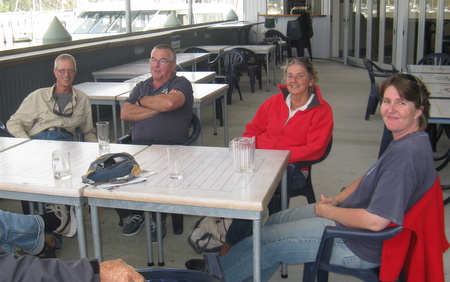
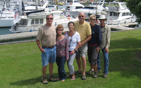
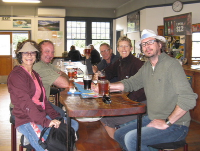
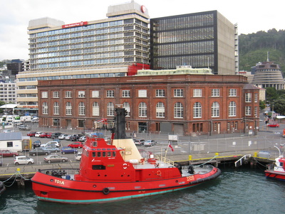
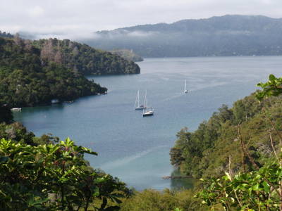
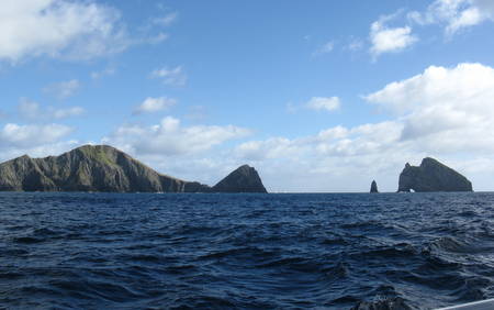
Opua, New Zealand (December through February). After our 6½ day passage from Minerva Reef (Tonga), we arrived in Opua on the evening of December 16 and spent the night tied up at the Customs Dock. The next morning, the Customs and Quarantine officials arrived at Slip Away to welcome us and check us in. Quarantine is strict in New Zealand, but we were fairly well informed of their requirements and showed up with as little contraband as possible. We had no fresh fruits or veggies, so we were good on that. The biosecurity officer looked through our fridge and confiscated the last of our turkey lunchmeat and a couple of leftover hot dogs, and he also took honey and dried beans from our stores of dry goods, but that was about all we lost. By mid-morning, we had completed all of our check-in paperwork and inspections. We helped our friends Karen & Jason on YOLO shove off the Customs Dock, and then we untied ourselves and headed into one of the Opua Marina slips. The rough seas in the last 50 miles of our passage covered Slip Away in salt, and we needed a good supply of fresh water to give her a thorough cleaning. Although we're not opposed to washing the boat with water made by our watermaker, Opua's bay was quite murky due to recent rains, so we didn't want to run the watermaker here. And, it was a nice treat to spend a few days in a slip - we hadn't been in a marina since we left Tahiti nine months prior. That same afternoon, our friends Andrew & Kerri (s.v. Mariposa) arrived from Auckland (by car), and we joined them, as well as Otto & Lily (s.v. Vagabond) and Paul & Maureen (s.v. Calypso), for drinks at the Opua Cruising Club and dinner at the Swordfish Club in Paihia (about 5 km from Opua). Quite a nice welcome to New Zealand!
Empty glasses and big smiles all around.
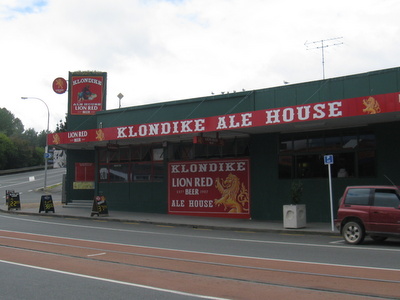
Rich with Andrew, Maureen & Kerri at the Opua Cruising Club.We spent the next few days cleaning up Slip Away, catching up with friends, finding our way around Opua (which is quite small) and venturing into Paihia, which is mostly a tourist town, but it has a good grocery store. We'd heard prices in New Zealand were high, and we'd heard right - gasoline was running about NZ$2.10/liter (which equates to about US$6.35/gallon), a rotisserie chicken at the grocery store was NZ$13 (about US$10), and the cheapest six-pack of beer was NZ$10 (about US$8).
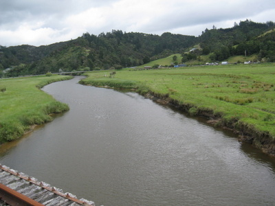
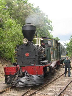
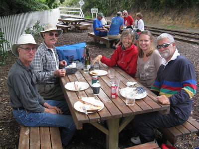
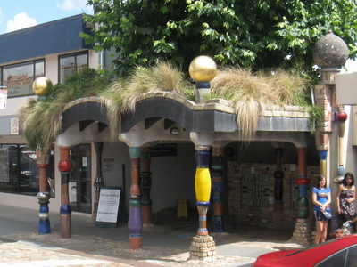
A few days before Christmas, some folks organized an outing to Kawakawa (about 10 km or 6 miles from Opua), which is the home of the Bay of Islands Vintage Railway. We rode the train through scenic countryside and enjoyed a potluck lunch at a picnic area at the end of the line. After lunch, we rode the train back to town, where we stopped by one of the local taverns for a drink and also visited Kawakawa's other big tourist attraction - the Hundertwasser Toilets, which were designed by Austrian artist and architect Friedensreich Hundertwasser.
Some of the scenic countryside near Kawakawa
The Bay of Islands Vintage Railway
Picnic lunch - Rich with Jim & Kim (s.v. Auspice)
and Karen & Paul (s.v. Gigi)
Most New Zealand towns have a local tavern,
and we enjoyed visiting a few of them
The Hundertwasser toilets, constructed from recycled old glass
bottles and reclaimed bricks, received the prestigious
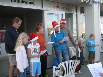
"Golden Plunger" award (just in case you were wondering).On Christmas Eve, a couple of the boats with kids on board organized some caroling, and on Christmas Day (which was sunny and warm), we enjoyed a potluck lunch in a picnic area at the marina, with about 30 of the cruising crowd in attendance.
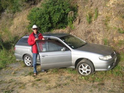
A couple of days after Christmas, we bought ourselves a present - a car! Used cars are actually quite reasonably priced in New Zealand, and for a few thousand dollars, we were the proud owners of a 1998 Nissan Avenir. We bought our car from Phil Zisakis, a former cruiser from the USA who recently emigrated to New Zealand and started a business called "Cars for Cruisers." Phil's background is in the automotive industry, and he understands what cruisers want. He sells inexpensive cars and then commits to buying them back within a specified time period and with a reasonable, agreed-upon deduction from the original purchase price. New Zealand has access to a good supply of used cars from Japan, which has strict regulations regarding older cars, most of which are exported for sale abroad by the time they are ten years old. Although we generally try to use public transportation in the countries we visit, it's pretty much non-existent in the rural areas of New Zealand, so we really needed a car to get around. We hadn't owned a car in almost eight years, so this was a bit of an adjustment. The bigger adjustment, however, was driving on the left side of the road, but we caught on quickly. Driving on streets wasn't really a problem because we kept the driver's side of the car on the same side as the line down the middle of the road. Driving in parking lots often required more focus.
Christmas caroling with the crews of Madrona and Pegasus of Jersey
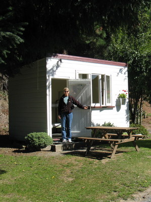
Our Christmas present - a 1998 Nissan AvenirOur plan was to head out on a road trip around the first of February. There's a lot to see in New Zealand, and we wanted to spend time on both the North and South Islands. We thought the scenery of the North Island was quite beautiful, and all the reports we heard about the South Island were that it was spectacular.
Our travel plans were waylaid, however, when sciatica pain in Jan's left leg debilitated her for a couple of months. Jan started experiencing some leg pain in Tonga after a particularly long swim and beach walk, and she thought she had strained muscle, tendons and/or ligaments. She was having good days and some not-so-good days, but over the New Year weekend, it took a turn for the worse. As soon as the doctor's office opened after the holidays, Jan was there seeking relief from excruciating pain. The doctor confirmed the diagnosis of sciatica, and gave her some strong painkillers. X-rays showed nothing, and the doctor told her it would likely resolve on its own, but it could take two to three months. At this point, Jan could barely walk, and two to three months for recovery wasn't exactly what she wanted to hear! Jan sought additional advice, and our physician-friend Mike (s.v. Infini) suggested that acupuncture might offer her some relief. Jan improved under the care of acupuncturist Peter Keckskemeti (in Whangarei and Keri Keri), and she also received some cranial sacral therapy administered by therapist Jeannette Corbett in Keri Keri. Both of these healing methods were new to us, and they weren't always pleasant, but we believe they speeded up Jan's recovery. Jan was also quite religious about doing recommended exercises and stretches, and less than two months, she was very happy to be back on her feet again (literally!).
So, our first couple of months in New Zealand were not what we anticipated. The only traveling we did was to appointments in Keri Keri (about 40 minutes away) and/or Whangarei (about 50 minutes away). At least the drives from Opua to these other towns passed through scenic countryside. We did make one trip down to Auckland to see our friends Don & Paulie (m.v. Storm Haven), with an added bonus of seeing Steve & Carolyn (s.v. Mutineer V) who were visiting them. We last saw Steve & Carolyn in Mazatlan, Mexico, in December 2005. A fun reunion!
Don & Paulie (m.v. Storm Haven), Carolyn & Steve (s.v. Mutineer V) and
the two of us with Storm Haven in the background (the Nordhavn)
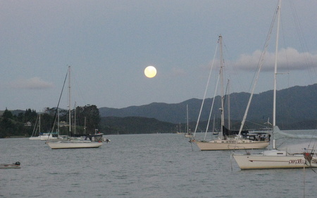
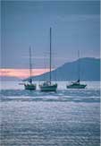
A beautiful full moon rising over the moored boats in Opua
Near the end of February, Jan had her last acupuncture appointment in Whangarei. She was feeling much, much better, and Dr. Peter told her she was good to go, so we headed out on the start of our road trip.
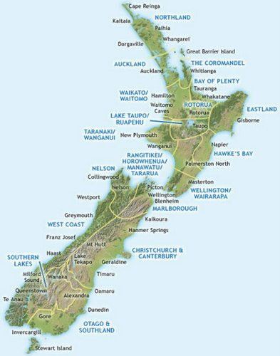
New Zealand New Zealand is comprised of two main islands, appropriately called the North and South Islands, as well as several other smaller islands. It was settled by the Maori (emigrants from Polynesia) in the 13th century and was discovered by Dutch navigator Abel Tasman in 1642. New Zealand was established as a British colony in 1841, and it is presently an independent nation (since 1931) and a member of the Commonwealth Group of countries.
New Zealand covers an area of just over 100,000 square miles (270,000 square kilometers), and the total population is about 4 million people. The capital of the country is Wellington, but the largest city is Auckland (population of about 1.4 million). The largest portion of the population is of European descent (mainly British), and the Maori are the largest minority population. New Zealanders are commonly referred to as "Kiwis."
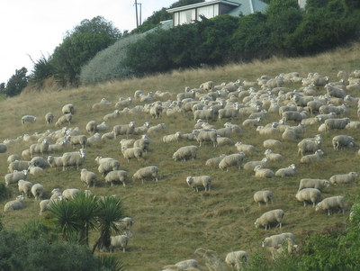
Much of New Zealand is agrarian, and in addition to its peoples, it is a nation of 40 million sheep, 17 million cows and 1 million deer. (They farm red deer here and export venison.)
In the past, New Zealand's economy was based on agricultural exports - dairy products, meat, timber and wool. New Zealand remains the world's largest exporter of dairy products and is second to Australia in wool, although wool exports have declined significantly. (Twenty years ago, they had twice as many sheep as they do now.) Recent economic growth has been in services and tourism. New Zealand is also making a name for itself in the movie industry. Peter Jackson, the producer and director of the Lord of the Rings trilogy and The Hobbit, is a Kiwi and the movies were all filmed in New Zealand.
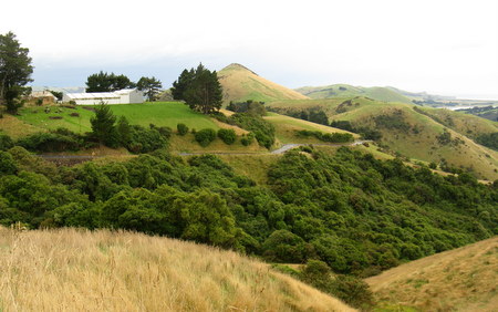
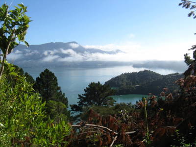
New Zealand's landscape is varied - volcanoes, subtropical rainforest, glaciers, coastline and beaches, rolling hillsides and rugged mountains. It sits between 34º and 47º south of the equator, which is roughly equivalent to the latitude of the area between Ventura, CA, and Seattle, WA, in the US. The climate is classified as "maritime temperate" (but we would describe it as cool), and it is fairly wet, which makes for very green islands. Since the closest significant landmass (Australia) is over 800 miles away, the seas have a strong influence on the weather. New Zealand's isolation contributes to unique biodiversity - 80% of its flora are native, and they have several species of indigenous fauna, including birds, reptiles and sea life. Over 20% of New Zealand has been set aside as National Parks, Forest Areas and Reserves.
North Island Travel Part I
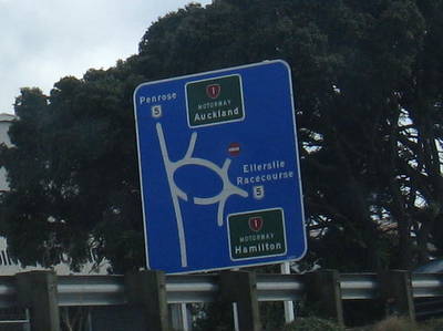
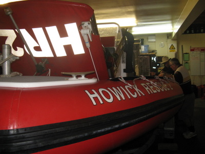
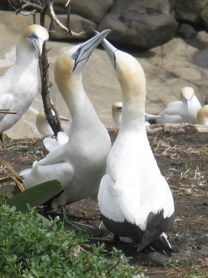
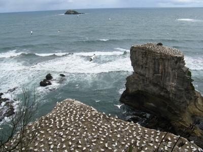
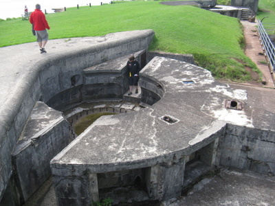
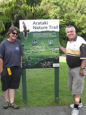
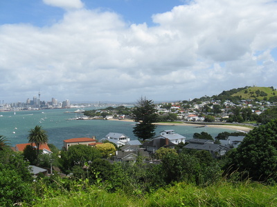
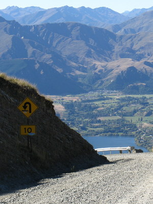
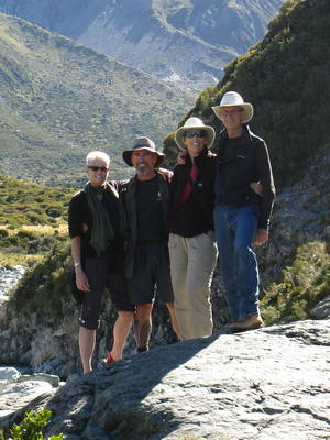
We'd been having reasonably good weather since our arrival in New Zealand, but on the day we left Opua for our road trip, it turned ugly. We were leaving Slip Away on one of the Opua Marina's moorings while we were gone, and Mike (s.v. This Side Up) had volunteered to give us a ride ashore so we could leave our dinghy on the mothership. When Mike picked us up, it wasn't raining, but it was blowing like stink. We had packed as much as possible into the car the night before, but we still had some clothing, pillows and the two of us that we wanted to get ashore in relatively dry condition. We packed the last items in large plastic garbage bags, took off our shoes, rolled up our pants, donned our full-length cheapie plastic raincoats and climbed into Mike's dinghy. We took a few good splashes on the way in, but we did OK. Auckland (February 23 to March 1). The drive from Opua to Whangarei wasn't too bad - some rain showers and lots of wind - but the rest of the way to Auckland (2½ hours) was miserable, with heavy rain - no fun at all when driving on rural two-lane roads in the company of logging trucks and other 18-wheelers. By the time we got to Auckland, it was rush hour, which wasn't much fun either. It was, therefore, with a fair amount of relief that we pulled into the driveway at the home of our friends Kerri & Andrew in Eastern Beach. We first met Kerri & Andrew when they were cruising on s.v. Mariposa in Cartagena, Colombia. Kerri is a native New Zealander, and this was actually the home of her mother Dorothy. We spent a very pleasant long weekend with Kerri, Andrew & Dorothy. They were superb hosts, and Kerri & Andrew showed us several sights near Auckland - the Howick Coast Guard Station where they both volunteered; nesting gannets (sea birds) at Muriwai Beach; a drive through the native rainforest of Waitakere Ranges Regional Park, along with a stop at the Arataki visitor Center; North Head (a fort built in World War II); the Naval Museum in Devonport; One-Tree Hill; and downtown Auckland, including the waterfront, Sky Tower and Albert Park. Our last day at their home was a Monday, and they all had to work, so the two of us enjoyed a quiet day in the neighborhood - lunch at a local cafe and a long stroll along some walking paths.
Auckland wasn't the easiest city to navigate. Signs like these
were fairly common, and it was hard to figure them out while
speeding by on the motorway!
Rich & Andrew checking out the engine on the
Howick Coast Guard Rescue boat
Mating dance of the gannets
Gannet sea bird colony at Muriwai Beach
Fort at North Head built during World War II
Kerri & Andrew leading us on a nature hike
View of Auckland CBD from North Head
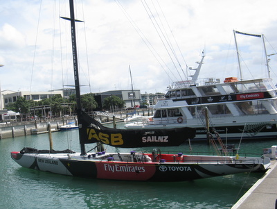
Former Americas Cup boat now used for tourism
on the Auckland waterfront.
View from the walking path in Eastern Beach.
Volcanic Rangitoto Island in the background is only 600 years old!After saying good-bye to Kerri, Andrew and Dorothy, we spent a couple more days in Auckland. Our friends Camille & John from Hermosa Beach, CA, were in town visiting John's sister Sasha, who lives in Auckland with her partner Gareth and their young kids Kiara & Tali. We spent a day together at the awesome Auckland Zoo, and the next day drove out to Piha Beach and hiked to Kitekite Falls.
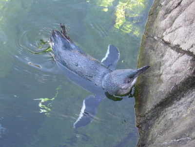
Little blue penguin at the Auckland Zoo
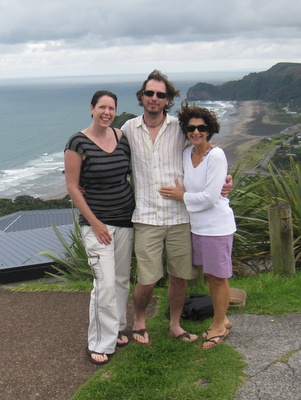
Sasha, John & Camille
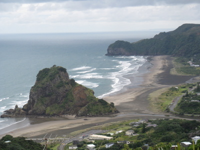
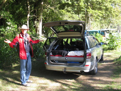
Black-sand Piha Beach along the coast west of AucklandDuring our visit with these friends, we spent the night at a nearby "Holiday Park" (campground) and tried out our plan to do some car camping. The back of our station wagon was big enough for the two of us to sleep in, so we purchased an air mattress and brought along bedding and some basic cooking/kitchen gear. We were hoping to save some money by car camping as much as possible during our road trip. We spent two nights car camping in Auckland, and it went pretty well. We were thinking this was a fine plan.
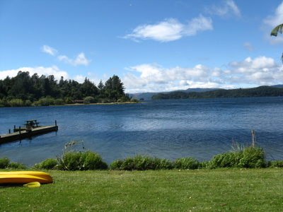
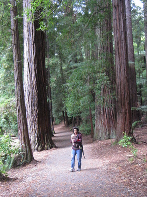
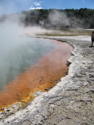
Lake Rotoiti (March 1 to 5). Gareth's mum Marion and her partner Mark hosted a lovely treat for us the next few days at a house at Lake Rotoiti (near Rotorua, 3-4 hours from Auckland). The house was big enough to accommodate all of us - Marion & Mark, Camille & John, Sasha & Gareth and their kids, the two of us and another family friend John Montgomery. We cooked wonderful meals, drank some excellent local beers and wines, and explored the area a bit. The first couple of days here were quite windy, with heavy rain one morning - the result of a passing "weather bomb" - but we were warm and dry inside the lake house. In spite of the weather, we were still able to see quite a bit. We took a walk through a forest of Redwood trees in Rotorua (brought here from California), hiked at Okere Falls (which were running strong after the heavy rain), took a boat ride on the lake and had a picnic on the beach. Camille & John, John Montgomery and the two of us also spent a morning at the Wai-O-Tapu Thermal Wonderland. Rotorua is situated in the Taupo Volcanic Zone, and the area has a significant amount of surface thermal activity. We spent the morning checking out boiling mud pots, colorful (and smelly) sulfur pools, geysers, crevasses and craters. Afterward, we stopped for lunch and a beer at the local tavern, a place John Montgomery knew from his youth. John Montgomery is a dairy farmer, and we thoroughly enjoyed this opportunity to spend time with him.
View from the house on Lake Rotoiti
Camille walking Tali through the Redwoods
Gareth taking Kiara for a ride in the skiff
Okere Falls are popular with kayakers and rafting trips
Steaming pools at
"Waiotapu Thermal Wonderland"
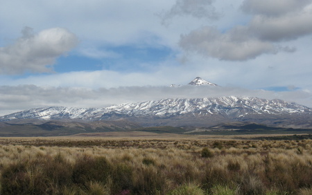
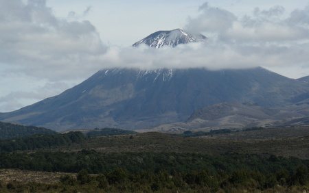
Lunch at the Waiotapu TavernAfter the lake house, the others returned to Auckland, but the two of us continued south to Wellington. It was a long drive but the scenery was spectacular as we passed Mt. Ngauruhoe and Mt. Ruapehu, part of the Tongariro National Park, with plenty of fresh snow dumped on them from the recent weather system. We stopped for lunch at the Gumboot Manor in the town of Taihape, which bills itself as the "Gumboot Capital of the World!"
Mt. Ruapehu
Mt. Ngauruhoe (aka Mt. Doom from the Lord of the Rings trilogy)Wellington (March 6 to 9). In Wellington, we were once again fortunate to have friends who welcomed us into their home - the Wilson Family (Jim, Heather, Cal & William) from s.v. Ceol Mor. We met the Wilsons (Americans from Washington, DC) in the Galapagos Islands in May 2010, and they sailed all the way to New Zealand by the end of that year. They took up residence in Wellington, and Cal and William were attending school at the same school Jim attended when his parents worked in U.S. foreign service and lived in Wellington. Pretty cool! The Wilsons had an apartment downtown and told us to stop and stay with them when we visited Wellington, so we did. (One should keep in mind that if you ever make that offer to us, we may just take you up on it!)
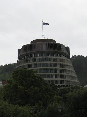
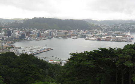
During our visit, Jim was out of town (back in the USA), Heather was working as a full-time volunteer at the Ronald McDonald House, and the boys were in school, so we were on our own during the daytime, but there was lots to do and see. We spent two days sightseeing in Wellington, which is the capital of New Zealand. We spent the first day visiting the Te Papa Museum, which is New Zealand's national museum of natural history and cultural heritage. On the second day, we toured Parliament in the morning, and after lunch, we rode a cable car up to the Kelburn lookout and the top entrance of the botanical gardens, then walked downhill through the gardens and back to downtown. In the evenings, Heather cooked delicious dinners, and we enjoyed some great conversations with her and the boys.
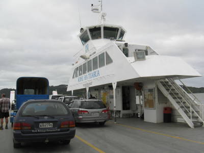
Wellington is also the embarkation point for ferries to the South Island. We made a reservation for passage on the Bluebridge Ferry, and the terminal was conveniently located next door to the Wilson's apartment.
Executive Wing of the NZ Parliament Buildings,
aka "The Beehive"
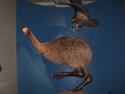
Giant Moa (world's tallest bird) and
Giant Eagle (world's largest eagle)
- both native to NZ and both now extinct -
display at Te Papa Museum
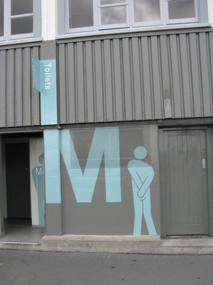
We got a kick out of these bathroom signs
and enjoyed the sometimes irreverent
Kiwi sense of humor.
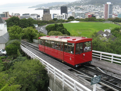
Wellington Cable Car
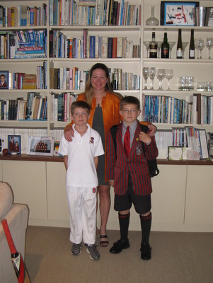
Three-quarters of the Wilson family -
Heather, William (in his cricket uniform)
and Cal (in his school uniform)
The Wilson's apartment building (red brick) was a
converted old wool shed, and the waterfront location was ideal.
South Island Travel
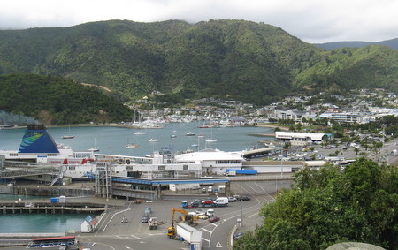
Picton to Pelorus Bridge (March 9). We caught an early ferry from Wellington on the North Island to Picton on the South Island. The weather was good, and the ride across Cook Strait was smooth (which is not always the case). The ferry ride (92 km or 57 miles) took about three hours, and we arrived in Picton in the late morning. Upon disembarking, we drove along the very scenic but also very narrow and curvy Queen Charlotte Drive to the town of Havelock, where we stopped for lunch.
Ferry terminal and busy harbor at Picton
Scenery along the Queen Charlotte Drive
After lunch, we continued on to the Pelorus Bridge Scenic Reserve, where we stopped for the night. We found a good riverside "camping" spot for the car, and then took a short hike in the reserve, which was very pretty. Our guidebook recommended going for a swim in the Pelorus River, and our friends Iain & Aly (s.v. Loon III) told us they swam here, but they are Canadian and heartier than us. We passed - too chilly! We were spending the night at a recently renovated Department of Conservation (DOC) campground. DOC campgrounds are less expensive than other commercial campgrounds, but they're usually pretty basic - pit toilets and cold showers (or no showers). But this one had nice new bathrooms, hot showers and a great communal kitchen. The communal kitchen is a nice feature found in most commercial campgrounds in New Zealand. Eating out is expensive here, so we almost always packed a lunch and cooked our own dinners.
Car camping that night didn't work out as well as it did in Auckland. South Island nights are pretty chilly, and neither of us slept well because we were cold. Also, in the morning, the interior of the car was dripping with condensation. We didn't have good sleeping bags or any real camping gear because we didn't want to invest a lot of money into those things since we'd likely never use them again. Our enthusiasm for car camping was waning...
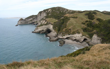
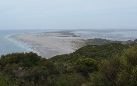
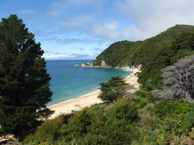
Our car all set up for a night of campingCape Farewell, Takaka & Abel Tasman National Park (March 10-13). Although we were a bit tired from our lack of sleep that night, we had a full day ahead of us. The glorious sunny day lifted our spirits and provided us energy. From Pelorus Bridge, we headed west and then north all the way to Cape Farewell at the northwest corner of the island. The driving was tedious on very windy roads, but the scenery was gorgeous. At Cape Farewell, we hiked to a lookout point and along a ridge for views of limestone cliffs along this coastline, as well as Farewell Spit, a sandbar that extends from the cape. After our day at Cape Farewell, we back-tracked about an hour to the small town of Takaka for the night.
Beautiful limestone cliffs at Cape Farewell
Farewell Spit sandbar which extends north of Cape FarewellHeavy rain was forecast for the next day, and we were definitely not interested in car camping in bad weather, so we booked a cabin at the Takaka Motor Camp. There are two main campground franchises in New Zealand - Kiwi Holiday Parks and Top 10 Holiday Parks. The Top 10 Holiday Parks are nicer but more expensive. We called the Top 10 Holiday Park in Pohara (near Takaka), and they quoted us NZ $72/night for a cabin - yikes! The Takaka Motor Camp was part of the Kiwi Holiday Park franchise, and their nightly rate for a cabin was NZ $55 - OK, we could afford that!
A cabin at a campground usually comes with a bed or bunk beds and sometimes linens (if not, one can rent them for an extra charge, but we had those with us). The cabin was usually pretty small - big enough for the bed and maybe a chair or two. We shared bathrooms and showers with the other campers, and we also had access to the communal kitchen, which sometimes includes dishes, pots and pans, and sometimes you have to use your own or rent them, but we brought that stuff with us too. Most of the campgrounds also have coin laundry facilities (but not always dryers because the Kiwis prefer to line-dry their laundry) and a "family room" of sorts with a TV and a couch or two.
The facilities at the Takaka Motor Camp weren't especially luxurious, but they were fine. This campground did not have a rec room, but we had a flat screen TV in our cabin - very nice! Most importantly, we had heat in our cabin.
The next day was rainy as forecast, and we would have liked to hang out at the library for the day, but it was a Sunday, and the library was closed. So, we stopped at the local I-Site office (their tourist information bureau) to ask them for a recommendation for a rainy day. The I-Site rep suggested the Whole Meal Cafe in town, and we spent several hours there, listening to a pianist while we sipped on flat whites (NZ's version of a latte) and shared a couple of pastries. That evening, we made dinner at the motor camp and watched "60 Minutes" on our flat screen TV.
While at the I-Site office, we also asked for a recommendation for a hike for the following day when the weather was forecast to clear up. On Monday morning, we were up early to hike a 20K (12.6 mile) loop trail at the north end of the Abel Tasman National Park - Wainui to Gibbs Hill to Totaranui to Whariwharangi. It was foggy and the ground was quite wet when we started, but the sun broke through mid-morning, and it ended up being a gorgeous day and fabulous hike. It was on this trek that we first started noticing the bird songs in New Zealand - the prettiest we've heard anywhere.
With our lunch stop, the hike took us a total of 7 hours. We were pretty "knackered" (a NZ term for "whooped") at the end of the day, and a beer tasted good when we got back to our cabin. We were also quite pleased that Jan had no issues with sciatica on the hike - we weren't really thinking about how long 20K was when we started out, and there were very few flat spots, so this wasn't an easy stroll.
Foggy start to our hike in Abel Tasman National Park
Jan still smiling with a few miles still to go
The day ended up being beautiful and sunny,
and the scenery was gorgeous
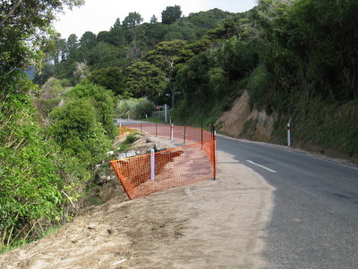
The road to the park was washed out in several spots
due to heavy rains earlier in the year
One of Rich's favorite places
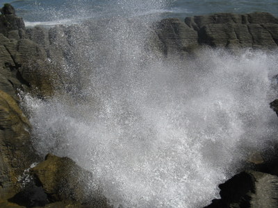
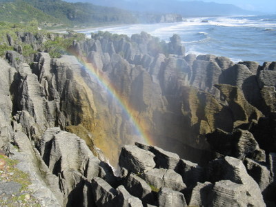
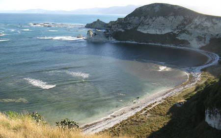
Punakaiki (March 13). We were on the road early the next morning for a long drive (about 6 hours) to Punakaiki (on the west coast between Westport and Greymouth). Part of the drive took us through Buller Gorge, which was quite scenic. Punakaiki is famous for its "Pancake Rocks", which are limestone formations dating back 30 million years. At high tide and with just a bit of ocean swell, the water thunders through the caverns beneath the rocks, and spouts out some blow holes. Miraculously, we arrived right around high tide, and it was quite a sight (and sound)!
Pancake Rocks Blowhole
After-BlowWe'd been keeping in touch with our friends Neil & Kathy (s.v. Attitude) who were also traveling on the South Island, and by sheer coincidence, we ran into them at the Pancake Rocks. Neil & Kathy were traveling on a motorcycle and were with their friends Mike & Lynne, who were on holiday (and traveling in a car). They were staying at a cottage on the beach and asked if we'd like to join them for dinner at their place. Sure! The local campground was walking distance to their cottage, so we headed there and booked a cabin (liking this cabin thing much better than sleeping in the car!). This cabin was actually the best one of our entire trip. It was two rooms with six beds in it, and it only cost us NZ $46/night (about US $37). We walked over to their cottage for a delicious dinner of pasta and mussels - NZ is famous for its green-lipped mussels. It was great catching up with Neil & Kathy, and we really enjoyed meeting Mike & Lynne - a fun evening!
Lewis Pass & Hanmer Springs (March 14 to 15). We left Punakaiki the next morning, and started our "zig-zag tour", which was recommended by John Montgomery, whom we met at Lake Rotoiti. We drove the Lewis Pass across the Southern Alps and were again quite impressed by the beauty of this island. We stopped along the way for a picnic lunch - roadside picnic tables are plentiful in NZ - at a very scenic spot, which was part of a DOC campground. The campground appeared to be empty, and it was our guess that was due to the sand flies here. The sand flies on the South Island are tenacious and notorious - their bites are extremely itchy and often last for weeks. We were covered with clothing from head to toe, but we still ended up with a few bites on our hands and faces.
Our scenic but buggy picnic spot
The Southern Alps via Lewis PassNear the end of Lewis Pass, we stopped and spent a couple of nights at Hanmer Springs, a hot springs resort town. By this time, we had more closely reviewed our budget and decided we could afford to stay in campground cabins instead of camping in the car. Temperatures were expected to dip down near freezing that night, and we rationalized that the price difference between a camping spot and a cabin was not enough to justify being miserable. So, we booked a cabin at a campground just outside of town. The owners of this campground were especially nice and friendly, and although the facilities were older they were well cared for, with some nice touches, like flower boxes (and once again heat!). There were fruit trees planted in the campground, and the owners told us to help ourselves to the fruit. Very nice!
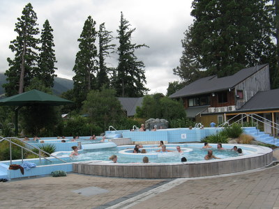
The next morning, we hiked up through the alpine forest to Conical Hill, with beautiful views of the town and valleys. After our hike, we spent the rest of our day at the Hanmer Springs Thermal Resort, enjoying a variety of pools set to different temperatures - a good day!
View of Hanmer Springs from Conical Hill
Our Campground Cabin
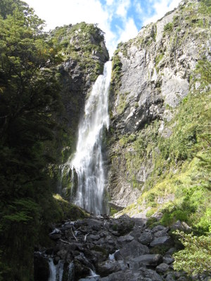
Hanmer Springs Thermal PoolsArthur's Pass to Hokitika (March 16). The next day, we completed the "zag" of our "zig-zag tour", driving back to Hokitika on the west coast via Arthur's Pass. Along the way, we stopped for a short hike at Devil's Punchbowl Falls - very pretty!
Scenery along Arthur's Pass
Devil's Punchbowl Falls
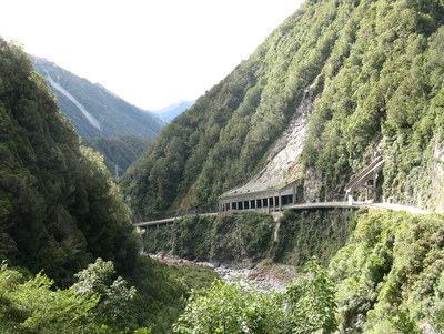
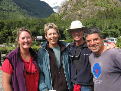
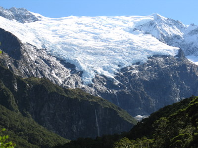
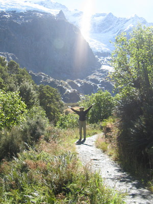
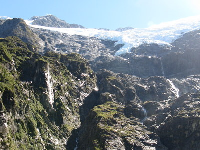
Road through Otira Gorge, an area prone to landslides.Franz Josef and Fox Glaciers (March 17). We left Hokitika early the next morning and continued south along the west coast to Franz Josef Glacier. On the way, we stopped for a bathroom break at a place where the sand flies were so bad that we saw a guy walking around in a full-coverage mosquito suit - yikes! At the start of the walking path out to the Franz Josef Glacier, we stopped to read a number of informative signs about the formation of the glacier, wildlife in the area, and such. While reading one of these signs, Jan noticed someone approaching her. She turned just as she saw that it was Fred (s.v. Songline) running over to give her a big hug. But, he caught her by surprise, and she lost her footing on the uneven ground and went down on her butt. Oops!!! But, no harm, no foul - Jan was unhurt, laughing and happy to see Fred! He and Cinda were on their way out of the park and headed north, so we were headed in opposite directions, but it was great to have a brief visit with them before going our separate ways.
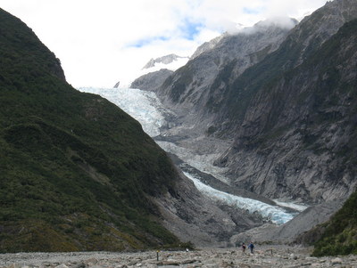
After our short visit with Fred & Cinda, we continued out the trail to the foot of Franz Josef Glacier, quite a beautiful sight. After lunch, we walked a trail around Lake Matheson, and then stopped for a quick view of Fox Glacier before continuing on to the village of Haast. The campground here had a lodge instead of cabins, with lodge room prices comparable to cabin prices, and the bathroom was down the hall instead of in another building. Nice! The room was basic (nothing but a bed), but the bed was super comfortable, and the lodge had a really nice common area with a big TV and comfy couches and chairs.
Hike out to Franz Josef Glacier
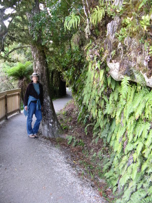
Subtropical rainforest flora along the hike
around Lake Matheson
Two of us with Cinda & Fred from Songline
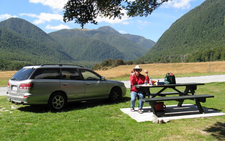
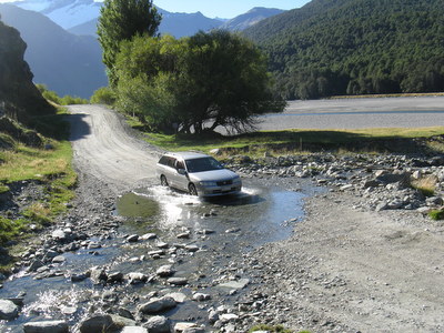
Haast Pass, Wanaka and Rob Roy Glacier (March 18 to 19). The next morning, we topped off our gas tank at the one gas station in Haast and paid NZ $2.43/liter (about US $7.36/gallon) - the highest price we paid for gas anywhere in NZ. We drove across the Haast pass (the southernmost pass across the Alps) in the rain, and it was one of the most beautiful drives of the trip - rainforest with lots of waterfalls along the side of the road. Near the end of the pass, it stopped raining, and we did a short hike to some really pretty blue pools. Our destination that day was the town of Wanaka, which is set on the shores of Lake Wanaka. We found ourselves a cabin - it wasn't our favorite campground (dated and not-so-well maintained facilities), but nevertheless, it provided shelter and warmth, as temps were getting cooler the further south we headed. We arrived in Wanaka late in the afternoon, found the grocery store and cooked dinner.
Blue Pools along Haast PassThe next day, we headed out for a hike to the Rob Roy Glacier in the Mt. Aspiring National Park. It was AWESOME!! It was unequivocally our favorite hike and experience of the trip. It wasn't easy to get to the trailhead - we drove on 30 kilometers (19 miles) of gravel road, forded 10 streams and dodged a few cows and sheep on the road, but it was worth every minute. The hike was 10K round trip (6.3 miles), up and back through rainforest, but the icing on the cake (literally) was the view of the glacier at the end of the trail. The glacier was huge, and we counted a dozen waterfalls descending from the it. It was a gorgeous sunny day to boot! Fabulous! On our way back into town, we called our friends Neil & Kathy who were coming into Wanaka that day, and we met them for drinks at the Wanaka Brewery. A great hike + tasty beer + good friends = a fantastic day!
Rob Roy Glacier
Jan is awestruck by the beauty here
Another view of the glacier with more of the waterfalls visible
Fording streams along the road to the Rob Roy glacier hike
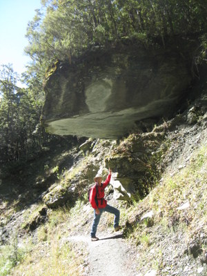
A sign on the trail read
"Rock Fall Possible...No Stopping"
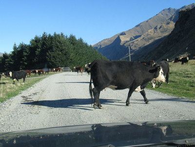
This cow didn't seem all that thrilled about moving off the road for us
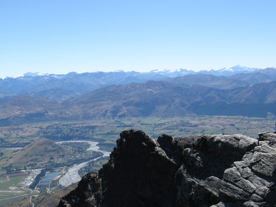
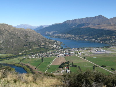
Queenstown, the Remarkables, Milford Sound, Arrowtown (March 20 to 23). We had another sunny day for the two-hour drive from Wanaka to Queenstown, and the scenery was gorgeous. We might have enjoyed it more, however, we hadn't been worried about running out of gas. We were well on our way before we thought about fueling up, and there was nothing in between the two towns. The "low fuel" light had been on for an uncomfortably long period of time when we pulled into the gas station in Queenstown.Queenstown is a picturesque resort town, which sits along the shores of Lake Wakatipu and at the base of the Remarkables Mountain Range. After fueling up, we headed out for a hike at the Remarkables Ski Area. The drive up to the Remarkables is an adventure in itself - a 13km (8 mile) gravel road twists and turns as it climbs 1300 meters (over 4000 feet), and the views of Queenstown and the surrounding areas are outstanding. Once we reached the parking lot of the ski resort, we hiked up underneath a ski lift to the Shadow Basin Lookout. The hike wasn't exceptionally long, but it was steep, and it took us almost an hour to get to the top. Since it was a clear, sunny day, the views were amazing - a horizon of snow-capped peaks - from Fiordland to the Southern Alps - gorgeous! Although it was beautiful, it was also windy and cold up on top of the mountain, and we huddled in between some rocks to get out of the wind while we ate lunch. After lunch, we hiked back down, and it was a white-knuckled drive down the mountain. Those hairpin curves on the gravel road were much scarier going down than going up!
View of the snow-capped peaks from Shadow Basin Lookout
White-knuckle ride down the Remarkables Road -
suggested speed is 10 kmh (6 mph) on this curve
View toward Queenstown from the road to the RemarkablesIn Queenstown, we stayed at the Pinewood Lodge, which is a "backpacker" inn. The first night, we rented a room with shared bathroom and kitchen, but for the following three nights, we booked Pinewood's "Millhouse" (a small two-bedroom cottage) to share with Neil & Kathy who were arriving the next day. There was lots to see around Queenstown, and we were looking forward to staying in one place for a few nights. Neil & Kathy arrived shortly after we moved into the "Millhouse", and the four of us walked into the downtown area of Queenstown, which was a short distance away. We tried the famous Fergburgers for lunch, strolled through an arts & crafts market on the waterfront and then walked through the Queenstown Gardens.
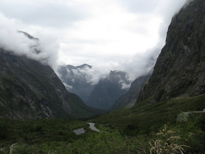
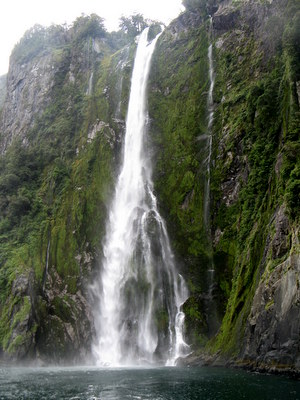
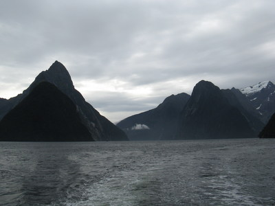
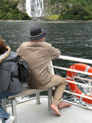
The following day the four of us were up early for a bus tour to Milford Sound and Fiordland National Park. None of us are much into bus tours, but it appeared to be a good way to go. Milford Sound is a four- to five-hour drive each way from Queenstown on roads that twist and turn, so we were happy to let someone else do the driving. Also, given the price of gas, the tour was a good deal. This tour came highly recommended, and we found it to be quite enjoyable. Martin was our driver and tour guide - he narrated the entire trip and was absolutely great! He studied zoology in school, lived for a few years on the premises of the Auckland Zoo, and was incredibly knowledgeable about the history, flora and fauna of New Zealand. On the way, we stopped for a short lunch break at the town of Te Anau, and at Martin's recommendation, we visited the local bakery and tried a venison meat pie - quite tasty! As we continued on, we made a few other stops for scenic views and/or walks, and when we arrived at Milford Sound, we took a boat ride on the fjords. Fiordland National Park is New Zealand's largest National Park - over 1.2 million hectares (2.9 million acres). It was established in 1952 and was made a World Heritage Area in 1986. The weather wasn't perfect that day - a little rain and a little sun - but the scenery was still spectacular. On our way back to Queenstown, we watched two movies - "Whale Rider" about Maori culture, and "The World's Fastest Indian" (starring Anthony Hopkins), which is the story of Burt Munro, a New Zealander who broke land-speed records on his Indian motorcycle at Utah's Bonneville Salt Flats. Both were very good movies.
Scenery along the drive through Fiordland
Stirling Falls
Milford Sound with Mitre Peak (1692 meters / 5550 feet) on leftOn our last day in Queenstown, Neil had plans to go bungee jumping. (He tried to talk us into it, but we passed. Kathy went along to watch.) We spent the day in Arrowtown, a former-gold mining town about 20 minutes from Queenstown. We toured the museum, walked along the Arrow River where gold was discovered in the 1860's and did a little souvenir shopping. It's funny, but one of the things we remember most about our trip to Arrowtown was a cup of coffee. New Zealand has good coffee, but it's not cheap - the price at most cafes is NZ $4 (US $3.20) per cup. A "long black" (black coffee) or a "flat white" (like a latte) is the same price. When we arrived in Arrowtown, as we were walking past the New Orleans Hotel, we saw a sign outside which offered coffees for NZ $2.50. What a deal! The coffee was good and was served in the hotel pub, which had a cozy feel to it.
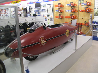
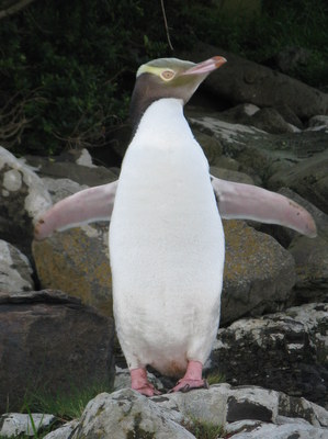
Curio Bay (March 24). When we left Queenstown, we drove south through Invercargill, stopping at the Hayes/Hammer Hardware store, which had Burt Munro's Indian motorcycle on display. This was a really nice hardware store, and actually had quite a collection of classic cars and motorcycles. After the hardware store, we continued on to Curio Bay, along the south coast of the South Island. Late that afternoon, we walked to a beach with fossilized remains of an ancient forest. But, the real attraction here were the yellow-eyed penguins. We were forewarned that it was "molting" season, so we might not see too many, but we saw five of them. We kept our distance, but watched them for close to an hour - very cool!
The World's Fastest Indian on display in Invercargill
Yellow-eyed penguin -
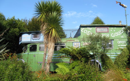
the world's rarest - at Curio BayDunedin (March 25 to 27). Neil & Kathy stayed another night at Curio Bay, but we continued on via the "Southern Scenic Route" to Dunedin. Along the way (per the recommendation of Aly & Iain, s.v. Loon III), we stopped in Papatowai at "The Lost Gypsy Gallery", a bus "museum" of sorts with a collection of unusual gadgets, and a fun place to explore for an hour or so.
Scenery along the "Southern Scenic Route"
The Lost Gypsy Gallery
Arriving in Dunedin was a bit of a culture shock because it is a city of over 100,000 people and a university town - quite a different place from the rural areas and small towns we'd been in for the past few weeks! We found the I-Site office downtown, booked accommodations for the night and then headed out to see the Otago Peninsula, which is a wildlife sanctuary for a variety of local species. There were a number of hikes which looked appealing but we didn't have a lot of time, so we drove out to the end where the Albatross Rescue Center was located. We visited the free museum, but passed on the tour, which cost somewhere around NZ $100/person. While visiting the museum, it poured down rain, and when we came back outside, the temperature had dropped significantly. The wind was bitter cold! We stood outside for a short while and saw a few albatrosses flying in the sky - incredible wingspan on these birds! But, it was too cold to hang out for long, and we headed for the car and drove back to town. We had a campground cabin booked for the night, and we arrived in time to make dinner. The campground was fairly large, had two communal kitchens, and both of them were filled with pre-teens. Yikes!!! We found out they were in town for a swimming competition, and they had booked most of the campground accommodations. Dinner was far from quiet, but we did score a piece of birthday cake from the kids for dessert.
Dunedin's Otago PeninsulaOur experience in the cabin that night was not a good one. Dunedin was the coldest place we visited, and they had a terrible heating system in the cabin. First of all, the heat came out of a vent located high up on a wall - near the ceiling. The bed was only a few inches off the floor, so all the cold air settled where we were sleeping, while all the heat gathered up around the ceiling. Brilliant! Then, the heater was on a timer, and the maximum time available on the timer was one hour - who wants to get up every hour to re-set the timer?! To top it off, when the timer was running, it made a loud clicking noise, which kept us awake. Needless to say, we were not happy campers! When we woke up the next morning, it was 50F (10C) in the cabin, we were freezing, and we were irritated that we had booked and paid in advance for two nights here. As we headed out that morning, we stopped by the office to complain. The receptionist called the maintenance guy, and we politely explained to him that their heating system sucked. After some discussion in which he initially tried to tell us that heat does not rise, he admitted that this system was installed to meet "green" standards. When Jan asked if there was any way we could get a space heater for our room, he gave us a puzzled look, not knowing what a space heater was. When she described what she meant, the light went on - they call it a "panel heater." He brought one to our cabin, and we slept much better the next night.
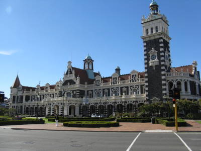
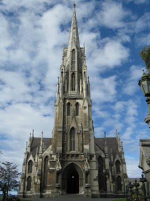
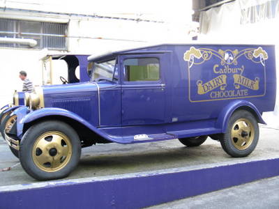
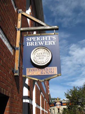
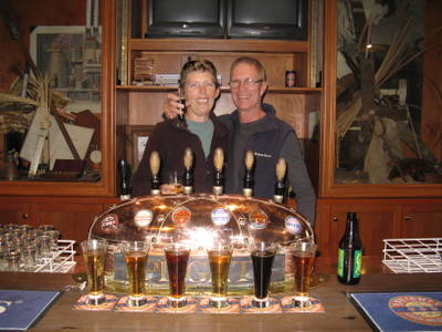
We had a full day of sightseeing scheduled for that day. We started out in the morning taking a self-guided walking tour of the city. Over 100 years ago, after gold was discovered nearby, Dunedin was New Zealand's largest and wealthiest city, and there are many buildings here that date back to the late 1800's. Dunedin is described as the best-preserved city of Victorian and Edwardian heritage in the Southern Hemisphere, and the architecture was lovely. We ate our lunch sandwiches as we sat on a bench in the courtyard of a beautiful old church. After lunch we were scheduled for a "Chocolate and Beer" tour - a tour of the Cadbury Chocolate factory and afterward a tour of the Speight's Brewery. We weren't so impressed with the chocolate tour - the factory was interesting, but the tour guide was annoying (had apparently given the tour too many times), and we weren't all that impressed with the taste of Cadbury chocolates. We loved the Speight's Brewery tour - the tour guide was pleasant, the history and operations were interesting, and we really enjoyed the free tastings at the end of the tour.
Earlier in the afternoon, as we were walking on the street from Cadbury's to Speight's, we heard someone calling our names. It was Neil & Kathy, who had just arrived in town. Neil was interested in finding a place to try Bluff Oysters, which are harvested nearby in the town of Bluff and are described as the Southland's "finest delicacy" and some of the "best in the world." We wanted to try them too, so after the Speight's tour, we joined them at a restaurant which was recommended to Neil. The oysters were good, but they didn't quite meet our expectations..
Dunedin's Railway Station
This church had a beautiful courtyard with benches -
nice location for a picnic lunch
Loved this bus sign - much better than "Out of Service"
Cadbury delivery truck
The free beer samples at the end of the
Speight's tour were worth the price of admission
Oamaru (March 27). We left Dunedin the next morning on our way to Oamaru, along the southeast coast. On our way, we stopped to see the Moeraki Boulders, huge spherical stones (reportedly 60 million years old) scattered on a beach. Very cool! Oamaru is famous for its colony of little blue penguins, and we stopped in and visited the museum, but we passed on paying NZ $25 per person to sit in the grandstand and watch the penguins come ashore that evening. It was also molting season for the little blue penguins, so the numbers coming ashore were fewer, and when we talked to one of the museum staff, she told us they had 28 come ashore that evening, but during the high season, they have 200 to 300. Although we didn't get to see the little blue penguins here, we had seen them in the Auckland Zoo, so we didn't feel too deprived. We stayed at a "Top 10" Holiday Park that night, sharing a two-bedroom cabin with Neil & Kathy. It was the only "Top 10" we stayed at during our entire trip, and the facilities were very nice!
Rich with some of the Moeraki Boulders
Neil & Kathy roll into Oamaru on their bike
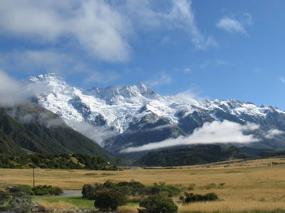
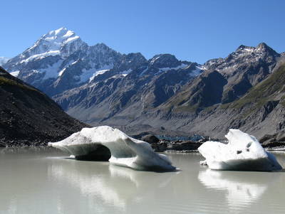
Aoraki Mt. Cook (March 28 & 29). From Oamaru, Neil & Kathy and the two of us headed inland toward Aoraki Mt. Cook (Aoraki is the Maori name). On the way, we stopped for coffee in a little town called Kurow, and we met a local guy who was in the New Zealand SAS in Vietnam and attached to the US Special Operations Group. We had a great conversation with him, and it was especially interesting for Rich & Neil who both served in the US military during that time. As we drove toward Aoraki Mt. Cook, low clouds blocked the views of the snow-covered peaks, but the weather forecast was calling for clear skies the next day, so we were keeping our fingers crossed. The Aoraki Mt. Cook National Park covers more than 70,000 hectares (173,000 acres) with 140 peaks over 2000 meters (6500+ feet) high. Mt. Cook is New Zealand's highest peak, at 3,754 meters (12,316 feet). It was here that New Zealander Sir Edmund Hillary trained before he and his Sherpa guide Tenzing Norgay became the first climbers to summit Mt. Everest.
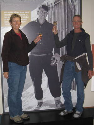
When we arrived in Aoraki Mt. Cook, we checked into the Mt. Cook Backpackers Lodge. Accommodations were pretty pricey in this area, so the four of us shared a room with two sets of bunk beds. The room did have an ensuite bathroom, which was a nice bonus. After checking in, we visited the Sir Edmund Hillary Museum in the Hermitage Hotel, and the displays and photos were excellent. While we were visiting the museum, there was a party going on (a going-away party for someone who worked at the museum), and they were serving champagne and orange juice. Not one to be shy, Neil asked if he could have a Mimosa, and they mixed one up for both him and Kathy. We weren't far behind him asking for a glass of champagne.
There were still low clouds in the sky the next morning, but by late morning, they were clearing, and the views were incredible. We hiked the Hooker Valley Track out to Hooker Lake and back (10 km or 6.2 miles total). Mt. Cook was not visible at first, but when it came into view, it was pretty spectacular. It towers over Hooker Lake, which is strewn with icebergs. It was an outstanding hike and day!
A toast to Sir Edmund Hillary
The start of our hike - clouds lifting for a view of the
Main Divide with Huddleston and Stocking Glaciers
Kathy, Neil & the two of us
hiking the Hooker Valley Track
Majestic Mt. Cook with icebergs on Hooker Lake
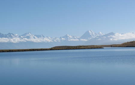
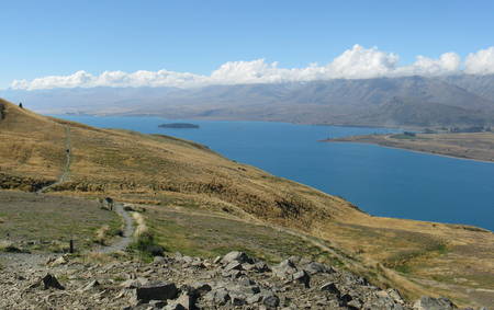
Lake Tekapo (March 30). On our drive from Mt. Cook to Lake Tekapo, the sun was shining, and the views were spectacular. It seemed like we were stopping at every other turnout to take more photos. Lake Tekapo is famous for it's glacier-fed turquoise blue lake - very pretty! We drove up to Mt. John, where there is an observatory, and hiked a loop trail around the top. Afterward, we walked through town and visited a couple of sights along the lake before stopping at a local tavern for happy hour.
Departing Aoraki Mt. Cook National Park on a beautiful sunny day
Hiking trails on Mt. John with views of Lake TekapoAt Lake Tekapo, we said good-bye to Neil & Kathy. Our travels together happened out of coincidence rather than planning, but we were glad it had worked out that way because we had a lot of fun with them. We were all headed to Christchurch, but the two of us were going to stay and visit with our friends Phil & Helen (s.v. Dolce Vita), whom we met in Tonga. Kathy & Neil were planning to spend a couple of days in Christchurch, but they would be moving on before us.
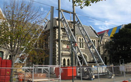
Christchurch (March 31 to April 4). Christchurch is the largest city on the South Island (population of about 350,000), and the third largest city in New Zealand. It was a lovely city with beautiful architecture before it was hit with two devastating earthquakes - a 7.1 magnitude in September 2010 and a 6.3 magnitude in February 2011, in which 185 people died. The earthquakes changed forever the landscape of the city and the lives of the people who live here.
Phil & Helen welcomed us warmly and gave us a place to call home for several days. We saw some sights, but also had some much-needed downtime and enjoyed the company of these friends. On a Sunday afternoon, Phil took us on a driving tour of the city, and we got a first-hand look at the devastation caused by the earthquakes. The city is trying to make the best of things, but recovery was still a long way off. Some of the beautiful older buildings were torn down because they were damaged beyond repair, and many people lost their homes. Phil & Helen were fortunate that they could still live in their house, although it suffered significant damage with large cracks in some of their walls.
Repairing earthquake damage to the Fine Arts Centre
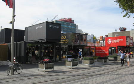
Making the best of a bad situation - in a downtown area where all the buildings
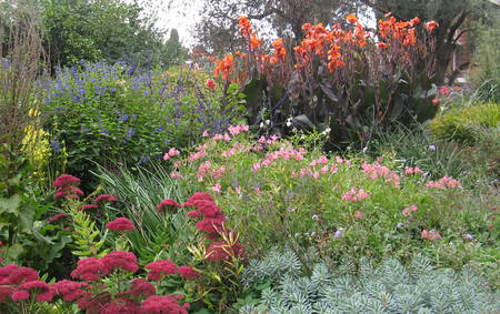
were destroyed, the city constructed a mall made from shipping containersPhil is the CEO of a trade school, and Helen is a primary school teacher, so we were on our own during the day while they were at work. Although some sights, such as Cathedral Square, were inaccessible, we had no problem finding ways to keep ourselves occupied. We visited the outstanding Christchurch Botanical Gardens and Canterbury Museum, did a hike on the Rapaki Track, and spent one day at home catching up on filing photos, writing our trip journal and calling family in the US. Jan was happy to pitch in and cook dinner since Helen & Phil were working all day, and one evening we went out to the local pub - Harringtons - for a delicious and reasonably priced three-course meal, which we enjoyed with a pint of tasty local brew.
Colorful flowers at the Christchurch Botanical Gardens
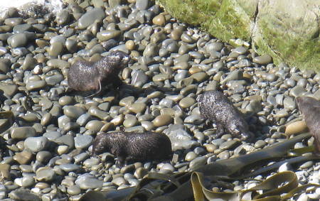
View of the city from the Rapaki TrackKaikoura (April 5). Easter was approaching, and we were planning to spend the long weekend with Phil & Helen on their sailboat Dolce Vita in the Marlborough Sounds. The boat was moored in Picton, about 4½ hours north of Christchurch. On the way to the boat, we wanted to stop at Kaikoura, so we left a day ahead of Phil & Helen. In Kaikoura, we walked the Peninsula Walkway, a nice track along the rugged coastline, hoping to see some whales swimming offshore. No such luck, but we did see quite a few large seals on the beach. We spent the night at the Dolphin Backpackers Inn, where the resident cat was determined to steal some of Jan's chicken dinner! The next morning, on our way up to Picton, we stopped at Ohau Point where we saw lots of fur seal pups playing in a creek and in a pool at the base of a waterfall.
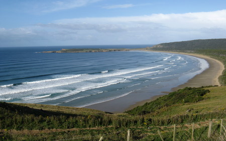
Views from the Kaikoura Peninsula Walkway
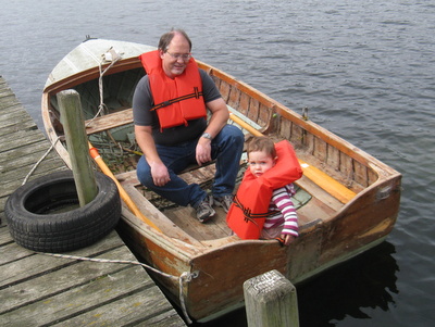
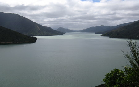
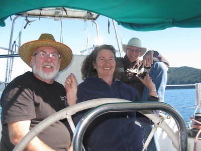
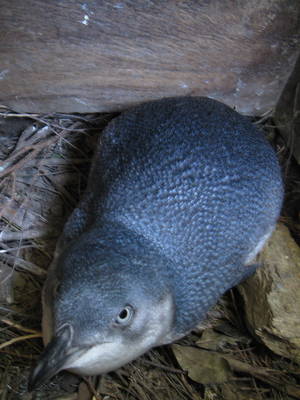
Fur seal pups at Ohau PointMarlborough Sounds (April 6 to 9). We met Phil & Helen in Picton, did some grocery shopping and then headed to the Waikawa Bay Marina. Phil & Helen moved Dolce Vita from a mooring ball into a marina slip, and we stowed all of our stuff, joined another couple for drinks on board their boat and then spent the night on Dolce Vita at the marina. We departed the marina on Dolce Vita the next morning and spent the next three days in the Marlborough Sounds, sailing between anchorages and hiking lovely trails. These are outstanding cruising grounds, and we feel very fortunate to have had the opportunity to see them by boat. We hiked on Motuara Island, where we found a little blue penguin in a nesting box and heard beautiful bird songs, visited a monument to Captain Cook in Ship's Cove, watched Hector Dolphins (only found in NZ) swim along side the boat, hiked along the Queen Charlotte track near Te Mahia, and anchored in some beautiful bays. The weather was gorgeous - warm (by South Island standards) and sunny, with light winds - we couldn't have asked for more. Our last night out, we spent at Helen's family "bach" (pronounced "batch"), which is like a weekend cabin, but this one can only be reached by boat. Our time on the Marlborough Sounds with Phil & Helen was a very special experience for us!
On the Tuesday after Easter, it was time for us to head back to the North Island. We weighed Dolce Vita's anchor and motored back to Waikawa Bay. The four of us ate lunch at a cafe near the waterfront in Picton, and then we bid good-bye to Phil & Helen and caught the ferry back to Wellington.
Phil, Helen & Rich on board Dolce Vita
Little blue penguin in her nesting box
Anchorage at Mistletoe Bay
View from Queen Charlotte Track
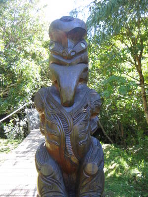
Maori Tekoteko at Ship's Cove.
These statues honor ancestors and
are used to ward off evil spirits.
Helen's family "bach"
North Island (Part II) Wellington (April 10). We arrived in Wellington right about dinner time, and we were again invited to stay with the Wilson family. This time Jim was in town, but Heather was back in the USA for a wedding. We went out for dinner and had a great evening catching up with Jim, Cal and William and talking about their plans. They have since moved back aboard their sailboat Ceol Mor, and they are continuing on with their circumnavigation (returning home to Washington, DC). Here's their website: www.svceolmor.com.
The next morning, Jim took us out to breakfast at the Maranui Surf Life Saving Club Cafe on Lyall Bay and drove us up to Mt. Victoria for a view of Wellington from the highest peak in the city. We then said good-bye to the Wilsons, wishing them well on their upcoming voyage.
Wellington to Taupo (April 11). From Wellington, we drove up to Taupo, which is a little over one-third of the way up the north island. We were pretty much in "heading home" mode, but we were making a couple of stops along the way.
View of Wellington from Mt. Victoria
Taupo to Warkworth (April 12). From Taupo, we headed to Warkworth, which is just north of Auckland. As we drove through Auckland, we stopped and visited for a couple of hours with the Gromit family (Mike, Cornelia, Zoe, Maia & Liam) at Bayswater Marina. It was great to see them, and we had lots of catching up to do and stories to tell one another about our experiences in New Zealand. On the north side of Warkworth is a tourist attraction called "Sheep World". We had driven by it a few times and wanted to visit. A few weeks prior, we found half-price tickets on GrabOne (like GroupOn in the US) and bought them. There was a campground adjacent to Sheep World, so we figured that would be the perfect location to spend the night. The campground didn't have any cabins, but they had a caravan (camper) which we could rent for the night. The folks who ran the campground were very nice, but the facilities were the worst of our whole trip. The mattress on Jan's side of the bed sagged badly, and she had to use a blanket to try to level it out. It seemed to us that the caravan was about ready for the junkyard, but at least we were able to make coffee and eat breakfast in it the following morning.
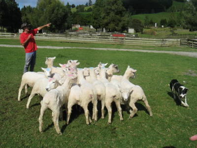
Sheep World and Whangarei (April 13). Sheep World opened at 9 am, and we were there shortly after the doors opened. We had a good time at Sheep World - the animal displays were informative, and we enjoyed the "show", which included demonstrations of sheep herding, sorting and corralling, and shearing, as well as an opportunity to bottle feed some baby sheep and goats.
Sheep herding demonstration at "Sheep World"From Sheep World, we continued north to Whangarei to see Neil & Kathy. We had a small bag of their stuff which we offered to transport in our car so they wouldn't have to carry it on their motorcycle. Our arrival in Whangarei coincided with a yachtie farewell party organized by local businesses, so we tagged along. The food was good, and the entertainment (traditional Maori dancing) was excellent. We ran into several of our boating friends at the party, which was a lot of fun. After the party, Bruce & Alene (s.v. Migration) invited Neil & Kathy and the two of us over for drinks. We'd known of Bruce & Alene for several years, but we never met until this party. Migration and Slip Away were both in Mexico in 2006, had lots of friends in common, and even communicated by email a few times, but our paths had never actually crossed. When Jan saw Bruce at the party, she knew who he was from photos, and went over to introduce herself. They were both delighted to finally meet in person. And, ironically, we found out that Alene grew up in Cincinnati (Jan's hometown). Small world! We had a great time visiting on Migration after the party, and they shared with us a ginger wine, which was a tasty sipping wine. After Migration, we headed back to Attitude, and spent the night in their very comfortable v-berth.
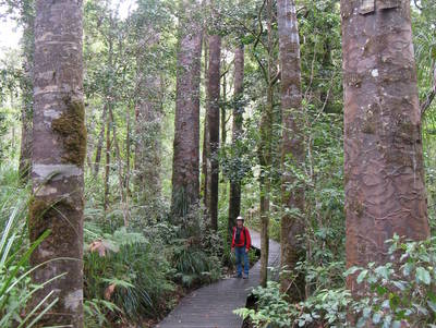
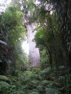
Whangarei to Kaitaia (April 14). Neil cooked us a great breakfast the next morning, and then we were on our way again. From Whangarei, we headed to the Waipoua Forest to see the big Kauri trees. Kauris are only found in New Zealand, and they are long-lived but slow-growing hardwood trees which were almost logged to extinction. We visited the Waipoua Visitor Center, and then did a few forest walks, including one to see Tane Mahuta, the largest and oldest tree (2000 years old). After visiting the Kauri trees, we continued north toward Kaitaia, and our timing was perfect to catch the Hokianga Ferry, which saved us a few miles of driving. Shortly before reaching our destination, we hit a hawk - scared the living daylights out of us! He was feeding on some road kill (a common sight in NZ), and as we came upon him, the hawk was a little slow leaving the dinner table. He bounced off our bumper and then our windshield, right in front of Jan. Fortunately, he survived and we had no damage to the car. We arrived in Kaitaia just before sunset and spent the night at a hostel.
Rich and the Kauri trees in the Waipoua Forest
Tane Mahuta - the oldest and biggest Kauri tree -
Rich is also in the photo for perspective.
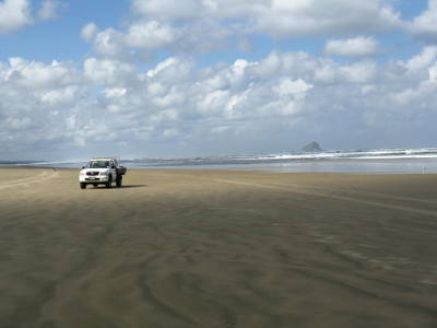
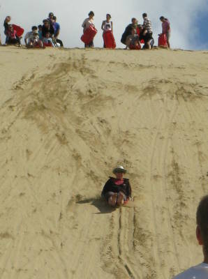
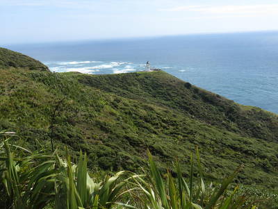
All aboard the Hokianga FerryCape Reinga (April 15). This was our last day of land travel in New Zealand, and we were booked on Sand Safari's tour of 90-mile beach and Cape Reinga at the northern tip of the North Island (another half-price GrabOne deal). It was a bus tour, narrated by the driver, and again he was very entertaining and informative. We drove north along 90-mile beach, stopped to do some sand surfing and then visited Cape Reinga. It was a sunny and warm day, and the scenery was beautiful.
Driving north on 90-mile beach. Huge amounts of sand in the far
north came from central North Island volcano eruptions
2 million years ago.
Surfing down the sand dunes - it's important to
keep your feet up, or you get a face full of sand.
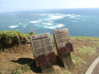
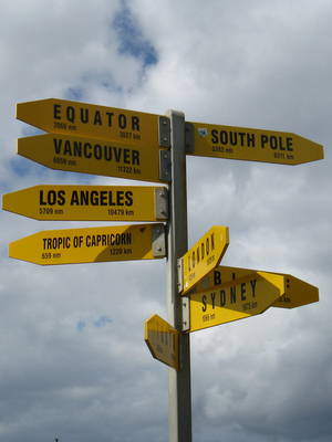
Cape Reinga - the north tip of the north island
Turbulent waters at Cape Reinga -
where the Tasman Sea meets the Pacific Ocean
The South Pole isn't all that far away
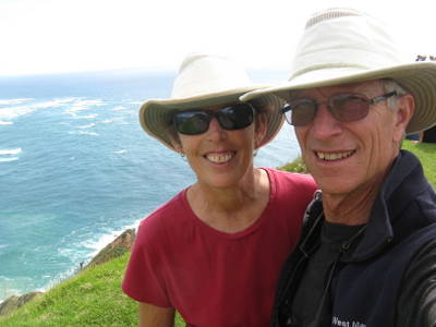
The two of us at Cape Reinga
After the tour, we drove back to Opua (about 1½ hours away). Mike & Sue were on board Infini in the Opua Marina and offered us a berth for the night. Sue cooked us a delicious dinner, and we had a great evening catching up with these good friends. The next morning, Neville from Catwagon picked us up from Infini and dinghied us to Slip Away, who was waiting patiently for us on her mooring. We'd been on the road for almost eight weeks and traveled over 8000 kilometers (5000 miles). It was good to be home! Thinking back on our travels in New Zealand. Outstanding is the word that comes to mind. The scenery was fabulous - we took over 1,500 photos, and although we posted a lot on this webpage, it doesn't begin to capture all that we saw. The National Parks in New Zealand are incredibly beautiful, and the hiking trails are exceptionally maintained. Also, traveling throughout New Zealand was easy. The roads were well maintained, and with the exception of Auckland, it was not difficult to find our way around. There are some multi-lane roads in the bigger cities, but for the most part, we were driving on two-lane roads - and most of the bridges on the South Island were only one lane. There was rarely a lack of pretty scenery while we were driving - rolling green hills, snow-capped mountains, coastline, river gorges, beautiful green flora and lots of cows and sheep. We found the local people we met along the way to be very friendly and helpful, but they had some interesting habits. For example, some Kiwis like to go barefoot pretty much everywhere - it is commonplace to see them barefoot in the grocery store. We also found it interesting that Kiwis eat a lot of pork, and yet, in all our travels in New Zealand, we never saw a pig farm. One can buy a multitude of varieties of ham and bacon, but it's pretty much impossible to find turkey lunchmeat. We did find chicken lunchmeat (one small variety amidst the acres of ham), and although it was white meat, it tasted suspiciously like ham. It was also sometimes amusing to us that even though we and the Kiwis both speak English, we often times use very different words and expressions. When we first started traveling in New Zealand, Rich began keeping a list of words and expressions which were foreign to us, and he came up with over 50 of them, and the list continues to grow. A few of the words/expressions included chilly bin (cooler), judder bars (speed bumps), tumbler (clothes dryer), jumper (sweater), heaps (lots of something), chuffed (psyched or extremely pleased), puffed (out of breath), and rattle your dags (hurry up!). The time we spent in New Zealand was great, and once again, we recognize how lucky we are to have the opportunity to spend so much time in a foreign country and immerse ourselves in the local culture.
One-lane bridges were the norm
on the South Island. Signs at either end
indicated who had right of way.
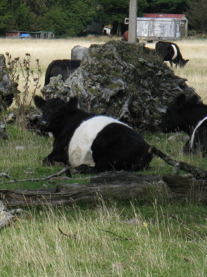
We saw lots of cows in NZ, but these were our
favorite - the Belted Galloways - aka Oreo cows
Heaps of sheep in New Zealand
Coat, hat and bare feet -
No doubt this guy is a Kiwi!
Opua (April 15 to 28). After returning from our land travel, we spent a couple more weeks in Opua. Our final days in Opua were bittersweet with lots of fun get-togethers with our cruising friends, but also lots of good-byes as folks headed off to various destinations for the next sailing season - Fiji, Vanuatu, Australia and other exotic locales. The Island Cruising Association hosted a number of free seminars at the Opua Cruising Club, and even though we weren't sailing away this season, we attended for future reference. We had decided that it was time to make a trip back to the USA (via airplane) to see family and friends. We would be leaving Slip Away in New Zealand for the Southern Hemisphere winter while we enjoyed a Northern Hemisphere summer. We did one last sightseeing trip - taking the car ferry from Opua across the bay to Russell, an historic whaling town once known as the "Hell Hole of the Pacific." It's much nicer now! After that, we sold our car back to Phil at "Cars for Cruisers."
We had decided to leave Slip Away in dry dock at Norsand Boatyard while we were back in the States, so we needed to move her to Whangarei (about 80 nm away by sea). We saw a decent weather window a couple of weeks before our haul-out date and decided to get down there because good weather windows aren't always hanging around in New Zealand. We'd been very fortunate to have had great weather while traveling on the South Island, while the North Island had been wet and stormy.
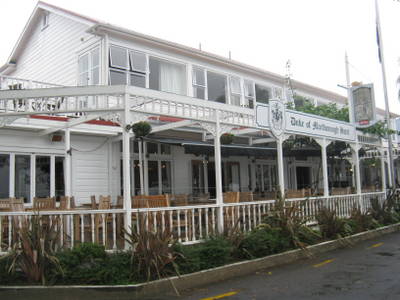
The Duke of Marlborough Hotel in Russell
dates back to the early 1800's.
Opua to Tutukaka (April 28, 48 nm, 8 hours). We departed Opua in the morning, and it felt good to have water moving under Slip Away's keel. We motored north out of the Opua Channel and past the Bay of Islands. After rounding Cape Brett, and turning to the southeast, the wind came up from the southwest (12-18 knots and a bit gusty), and we sailed for a few hours. By late afternoon, we were anchored for a calm night at Tutukaka Bay. Tutukaka to Marsden Cove (April 29, 26 nm, 5 hours). We left Tutukaka early the next morning, and continued on to Marsden Cove Marina. It was a wind-less day, and we motored the distance. Upon arrival at Marsden Cove, we topped off our diesel tank at their fuel dock and tied up to a berth, where we spent the night.
Marsden Cove to Town Basin Marina, Whangarei (April 30, 12 nm, 2 hours). We left Marsden Cove late morning to catch the rising tide on our way up the Hatea River to the Town Basin Marina in Whangarei. When we arrived at Town Basin, Kathy from Attitude and Graeme from Pelagic were there to help us tie up to our berth.
Back on the water! Rounding Cape Brett and sailing south to WhangareiTown Basin Marina, Whangarei (April 30 to May 9). We had a little over a week until our haul-out date at the boatyard, and we had decided to splurge on a berth at the Town Basin Marina, which is right in downtown Whangarei. We had spent a fair amount of time in Whangarei over the past few months, and we liked the feel of the town - there were restaurants and shops all within walking distance and a nice boardwalk along the marina and river - and the marina prices weren't terribly expensive. We had some work to do on Slip Away in preparation for leaving her for an extended period, and this was a nice place get started on it. We did a few boat chores, ran a few errands in town, and spent more time visiting with and saying good-bye to friends.
Norsand Boatyard, Whangarei (May 9 to 15). A week before our flight back to the US, we had Slip Away hauled out at Norsand Boatyard, where she would spend the winter in dry dock. After hauling out, we picked up the pace on our "to-do" list - cleaning, rinsing, stowing, disconnecting, defrosting, packing - but we were organized and had given ourselves enough time, so we weren't rushed or frantic. Not sure how that happened...
On the day before our flight to Los Angeles, Jim & Linda (s.v. Chesapeake) gave us a lift to the bus stop, and we took the bus to the Auckland Airport (with two connections, it was actually three buses and over four hours in transit). We had booked a night at a nearby hotel, and their shuttle van picked us up from the airport and brought us to the hotel. Early the next morning, the shuttle van took us back to the airport, and we were on our way.
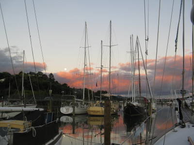
The evening of the "super moon" in Town Basin Marina
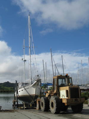
Hauling out Slip Away at Norsand Boatyard
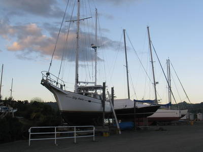
Slip Away in dry dock for the next several months